59 Bradford Road, Southsea, PO5 1AA
About 59 Bradford Road
59 Bradford Road is a three-bedroom mid-terrace house in Southsea (PO5 1AA). It has a recorded floor area of 104 m² (around 1119 sq ft), construction records dating it to 1900-1929 and council tax band B. The latest certificate (March 2025) shows a D (score 63), on the cusp of jumping into the C band. The recommended improvements would push it to C (score 80). Our model identifies extension potential, subject to local planning policy.
It changed hands recently, sold July 2025 for £222,000. Today's modelled estimate of £266,000 is 19.8% above the 2025 sale price. On a £-per-square-foot basis, the last sale (£198/sq ft) was about 93.1% above the typical sold price in the postcode.
Know exactly what you're buying at 59 Bradford Road
Before you offer, see what the listing won't tell you, the true value, the red flags and the full history.
Already flagged here
Launch offer · save £5
Valuation
against the asking price
Risks
planning & flood
Sold prices
similar homes nearby
Trends
the local market
What this property has
Inside
- Bedrooms3
- Bathrooms1
- Dining roomYes
- EnsuiteYes
Outside
- Private gardenrear
Building
- Extension potentialPossible
Energy performance
EPC Rating
Planning history
59 Bradford Road has no planning applications on record.
Notable planning nearby
111applications of note in the surrounding area
We flagged 1 thing worth checking at 59 Bradford Road
Independent checks surfaced things a buyer would want to understand before offering. The report explains each one in full, with the underlying data and what to ask.
- Signs of HMO activity in the area
30-day money-back guarantee
Sales history & valuation
59 Bradford Road valuation sits well clear of the typical sold price in this postcode.
£266,000
Modelled from EPC, postcode comparables.
£222,000
Recorded with HM Land Registry.
Sales timeline
3 July 2025Most recent
£222,000
Median price across the last 5 sales in PO5 1AA: £252,000 (2022–2019).
Nearby sales in PO5 1AA
Everything we know about 59 Bradford Road, in one report
What it's really worth, what could be wrong, and the planning, sales and area data in full.
What we flagged
- Signs of HMO activity in the area

Versus other Bradford Road homes
Years Held for 59 Bradford Road lags the street by a wide margin.
Price per m²
£2,135
Street avg £3,297
Floor Area
104 m²
Street avg 107 m²
Habitable Rooms
4 rooms
Street avg 6 rooms
CO₂ Emissions
4.2 t/year
Street avg 4.3 t/year
Similar properties nearby
1 Harrow Road
PO5 1SJ
1 Pains Road
PO5 1HE
1 Montgomerie Road
PO5 1EB
1 Chelsea Road
PO5 1NH
1 Dufose Terrace, St Andrews Road
PO5 1DX
1 Baileys Road
PO5 1EA
1 Cleveland Road
PO5 1SF
1 Boulton Road
PO5 1NS
The neighbourhood at a glance
Rail-style transport is unusually close for this postcode.
Crime
11/mo
Steady year-on-year across the wider district.
Nearest stop
0.0 km
Bradford Junction — bus stop.
Closest school
0.2 km
Ark Ayrton Primary Academy. 36 schools nearby.
Go deeper on the local area
The full report breaks down crime, transport links, schools and air quality in depth.
Road noise across the postcode
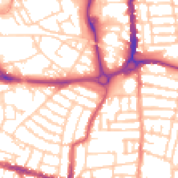
Daytime· 07:00 – 23:00
54.5dB

Night-time· 23:00 – 07:00
43.4dB