Are you a property professional?Get qualified leads from motivated homeowners.
Get started51 Bath Street, Abingdon, OX14 1EA
4 planning records
About 51 Bath Street
A plain-English summary derived from public records, EPC certificates, sold prices and local data.
51 Bath Street is a four-bedroom end-of-terrace house in Abingdon (OX14 1EA). It has a recorded floor area of 162 m² (around 1744 sq ft), construction records dating it to 1900-1929 and council tax band D. The latest certificate (August 2020) shows a D (score 60), on the cusp of jumping into the C band. The rating has held steady at D across 2 certificates since July 2010. Between certificates, wall efficiency went from Very Poor to Poor and lighting went from Average to Very Good; while roof efficiency dropped from Good to Very Poor and window efficiency dropped from Good to Average. The recommended improvements would push it to C (score 75). Period features are noted in the property record.
It hasn't traded since May 2004, a hold of 22 years that's notably long for the area. At 162 m² the property is well over the postcode median (72 m² across 11 EPCs), placing it in the larger end of the local stock. Today's modelled estimate of £532,000 sits 149.8% above the 2004 sale of £213,000. On a £-per-square-foot basis, the last sale (£122/sq ft) was about 49.4% below the postcode norm. 4 planning records sit against the property, 0 approved, 1 refused.
What this property has
Pulled from EPC certificates, claim submissions and our property model. Empty categories are hidden — we only show what's known.
Inside
- Bedrooms4
- Bathrooms2
- Dining roomYes
- EnsuiteYes
Energy performance
Every EPC certificate filed against this property — current rating, recorded improvements, and where there's headroom to reach a higher band.
51 Bath Street's carbon output runs well above what efficient homes in the postcode produce.
Current Certificate(1 of 2)
Aug 2020
EPC Rating
A
B
C
D
D60
E
F
G
Main Heating
Gas
Main Fuel
Gas
Hot Water
Good
Windows
Average
CO2 Emissions
8.0 t/year
Occupancy
Owner Occupied
Planning history
Applications and permits filed against 51 Bath Street, Abingdon, OX14 1EA, sourced from the PlanIt planning register.
51 Bath Street has 2 separate extension applications on the council record.
- Feb 2026RenovationHeritageNo decision Issued
The installation of one skylight, one new plasterboard internal wall to create a bedroom, two new timber panelled fire doors; removal of two cupboards and associated installation of a short length of handrail; change of bathroom to two shower rooms with new door into en-suite added, and existing doorway in-filled with plasterboard; cladding of staircase with fireboard.
Sales history & valuation
Recorded transactions, our model's current estimate, and a quick read on what neighbouring properties have sold for.
51 Bath Street valuation sits well clear of the typical sold price in this postcode.
Current estimate
See how we calculated this£532,000
Modelled from EPC, postcode comparables.
Last sold (2004)
£213,000
Recorded with HM Land Registry.
Sales timeline
Versus other Bath Street homes
Four headline reads against 7 similar houses on this street, drawn from the latest EPC and Land Registry data.
Price per m² for 51 Bath Street lags the street by a wide margin.
Price per m²
£1,315
Street avg £3,675
Floor Area
162 m²
Street avg 113 m²
Habitable Rooms
7 rooms
Similar properties nearby
A handful of close matches in the same postcode area, ranked by likeness on bedrooms, type and floor area.
The neighbourhood at a glance
A condensed read of the local area. Each tile links through to the full breakdown on the Abingdon district page.
Crime
6/mo
Steady year-on-year across the wider district.
Nearest stop
0.1 km
Bath Street — bus stop.
Road noise across the postcode
Modelled day and night-time noise levels around OX14 1EA from Defra's strategic mapping. The pin marks this postcode's centroid.
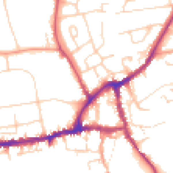
Daytime· 07:00 – 23:00
51.9dB

Everything within walking distance
Schools, transport stops and scenic spots near this property — 45 points of interest in total.
Beautiful places to visit nearby
Curated scenic spots within reach of this postcode, served by Beautifulplaces.ai. Photography and tagging come from their open dataset.
Common questions
The questions buyers, sellers and homeowners most often ask about 51 Bath Street, Abingdon, OX14 1EA. Each answer is also embedded as structured data for search engines.