6 Greville Place, Westminster, London, NW6 5JN
About 6 Greville Place
6 Greville Place is a six-bedroom detached house in Westminster, London, London (NW6 5JN). It has a recorded floor area of 499 m² (around 5371 sq ft), construction records dating it to 1976-1982 and council tax band H. The latest certificate (June 2025) shows a D (score 66), on the cusp of jumping into the C band. When first surveyed in January 2015 the rating was F, the property has climbed 2 bands since. Between certificates, wall efficiency went from Poor to Average, lighting went from Very Poor to Good and main heating went from Average to Good; while window efficiency dropped from Poor to Very Poor and hot-water efficiency dropped from Good to Very Poor. The recommended improvements would push it to C (score 76).
25 planning records sit against the property, 12 approved, 3 refused. Past consents include tree works and an extension, meaningful when judging how the property has evolved. The record references listed-building consent, which constrain future alterations. On a £-per-square-foot basis, the last sale (£987/sq ft) was about 112.4% above the typical sold price in the postcode. On the market in May 2017 and unlisted since — roughly 9 years. 6 bedrooms is on the larger side for this postcode, where 3 is the typical count.
What this property has
Inside
- Bedrooms6
- Bathrooms6
- Dining roomYes
- Utility roomYes
- EnsuiteYes
- StudyYes
Everything you need to know about 6 Greville Place
The true value, the hidden risks and the full sale history, in one report.
30-day money-back guarantee

The data behind every report


Energy performance
6 Greville Place's carbon output runs well above what efficient homes in the postcode produce.
EPC Rating
Property Improvements
Changes detected from historical EPC data
Heating controls changed
Hot water efficiency decreased
Wall insulation improved
More low energy lighting installed
Planning history
6 Greville Place has 2 separate extension applications on the council record.
- Dec 2022Tree WorksTreesIn report
1 x weeping pear tree: fell1 x fig: crown reduce to previous, most recent reduction points and lift to 2m.1 x evergreen Magnolia: reduce back from property by 1-2m (twiggy growth only and reshape remaining crown by up to 10% to balance.1 x multi-stemmed bay (T4): crown reduce to previous, most recent reduction points and reduce fine lateral branches back to main stems where they are closest to property.
- Documents
- 9 docs on file
- Reference
- 22/07781/TCA
- Nov 2020Tree WorksTreesIn report
1 x beech tree: Reshape tree by reducing overlong branches only back into main canopy line without carrying out a full crown reduction, to create a natural flat oval crown shape.
- Agent
- pace arb ltd
- Documents
- 6 docs on file
- Reference
- 20/06173/TCA
What's in 6 Greville Place, Westminster, London, NW6 5JN's planning history?
23 more on this property, plus refusals, disputes and full decisions nearby, in the report.
Sales history & valuation
6 Greville Place valuation sits well clear of the typical sold price in this postcode.
£5,260,000
Modelled from EPC, postcode comparables.
£5,300,000
Recorded with HM Land Registry.
Sales timeline
30 May 2017Most recent
£5,300,000
Median price across the last 4 sales in NW6 5JN: £825,000 (2010–1998).
Everything you need to know about 6 Greville Place
The true value, the hidden risks and the full sale history, in one report.
30-day money-back guarantee
The data behind every report
Similar properties nearby
10 Maple Mews, Westminster
NW6 5UZ
1 Andover Place, Westminster
NW6 5EF
1 Greville Mews, Camden
NW6 5HX
1 Westburn Mews, Westminster
NW6 5HJ
10 Andover Place, Westminster
NW6 5EF
1 Chichester Road, Brent
NW6 5QW
1 Maple Mews, Westminster
NW6 5UZ
10 Oxford Road, Brent
NW6 5SL
The neighbourhood at a glance
Rail-style transport is unusually close for this postcode.
Crime
8/mo
Rising year-on-year across the wider district.
Nearest stop
0.2 km
Kilburn Park Road — bus stop.
Closest school
0.3 km
St George's Catholic School. 73 schools nearby.
Go deeper on the local area
The full report breaks down crime, transport links, schools and air quality in depth.
Road noise across the postcode
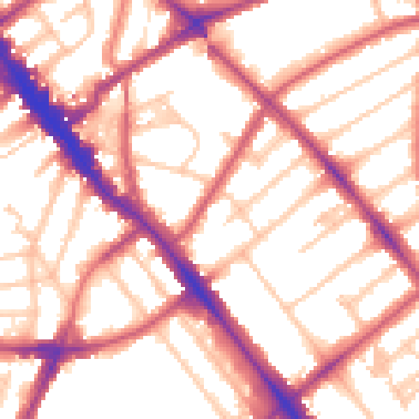
Daytime· 07:00 – 23:00
55.3dB

Night-time· 23:00 – 07:00
44.8dB