10 Belfry Drive, Corby, NN17 5GN
EPC B
About 10 Belfry Drive
A plain-English summary derived from public records, EPC certificates, sold prices and local data.
10 Belfry Drive is a two-bedroom semi-detached house in Corby (NN17 5GN). It has a recorded floor area of 120 m² (around 1292 sq ft). The latest certificate (August 2019) returns a high B (score 85), putting the home a stone's throw from an A rating. The recommended improvements would push it to A (score 95).
At 120 m² the property is well over the postcode median (59 m² across 28 EPCs), placing it in the larger end of the local stock. One planning record on file: an extension approved in 2020. Past consents include an extension, meaningful when judging how the property has evolved. Today's modelled estimate of £274,000 is 15.1% above the 2019 sale price. On a £-per-square-foot basis, the last sale (£184/sq ft) was about 31.8% below the postcode norm. Sold September 2019 for £237,995.
What this property has
Pulled from EPC certificates, claim submissions and our property model. Empty categories are hidden — we only show what's known.
Inside
- Bedrooms2
- Bathrooms1
Energy performance
Every EPC certificate filed against this property — current rating, recorded improvements, and where there's headroom to reach a higher band.
EPC Rating
A
B
B85
C
D
E
F
G
Main Heating
Gas
Main Fuel
Gas
Hot Water
Good
Windows
Very Good
CO2 Emissions
1.7 t/year
Occupancy
—
Planning history
Applications and permits filed against 10 Belfry Drive, Corby, NN17 5GN, sourced from the PlanIt planning register.
10 Belfry Drive has an approved single-storey rear extension on the planning record.
- Dec 2020ExtensionOutlinePrior Approval not required
Extension: Single storey · Rear of property
1Single storey rear extension
Sales history & valuation
Recorded transactions, our model's current estimate, and a quick read on what neighbouring properties have sold for.
10 Belfry Drive valuation sits well clear of the typical sold price in this postcode.
Current estimate
See how we calculated this£274,000
Modelled from EPC, postcode comparables.
Last sold (2019)
£237,995
Recorded with HM Land Registry.
Sales timeline
Launch offer · 33% off
The complete analysis of 10 Belfry Drive, Corby, NN17 5GN
Everything we know about this property, compiled into one in-depth, downloadable report.
Detailed analysis
A written breakdown of everything that matters
Versus other Belfry Drive homes
Four headline reads against 28 similar houses on this street, drawn from the latest EPC and Land Registry data.
EPC Rating for 10 Belfry Drive runs comfortably ahead of the street norm.
Price per m²
£1,983
Street avg £2,899
Floor Area
120 m²
Street avg 77 m²
CO₂ Emissions
1.7 t/year
Similar properties nearby
A handful of close matches in the same postcode area, ranked by likeness on bedrooms, type and floor area.
The neighbourhood at a glance
A condensed read of the local area. Each tile links through to the full breakdown on the Corby district page.
Crime
4/mo
Steady year-on-year across the wider district.
Nearest stop
0.1 km
(Priors Hall) Flaxland Way — bus stop.
Road noise across the postcode
Modelled day and night-time noise levels around NN17 5GN from Defra's strategic mapping. The pin marks this postcode's centroid.
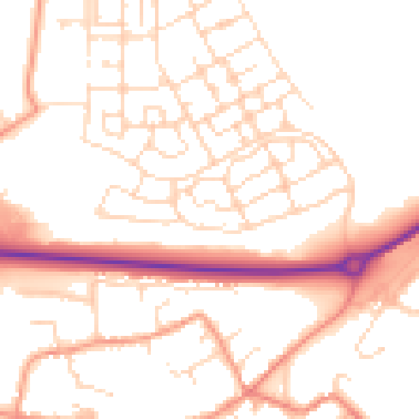
Daytime· 07:00 – 23:00
51.8dB

Everything within walking distance
Schools, transport stops and scenic spots near this property — 34 points of interest in total.
Common questions
The questions buyers, sellers and homeowners most often ask about 10 Belfry Drive, Corby, NN17 5GN. Each answer is also embedded as structured data for search engines.
