19 Birkdale Drive, Corby, NN17 5GJ
EPC B
About 19 Birkdale Drive
A plain-English summary derived from public records, EPC certificates, sold prices and local data.
19 Birkdale Drive is a detached house in Corby (NN17 5GJ). It has a recorded floor area of 193 m² (around 2077 sq ft). The latest certificate (January 2020) returns a high B (score 85), putting the home a stone's throw from an A rating.
At 193 m² the property is well over the postcode median (131 m² across 31 EPCs), placing it in the larger end of the local stock. One planning record on file: an extension approved in 2021. Past consents include an extension, meaningful when judging how the property has evolved. Today's modelled estimate of £479,000 is 19.8% above the 2020 sale price. On a £-per-square-foot basis, the last sale (£193/sq ft) was about 20.1% below the postcode norm. Last sale on file: £399,995 in July 2020.
Energy performance
Every EPC certificate filed against this property — current rating, recorded improvements, and where there's headroom to reach a higher band.
EPC Rating
A
B
B85
C
D
E
F
G
Main Heating
Gas
Main Fuel
Gas
Hot Water
Good
Windows
Very Good
CO2 Emissions
2.7 t/year
Occupancy
—
Planning history
Applications and permits filed against 19 Birkdale Drive, Corby, NN17 5GJ, sourced from the PlanIt planning register.
19 Birkdale Drive has an approved single-storey rear extension on the planning record.
- Nov 2021ExtensionAmendmentGranted
Extension: Single storey · Rear of property
Single storey rear extension
Sales history & valuation
Recorded transactions, our model's current estimate, and a quick read on what neighbouring properties have sold for.
The latest sale landed in the post-pandemic price surge — useful context when reading the figure.
Current estimate
See how we calculated this£479,000
Modelled from EPC, postcode comparables.
Last sold (2020)
£399,995
Recorded with HM Land Registry.
Sales timeline
Launch offer · 33% off
The complete analysis of 19 Birkdale Drive, Corby, NN17 5GJ
Everything we know about this property, compiled into one in-depth, downloadable report.
Detailed analysis
A written breakdown of everything that matters
Versus other Birkdale Drive homes
Four headline reads against 31 similar houses on this street, drawn from the latest EPC and Land Registry data.
On price per m², 19 Birkdale Drive runs well behind the street norm.
Price per m²
£2,073
Street avg £2,654
Floor Area
193 m²
Street avg 117 m²
CO₂ Emissions
2.7 t/year
Similar properties nearby
A handful of close matches in the same postcode area, ranked by likeness on bedrooms, type and floor area.
The neighbourhood at a glance
A condensed read of the local area. Each tile links through to the full breakdown on the Corby district page.
Crime
4/mo
Steady year-on-year across the wider district.
Nearest stop
0.2 km
(Priors Hall) Flaxland Way — bus stop.
Road noise across the postcode
Modelled day and night-time noise levels around NN17 5GJ from Defra's strategic mapping. The pin marks this postcode's centroid.
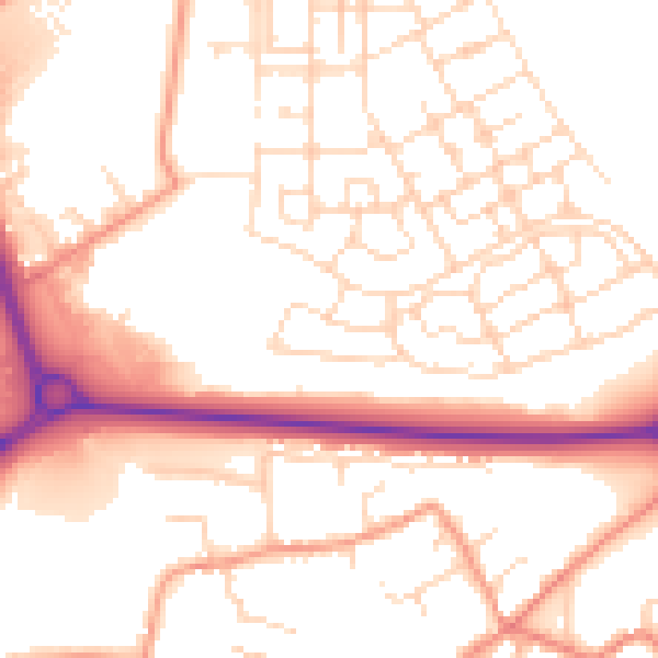
Daytime· 07:00 – 23:00
53.0dB

Everything within walking distance
Schools, transport stops and scenic spots near this property — 35 points of interest in total.
Common questions
The questions buyers, sellers and homeowners most often ask about 19 Birkdale Drive, Corby, NN17 5GJ. Each answer is also embedded as structured data for search engines.
