30 32, Stephenson Way, Corby, NN17 1DB
About 30 32
A plain-English summary derived from public records, EPC certificates, sold prices and local data.
30 32 is a five-bedroom detached house in Corby (NN17 1DB). It has a recorded floor area of 150 m² (around 1617 sq ft) and construction records dating it to 1930-1949. The latest certificate (November 2008) shows an E (score 51), well below the UK norm with real room to improve. The latest certificate is from November 2008, so improvements made since then won't be reflected. Other recorded features include attached land beyond the plot.
Untraded for 17 years, with the last transfer in July 2009. That sale fell during the post-crash dip, which often skews comparisons against later neighbouring sales. Sale prices here have outpaced England HPI: 6.2% per year against 0% for the wider region. Today's modelled estimate of £295,000 sits 90.3% above the 2009 sale of £155,000. On a £-per-square-foot basis, the last sale (£96/sq ft) was about 20.3% below the postcode norm. At 150 m² the property is well over the postcode median (64 m² across 47 EPCs), placing it in the larger end of the local stock. It lags the bulk of the postcode on energy efficiency (less efficient than 85% of similar EPCs). 5 bedrooms is on the larger side for this postcode, where 3 is the typical count.
What this property has
Pulled from EPC certificates, claim submissions and our property model. Empty categories are hidden — we only show what's known.
Inside
- Bedrooms5
- Dining roomYes
- FireplaceYes
Outside
- Private garden
Energy performance
Every EPC certificate filed against this property — current rating, recorded improvements, and where there's headroom to reach a higher band.
30 32's carbon output runs well above what efficient homes in the postcode produce.
EPC Expired
This certificate is over 10 years old and is no longer valid.Expired 11 Nov 2018
Planning history
Applications and permits filed against 30 32, Stephenson Way, Corby, NN17 1DB, sourced from the PlanIt planning register.
No planning applications are recorded against 30 32, Stephenson Way, Corby, NN17 1DB. The full report also covers planning activity across the surrounding area.
Full planning data for 30 32, Stephenson Way, Corby, NN17 1DB
Every application and decision on this property and nearby, in full, in the report.
Sales history & valuation
Recorded transactions, our model's current estimate, and a quick read on what neighbouring properties have sold for.
30 32's estimated value is more than triple its earliest registered sale price (2001).
Current estimate
See how we calculated this£295,000
Modelled from EPC, postcode comparables and a sale-price growth of 6.2% per year over 8 years.
Last sold (2009)
£155,000
Growth on file: 6.2% per year over 8 years.
Sales timeline
Launch offer · 33% off
The complete analysis of 30 32, Stephenson Way, Corby, NN17 1DB
Everything we know about this property, compiled into one in-depth, downloadable report.
Detailed analysis
A written breakdown of everything that matters
Versus other Stephenson Way homes
Four headline reads against 32 similar houses on this street, drawn from the latest EPC and Land Registry data.
On floor area, 30 32 stands well clear of the street.
Price per m²
£1,032
Street avg £1,465
Floor Area
150 m²
Street avg 74 m²
Habitable Rooms
8 rooms
Street avg 4 rooms
Similar properties nearby
A handful of close matches in the same postcode area, ranked by likeness on bedrooms, type and floor area.
The neighbourhood at a glance
A condensed read of the local area. Each tile links through to the full breakdown on the Corby district page.
Rail-style transport is unusually close for this postcode.
Crime
4/mo
Steady year-on-year across the wider district.
Nearest stop
0.0 km
(Lloyds) Franklin Fields — bus stop.
Road noise across the postcode
Modelled day and night-time noise levels around NN17 1DB from Defra's strategic mapping. The pin marks this postcode's centroid.
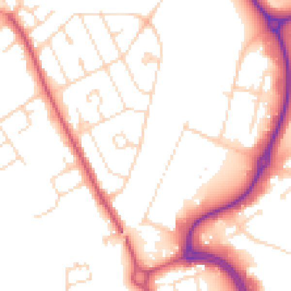
Daytime· 07:00 – 23:00
52.5dB

Everything within walking distance
Schools, transport stops and scenic spots near this property — 45 points of interest in total.
Common questions
The questions buyers, sellers and homeowners most often ask about 30 32, Stephenson Way, Corby, NN17 1DB. Each answer is also embedded as structured data for search engines.
