10 Telfords Close, Corby, NN17 1BF
About 10 Telfords Close
A plain-English summary derived from public records, EPC certificates, sold prices and local data.
10 Telfords Close is a two-bedroom mid-terrace house in Corby (NN17 1BF). It has a recorded floor area of 74 m² (around 797 sq ft), construction records dating it to 1983-1990 and council tax band B. The latest certificate (September 2022) shows a C (score 72). The rating has held steady at C across 2 certificates since November 2008. Between certificates, lighting went from Average to Very Good; while roof efficiency dropped from Very Good to Good and main heating dropped from Very Good to Good. The recommended improvements would push it to B (score 87).
Untraded for 18 years, with the last transfer in May 2008. That sale landed at the peak of the pre-credit-crunch market, which is a useful reference point when interpreting the price. Today's modelled estimate of £180,000 is 44% above the 2008 sale price.
What this property has
Pulled from EPC certificates, claim submissions and our property model. Empty categories are hidden — we only show what's known.
Inside
- Bedrooms2
Outside
- Private gardenYes
Building
- Heating system
Energy performance
Every EPC certificate filed against this property — current rating, recorded improvements, and where there's headroom to reach a higher band.
Current Certificate(1 of 2)
Sept 2022
EPC Rating
A
B
C
C72
D
E
F
G
Main Heating
Gas
Main Fuel
Gas
Hot Water
Good
Windows
Good
CO2 Emissions
2.6 t/year
Occupancy
Rented
Planning history
Applications and permits filed against 10 Telfords Close, Corby, NN17 1BF, sourced from the PlanIt planning register.
No planning applications are recorded against 10 Telfords Close, Corby, NN17 1BF. The full report also covers planning activity across the surrounding area.
Full planning data for 10 Telfords Close, Corby, NN17 1BF
Every application and decision on this property and nearby, in full, in the report.
Sales history & valuation
Recorded transactions, our model's current estimate, and a quick read on what neighbouring properties have sold for.
The latest sale landed at the peak of the pre-credit-crunch market — a high-water reference point.
Current estimate
See how we calculated this£180,000
Modelled from EPC, postcode comparables.
Last sold (2008)
£125,000
Recorded with HM Land Registry.
Sales timeline
Launch offer · 33% off
The complete analysis of 10 Telfords Close, Corby, NN17 1BF
Everything we know about this property, compiled into one in-depth, downloadable report.
Detailed analysis
A written breakdown of everything that matters
Versus other Telfords Close homes
Four headline reads against 19 similar houses on this street, drawn from the latest EPC and Land Registry data.
Years Held for 10 Telfords Close runs comfortably ahead of the street norm.
Price per m²
£1,689
Street avg £1,665
Floor Area
74 m²
Street avg 85 m²
Habitable Rooms
4 rooms
Similar properties nearby
A handful of close matches in the same postcode area, ranked by likeness on bedrooms, type and floor area.
The neighbourhood at a glance
A condensed read of the local area. Each tile links through to the full breakdown on the Corby district page.
Daytime road noise here sits well below conversation level — a quiet pocket of the postcode.
Crime
4/mo
Steady year-on-year across the wider district.
Nearest stop
0.1 km
Road noise across the postcode
Modelled day and night-time noise levels around NN17 1BF from Defra's strategic mapping. The pin marks this postcode's centroid.
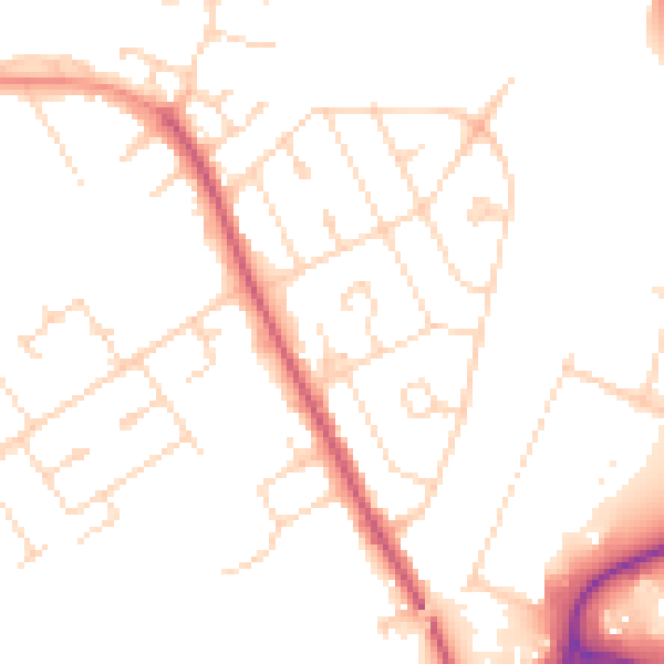
Daytime· 07:00 – 23:00
49.4dB

Everything within walking distance
Schools, transport stops and scenic spots near this property — 44 points of interest in total.
Common questions
The questions buyers, sellers and homeowners most often ask about 10 Telfords Close, Corby, NN17 1BF. Each answer is also embedded as structured data for search engines.
