44 Gilchrist Avenue, Corby, NN17 1BA
5 sales on record
About 44 Gilchrist Avenue
A plain-English summary derived from public records, EPC certificates, sold prices and local data.
44 Gilchrist Avenue is a mid-terrace house in Corby (NN17 1BA). It has a recorded floor area of 77 m² (around 829 sq ft), construction records dating it to 1930-1949 and council tax band A. The latest certificate (February 2015) shows an E (score 44), well below the UK norm with real room to improve. The recommended improvements would lift it to C (score 77), a 2-band jump. The latest certificate is from February 2015, so improvements made since then won't be reflected.
Sale prices here have outpaced England HPI: 9.4% per year against 0% for the wider region. Today's modelled estimate of £160,000 sits 77.8% above the 2015 sale of £90,000. 11 years since the last transfer (August 2015). Across the public record there are 5 sales, relatively high churn for a single property. At 77 m² it's 19.7% larger than the typical home in the postcode (64 m² median across 35 EPCs). It lags the bulk of the postcode on energy efficiency (less efficient than 86% of similar EPCs).
Energy performance
Every EPC certificate filed against this property — current rating, recorded improvements, and where there's headroom to reach a higher band.
44 Gilchrist Avenue's carbon output runs well above what efficient homes in the postcode produce.
EPC Expired
This certificate is over 10 years old and is no longer valid.Expired 18 Feb 2025
Planning history
Applications and permits filed against 44 Gilchrist Avenue, Corby, NN17 1BA, sourced from the PlanIt planning register.
No planning applications are recorded against 44 Gilchrist Avenue, Corby, NN17 1BA. The full report also covers planning activity across the surrounding area.
Full planning data for 44 Gilchrist Avenue, Corby, NN17 1BA
Every application and decision on this property and nearby, in full, in the report.
Sales history & valuation
Recorded transactions, our model's current estimate, and a quick read on what neighbouring properties have sold for.
Price for 44 Gilchrist Avenue has grown more than fourfold since the 1997 starting point.
Current estimate
See how we calculated this£160,000
Modelled from EPC, postcode comparables and a sale-price growth of 9.4% per year over 18 years.
Last sold (2015)
£90,000
Growth on file: 9.4% per year over 18 years.
Sales timeline
Launch offer · 33% off
The complete analysis of 44 Gilchrist Avenue, Corby, NN17 1BA
Everything we know about this property, compiled into one in-depth, downloadable report.
Detailed analysis
A written breakdown of everything that matters
Versus other Gilchrist Avenue homes
Four headline reads against 35 similar houses on this street, drawn from the latest EPC and Land Registry data.
EPC Rating for 44 Gilchrist Avenue lags the street by a wide margin.
Price per m²
£1,169
Street avg £1,591
Floor Area
77 m²
Street avg 65 m²
Habitable Rooms
4 rooms
Similar properties nearby
A handful of close matches in the same postcode area, ranked by likeness on bedrooms, type and floor area.
The neighbourhood at a glance
A condensed read of the local area. Each tile links through to the full breakdown on the Corby district page.
Rail-style transport is unusually close for this postcode.
Crime
4/mo
Steady year-on-year across the wider district.
Nearest stop
0.1 km
(Lloyds) Franklin Fields — bus stop.
Road noise across the postcode
Modelled day and night-time noise levels around NN17 1BA from Defra's strategic mapping. The pin marks this postcode's centroid.
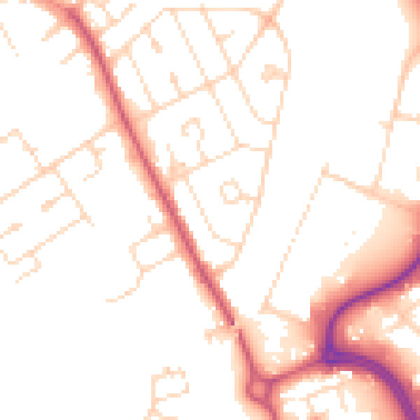
Daytime· 07:00 – 23:00
50.7dB

Everything within walking distance
Schools, transport stops and scenic spots near this property — 44 points of interest in total.
Common questions
The questions buyers, sellers and homeowners most often ask about 44 Gilchrist Avenue, Corby, NN17 1BA. Each answer is also embedded as structured data for search engines.
