48 The Firs, Daventry, NN11 0PX
About 48 The Firs
48 The Firs is a two-bedroom semi-detached house in Daventry (NN11 0PX). It has a recorded floor area of 56 m² (around 603 sq ft), construction records dating it to 1950-1966 and council tax band B. The latest certificate (May 2014) shows a D (score 57), a step below the typical UK home. When first surveyed in October 2011 the rating was E, the property has climbed 1 band since. Between certificates, wall efficiency went from Poor to Good, window efficiency went from Very Poor to Good and lighting went from Good to Very Good; while roof efficiency dropped from Average to Very Poor. The recommended improvements would lift it to B (score 90), a 2-band jump. The latest certificate is from May 2014, so improvements made since then won't be reflected. The property has solar panels on record, all of which lower running costs and tend to lift resale appeal.
At 56 m² it sits well below the postcode median (83 m² across 31 EPCs), making it one of the more compact homes locally. 2 planning records sit against the property, 2 approved, 0 refused. Past consents include a loft conversion, meaningful when judging how the property has evolved. Across 1996–2023, sale prices on this property compounded at 7.2% per year. On a £-per-square-foot basis, the last sale (£411/sq ft) was about 181.2% above the typical sold price in the postcode. Most recent transfer: October 2023 at £248,000.
Know exactly what you're buying at 48 The Firs
Before you offer, see what the listing won't tell you, the true value, the red flags and the full history.
Valuation
against the asking price
Risks
planning & flood
Sold prices
similar homes nearby
Trends
the local market
What this property has
Inside
- Bedrooms2
- Bathrooms2
- CloakroomYes
- EnsuiteYes
- StudyYes
- FireplaceYes
Outside
- Private gardenRear
- GarageDouble
Building
- Heating systemGas
- Solar panelsYes
Energy performance
Recommended upgrades on file would lift this property by multiple EPC bands.
EPC Expired
This certificate is over 10 years old and is no longer valid.Expired 17 May 2024
EPC Rating
Property Improvements
Changes detected from historical EPC data
Heating controls upgraded for better temperature management
Single glazing replaced with double or better glazing
Cavity wall insulation installed
More low energy lighting installed
Planning history
- Oct 2012Loft ConversionFullIn report
Insertion of front dormer to form rooms in roofspace and construction of detached garage
- Documents
- 9 docs on file
- Reference
- DA/2012/0676
- Oct 2012Loft ConversionOutlineIn report
Certificate Of Lawfulness (Proposed) for construction of rear dormer
- Documents
- 6 docs on file
- Reference
- DA/2012/0675
What's in 48 The Firs, Daventry, NN11 0PX's planning history?
Refusals, disputes and full decisions on this property and nearby, in the report.
Sales history & valuation
Price for 48 The Firs has grown more than fourfold since the 1996 starting point.
£253,000
Modelled from EPC, postcode comparables and a sale-price growth of 7.2% per year over 27 years.
£248,000
Growth on file: 7.2% per year over 27 years.
Sales timeline
9 October 2023Most recent
£248,000
+172.5%over 11 years23 March 2012
£91,000
+142.7%over 15 years29 August 1996
£37,500
Median price across the last 5 sales in NN11 0PX: £216,000 (2025–2022).
Everything we know about 48 The Firs, in one report
What it's really worth, what could be wrong, and the planning, sales and area data in full.
- Am I paying too much?
- Is something wrong with it?
- Is the agent's story true?
- Will it hold its value?

Versus other The Firs homes
48 The Firs outperforms the street on price per m² by a wide margin.
Price per m²
£4,429
Street avg £2,265
Floor Area
56 m²
Street avg 82 m²
Habitable Rooms
3 rooms
Street avg 4 rooms
CO₂ Emissions
3.0 t/year
Street avg 3.9 t/year
Similar properties nearby
1 Ashdown Road
NN11 0PZ
1 Harrow Lane
NN11 0GW
1 Hillary Close
NN11 0SN
1 Hawthorn Drive
NN11 0PU
1 Cedar Close
NN11 0TY
1 Burton Close
NN11 0TX
1 Harvest Close
NN11 0GX
1 Falconers Close
NN11 0PR
The neighbourhood at a glance
Crime
2/mo
Steady year-on-year across the wider district.
Nearest stop
0.1 km
Ashdown Road — bus stop.
Closest school
0.1 km
Falconer's Hill Academy. 11 schools nearby.
Go deeper on the local area
The full report breaks down crime, transport links, schools and air quality in depth.
Road noise across the postcode
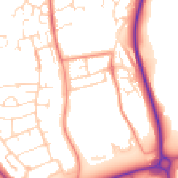
Daytime· 07:00 – 23:00
52.9dB

Night-time· 23:00 – 07:00
42.9dB