7 Knight Street, Netherfield, Nottingham, NG4 2FN
About 7 Knight Street
7 Knight Street is a two-bedroom mid-terrace house in Netherfield, Nottingham, Nottingham (NG4 2FN). It has a recorded floor area of 66 m² (around 710 sq ft), construction records dating it to 1900-1929 and council tax band A. The latest certificate (November 2024) shows a C (score 70). When first surveyed in September 2010 the rating was D, the property has climbed 1 band since. Between certificates, lighting went from Average to Very Good. The recommended improvements would push it to B (score 90). Period features are noted in the property record.
On energy efficiency it sits in the top 10% of properties in this postcode. Most recent transfer was June 2025 at £151,000 — fresh data. Across 1996–2025, sale prices on this property compounded at 6.3% per year. Today's modelled estimate of £176,000 is 16.6% above the 2025 sale price. On a £-per-square-foot basis, the last sale (£213/sq ft) was about 120.6% above the typical sold price in the postcode.
Know exactly what you're buying at 7 Knight Street
Before you offer, see what the listing won't tell you, the true value, the red flags and the full history.
Already flagged here
Valuation
against the asking price
Risks
planning & flood
Sold prices
similar homes nearby
Trends
the local market
What this property has
Inside
- Bedrooms2
- Bathrooms1
- Dining roomYes
Outside
- Private gardenYes
Building
- Period featuresYes
- RefurbishedYes
Energy performance
7 Knight Street ranks among the most efficient homes in the postcode for energy use.
EPC Rating
Property Improvements
Changes detected from historical EPC data
More low energy lighting installed
Heating controls upgraded for better temperature management
More low energy lighting installed
Planning history
7 Knight Street has no planning applications on record.
Notable planning nearby
9applications of note in the surrounding area
We flagged 2 things worth checking at 7 Knight Street
Independent checks surfaced things a buyer would want to understand before offering. The report explains each one in full, with the underlying data and what to ask.
- Signs of HMO activity in the area
- Environmental risk flagged
30-day money-back guarantee
Sales history & valuation
Price for 7 Knight Street has grown more than fourfold since the 1996 starting point.
£176,000
Modelled from EPC, postcode comparables and a sale-price growth of 6.3% per year over 29 years.
£151,000
Growth on file: 6.3% per year over 29 years.
Sales timeline
15 June 2025Most recent
£151,000
+31.3%over 4 years16 July 2020
£115,000
+58.6%over 6 years22 May 2014
£72,500
+6.6%over 3 years26 November 2010
£68,000
-5.5%over 5 years21 July 2005
£71,950
+86.9%over 3 years16 November 2001
£38,500
+48.1%over 5 years16 October 1996
£26,000
Median price across the last 5 sales in NG4 2FN: £128,000 (2025–2019).
Nearby sales in NG4 2FN
1 Knight Street, Netherfield, Nottingham, NG4 2FN
Sold Sept 2025
£132,00015 Knight Street, Netherfield, Nottingham, NG4 2FN
Sold Nov 2021
£127,5003 Knight Street, Netherfield, Nottingham, NG4 2FN
Sold Jun 2021
£128,00027 Knight Street, Netherfield, Nottingham, NG4 2FN
Sold Dec 2020
£160,00017 Knight Street, Netherfield, Nottingham, NG4 2FN
Sold Oct 2017
£90,000
Everything we know about 7 Knight Street, in one report
What it's really worth, what could be wrong, and the planning, sales and area data in full.
What we flagged
- Signs of HMO activity in the area
- Environmental risk flagged

Versus other Knight Street homes
7 Knight Street outperforms the street on price per m² by a wide margin.
Price per m²
£2,288
Street avg £1,247
Floor Area
66 m²
Street avg 81 m²
Habitable Rooms
4 rooms
Street avg 5 rooms
CO₂ Emissions
2.5 t/year
Street avg 4.2 t/year
Similar properties nearby
1 Chandos Avenue, Netherfield
NG4 2NF
1 Brierley Green, Netherfield
NG4 2PP
1 Cooper Street, Netherfield
NG4 2HX
1 Carnarvon Street, Netherfield
NG4 2FL
1 Cameo Close, Colwick
NG4 2BP
1 Ambleside Way, Gedling
NG4 2QY
1 Clumber Avenue, Netherfield
NG4 2LX
1 Conisbrough Avenue, Gedling
NG4 2RE
The neighbourhood at a glance
Rail-style transport is unusually close for this postcode.
Crime
2/mo
Steady year-on-year across the wider district.
Nearest stop
0.1 km
Knight Street — bus stop.
Closest school
0.6 km
Netherfield Primary School. 23 schools nearby.
Go deeper on the local area
The full report breaks down crime, transport links, schools and air quality in depth.
Road noise across the postcode
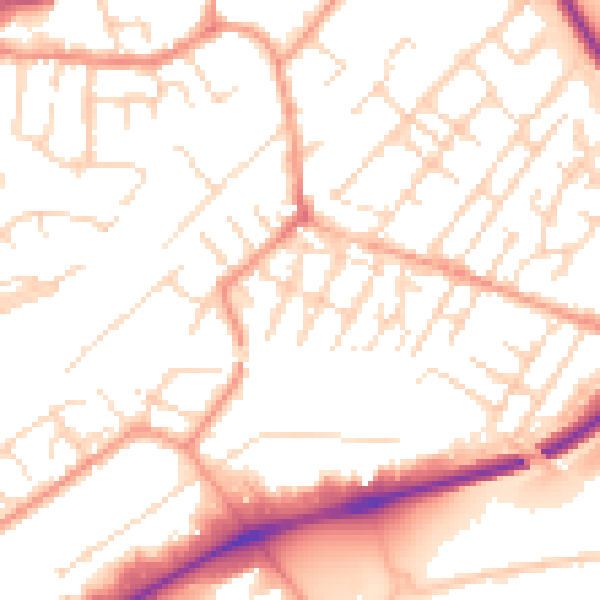
Daytime· 07:00 – 23:00
52.4dB

Night-time· 23:00 – 07:00
41.4dB