Briar Crest, Chesterfield Road, Huthwaite, Sutton In Ashfield, NG17 2QE
About Briar Crest
Briar Crest is a three-bedroom semi-detached house in Huthwaite, Sutton-In-Ashfield, Sutton In Ashfield (NG17 2QE). It has a recorded floor area of 89 m² (around 958 sq ft), construction records dating it to 1930-1949 and council tax band B. The latest certificate (July 2018) shows a D (score 58), a step below the typical UK home. When first surveyed in March 2016 the rating was E, the property has climbed 1 band since. Between certificates, lighting went from Good to Very Good; while wall efficiency dropped from Poor to Very Poor. The recommended improvements would push it to C (score 77). Our model identifies extension potential, subject to local planning policy.
Last sale on file: £154,000 in October 2018. Across the public record there are 4 sales, relatively high churn for a single property. Across 2005–2018, sale prices on this property compounded at 1.3% per year. Today's modelled estimate of £216,000 is 40.3% above the 2018 sale price. On a £-per-square-foot basis, the last sale (£161/sq ft) was about 22.9% above the typical sold price in the postcode. At 89 m² it's 22.6% smaller than the typical home in the postcode (115 m² median across 7 EPCs).
Know exactly what you're buying at Briar Crest
Before you offer, see what the listing won't tell you, the true value, the red flags and the full history.
Already flagged here
Valuation
against the asking price
Risks
planning & flood
Sold prices
similar homes nearby
Trends
the local market
What this property has
Inside
- Bedrooms3
- Bathrooms1
- Open-plan layoutYes
- Dining roomYes
Outside
- Private gardenYes
- GarageYes
Building
- Central heatingYes
- RefurbishedYes
- Extension potentialPossible
Energy performance
EPC Rating
Property Improvements
Changes detected from historical EPC data
Planning history
Briar Crest has no planning applications on record.
Notable planning nearby
4applications of note in the surrounding area
We flagged 1 thing worth checking at Briar Crest
Independent checks surfaced things a buyer would want to understand before offering. The report explains each one in full, with the underlying data and what to ask.
- Larger development activity nearby
30-day money-back guarantee
Sales history & valuation
Briar Crest's sale-price growth has lagged the wider UK trajectory across its history on file.
£216,000
Modelled from EPC, postcode comparables and a sale-price growth of 1.3% per year over 13 years.
£154,000
Growth on file: 1.3% per year over 13 years.
Sales timeline
11 October 2018Most recent
£154,000
+6.2%over 1 year27 October 2016
£145,000
+7.5%over 9 years26 July 2007
£134,850
+3.7%over 1 year18 November 2005
£130,000
Median price across the last 5 sales in NG17 2QE: £188,000 (2025–2012).
Nearby sales in NG17 2QE
Windrush, Chesterfield Road, Huthwaite, Sutton In Ashfield, NG17 2QE
Sold Jul 2025
£250,000Crich View, Chesterfield Road, Huthwaite, Sutton In Ashfield, NG17 2QE
Sold Jul 2018
£188,000Pennine View, Chesterfield Road, Huthwaite, Sutton In Ashfield, NG17 2QE
Sold Mar 2014
£143,0003 Dein Court, Chesterfield Road, Huthwaite, Sutton In Ashfield, NG17 2QE
Sold Nov 2012
£149,9502 Dein Court, Chesterfield Road, Huthwaite, Sutton In Ashfield, NG17 2QE
Sold Nov 2012
£149,950
Everything we know about Briar Crest, in one report
What it's really worth, what could be wrong, and the planning, sales and area data in full.
What we flagged
- Larger development activity nearby

Versus other Chesterfield Road homes
On epc rating, Briar Crest runs well behind the street norm.
Price per m²
£1,730
Street avg £1,623
Floor Area
89 m²
Street avg 111 m²
Habitable Rooms
4 rooms
Street avg 5 rooms
CO₂ Emissions
5.3 t/year
Street avg 3.7 t/year
Similar properties nearby
1 Blenheim Place, Huthwaite
NG17 2RD
1 Burton Close
NG17 2EW
1 Ashlands Close
NG17 2GL
1 Ashfield Road, Huthwaite
NG17 2NX
1 Caton Close
NG17 2EQ
1 Ashmore Avenue
NG17 2GU
1 All Saints Court, Huthwaite
NG17 2SP
1 Ashleigh Avenue
NG17 2ST
The neighbourhood at a glance
Daytime road noise here sits well below conversation level — a quiet pocket of the postcode.
Crime
5/mo
Steady year-on-year across the wider district.
Nearest stop
0.1 km
Portland Heights — bus stop.
Closest school
0.4 km
Woodland View Primary and Nursery School. 9 schools nearby.
Go deeper on the local area
The full report breaks down crime, transport links, schools and air quality in depth.
Road noise across the postcode
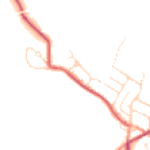
Daytime· 07:00 – 23:00
47.5dB
Night-time· 23:00 – 07:00
40.1dB