15 Alfred Street, Pinxton, Nottingham, NG16 6NQ
About 15 Alfred Street
15 Alfred Street is a detached house in Pinxton, Nottingham, Nottingham (NG16 6NQ). It has a recorded floor area of 125 m² (around 1345 sq ft), construction records dating it to 1967-1975 and council tax band B. The latest certificate (June 2014) shows an E (score 51), well below the UK norm with real room to improve. Earlier certificates rated it D (February 2014); the latest reading is one band lower. Between certificates, roof efficiency dropped from Very Good to Good and hot-water efficiency dropped from Average to Poor. The recommended improvements would lift it to C (score 80), a 2-band jump. The latest certificate is from June 2014, so improvements made since then won't be reflected.
At 125 m² the property is well over the postcode median (86 m² across 20 EPCs), placing it in the larger end of the local stock. 3 planning records sit against the property, 2 approved, 1 refused. Past consents include new windows and an extension, meaningful when judging how the property has evolved. Today's modelled estimate of £210,000 is 40% above the 2015 sale price. On a £-per-square-foot basis, the last sale (£111/sq ft) was about 27.6% above the typical sold price in the postcode. Last changed hands 10 years ago, in December 2015.
Know exactly what you're buying at 15 Alfred Street
Before you offer, see what the listing won't tell you, the true value, the red flags and the full history.
Valuation
against the asking price
Risks
planning & flood
Sold prices
similar homes nearby
Trends
the local market
Energy performance
15 Alfred Street's carbon output runs well above what efficient homes in the postcode produce.
EPC Expired
This certificate is over 10 years old and is no longer valid.Expired 03 Jun 2024
EPC Rating
Planning history
A a single-storey rear extension application was refused at 15 Alfred Street in 2021.
- Jun 2022RenovationAmendmentIn report
Minor amendment to planning permission 21/00488/FUL - replace proposed windows with bi-fold doors as pre attached drawing
- Agent
- Rick Cobham Design Ltd
New Windows- Documents
- 3 docs on file
- Reference
- 22/00255/MINAM
- Sept 2021ExtensionFullIn report
Extension: Single storey · Rear of property
Single storey rear extension to existing dwelling
- Agent
- Rick Cobham Design Ltd
- Documents
- 8 docs on file
- Reference
- 21/00488/FUL
What's in 15 Alfred Street, Pinxton, Nottingham, NG16 6NQ's planning history?
1 more on this property, plus refusals, disputes and full decisions nearby, in the report.
Sales history & valuation
15 Alfred Street valuation sits well clear of the typical sold price in this postcode.
£210,000
Modelled from EPC, postcode comparables.
£150,000
Recorded with HM Land Registry.
Sales timeline
18 December 2015Most recent
£150,000
Median price across the last 5 sales in NG16 6NQ: £125,000 (2025–2022).
Nearby sales in NG16 6NQ
8 Alfred Street, Pinxton, Nottingham, NG16 6NQ
Sold Sept 2025
£100,0004 Alfred Street, Pinxton, Nottingham, NG16 6NQ
Sold Apr 2025
£122,50024 Alfred Street, Pinxton, Nottingham, NG16 6NQ
Sold Jun 2023
£125,0009 Alfred Street, Pinxton, Nottingham, NG16 6NQ
Sold May 2022
£151,75011 Alfred Street, Pinxton, Nottingham, NG16 6NQ
Sold Jan 2022
£147,500
Everything we know about 15 Alfred Street, in one report
What it's really worth, what could be wrong, and the planning, sales and area data in full.
- Am I paying too much?
- Is something wrong with it?
- Is the agent's story true?
- Will it hold its value?

Versus other Alfred Street homes
Floor Area for 15 Alfred Street runs comfortably ahead of the street norm.
Price per m²
£1,200
Street avg £1,211
Floor Area
125 m²
Street avg 96 m²
Habitable Rooms
4 rooms
Street avg 5 rooms
CO₂ Emissions
7.2 t/year
Street avg 5.2 t/year
Similar properties nearby
1 Arthur Street, Pinxton
NG16 6NJ
1 Chapel Road, Selston
NG16 6BW
1 Annesley Lane, Selston
NG16 6AJ
1 Bridge End Avenue, Selston
NG16 6BE
1 Alfreton Road, Pinxton
NG16 6JZ
1 Burmese Road, Pinxton
NG16 6SD
1 Alberta Avenue, Selston
NG16 6GN
1 Brookhill Lane, Pinxton
NG16 6JX
The neighbourhood at a glance
Reported crime in the wider district is trending notably upward year-on-year.
Crime
3/mo
Rising year-on-year across the wider district.
Nearest stop
0.2 km
West End — bus stop.
Closest school
0.5 km
John King Infant Academy. 10 schools nearby.
Go deeper on the local area
The full report breaks down crime, transport links, schools and air quality in depth.
Road noise across the postcode
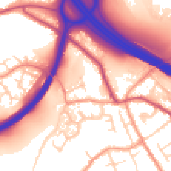
Daytime· 07:00 – 23:00
58.9dB

Night-time· 23:00 – 07:00
50.7dB