15 Ashfield Road, Newcastle Upon Tyne, NE3 4XL
About 15 Ashfield Road
15 Ashfield Road is a mid-terrace house in Newcastle Upon Tyne (NE3 4XL). It has a recorded floor area of 100 m² (around 1076 sq ft), construction records dating it to 1900-1929 and council tax band A. At 100 m² this is the largest unit on EPC record across the building (45–100 m²). The building's EPC ratings span E to C, with this unit at the top. The latest certificate (May 2024) shows a C (score 73). When first surveyed in March 2012 the rating was D, the property has climbed 1 band since. Between certificates, window efficiency went from Average to Good; while roof efficiency dropped from Average to Very Poor.
At 100 m² the property is well over the postcode median (67 m² across 43 EPCs), placing it in the larger end of the local stock. Sold July 2024 for £220,000. Across the public record there are 7 sales, relatively high churn for a single property. One planning record on file: a loft conversion approved in 2017. Past consents include a loft conversion, meaningful when judging how the property has evolved. Across 2000–2024, sale prices on this property compounded at 6.1% per year. On a £-per-square-foot basis, the last sale (£204/sq ft) was about 33.6% above the typical sold price in the postcode.
Everything you need to know about 15 Ashfield Road
The true value, the hidden risks and the full sale history, in one report.
30-day money-back guarantee

The data behind every report


Energy performance
EPC Rating
Property Improvements
Changes detected from historical EPC data
Heating controls upgraded for better temperature management
Window efficiency improved
Planning history
- Aug 2017Loft ConversionFullIn report
Installation of rooflights to front and rear to create loft conversion
- Documents
- 4 docs on file
- Reference
- 2017/1024/01/DET
We flagged 1 thing worth checking at 15 Ashfield Road
Independent checks surfaced things a buyer would want to understand before offering. The report explains each one in full, with the underlying data and what to ask.
- Larger development activity nearby
30-day money-back guarantee
Sales history & valuation
Latest sale on 15 Ashfield Road was the highest on Land Registry record across the postcode.
£217,000
Modelled from EPC, postcode comparables and a sale-price growth of 6.1% per year over 25 years.
£220,000
Growth on file: 6.1% per year over 25 years.
Sales timeline
30 July 2024Most recent
£220,000
+12.0%over 3 years22 October 2020
£196,500
+45.6%over 6 years16 July 2014
£135,000
-11.0%over 6 years2 August 2007
£151,750
+8.0%over 3 years30 June 2004
£140,500
+47.9%over 1 year19 September 2002
£95,000
+86.3%over 2 years24 January 2000
£51,000
Median price across the last 5 sales in NE3 4XL: £190,500 (2025–2024).
Nearby sales in NE3 4XL
30 Ashfield Road, Newcastle Upon Tyne, NE3 4XL
Sold Nov 2025
£190,50010 Ashfield Road, Newcastle Upon Tyne, NE3 4XL
Sold Sept 2025
£199,0009 Ashfield Road, Newcastle Upon Tyne, NE3 4XL
Sold Apr 2025
£175,00011 Ashfield Road, Newcastle Upon Tyne, NE3 4XL
Sold Oct 2024
£140,00018 Ashfield Road, Newcastle Upon Tyne, NE3 4XL
Sold May 2024
£195,000
Versus other Ashfield Road homes
On floor area, 15 Ashfield Road stands well clear of the street.
Price per m²
£2,200
Street avg £2,021
Floor Area
100 m²
Street avg 67 m²
Habitable Rooms
5 rooms
Street avg 3 rooms
CO₂ Emissions
3.4 t/year
Street avg 3.1 t/year
Everything you need to know about 15 Ashfield Road
The true value, the hidden risks and the full sale history, in one report.
30-day money-back guarantee
The data behind every report
Similar properties nearby
The neighbourhood at a glance
Crime
6/mo
Steady year-on-year across the wider district.
Nearest stop
0.1 km
Salters Road-Yetlington Drive — bus stop.
Closest school
0.7 km
Wyndham Primary School. 28 schools nearby.
Go deeper on the local area
The full report breaks down crime, transport links, schools and air quality in depth.
Road noise across the postcode
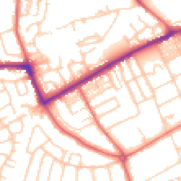
Daytime· 07:00 – 23:00
53.2dB

Night-time· 23:00 – 07:00
41.5dB