16 Brunton Avenue, Newcastle Upon Tyne, NE3 2PT
About 16 Brunton Avenue
16 Brunton Avenue is a two-bedroom semi-detached house in Newcastle Upon Tyne (NE3 2PT). It has a recorded floor area of 66 m² (around 710 sq ft), construction records dating it to 1930-1949 and council tax band B. The latest certificate (May 2024) shows a D (score 64), on the cusp of jumping into the C band. The recommended improvements would lift it to B (score 84), a 2-band jump. Other recorded features include a conservatory. Our model identifies extension potential, subject to local planning policy.
A recent sale: £145,500 in December 2024. Today's modelled estimate of £193,000 is 32.6% above the 2024 sale price. On a £-per-square-foot basis, the last sale (£205/sq ft) was about 32.3% above the typical sold price in the postcode.
What this property has
Inside
- Bedrooms2
- Bathrooms1
- Dining roomYes
- ConservatoryYes
Outside
- GarageYes
Building
- Heating systemGas
- RefurbishedYes
- Extension potentialPossible
Everything you need to know about 16 Brunton Avenue
The true value, the hidden risks and the full sale history, in one report.
30-day money-back guarantee

The data behind every report


Energy performance
Recommended upgrades on file would lift this property by multiple EPC bands.
EPC Rating
Planning history
16 Brunton Avenue has no planning applications on record.
The full report still covers planning activity across the surrounding area.
Sales history & valuation
16 Brunton Avenue valuation sits well clear of the typical sold price in this postcode.
£193,000
Modelled from EPC, postcode comparables.
£145,500
Recorded with HM Land Registry.
Sales timeline
18 December 2024Most recent
£145,500
Median price across the last 5 sales in NE3 2PT: £170,000 (2025–2020).
Nearby sales in NE3 2PT
1 Brunton Avenue, Newcastle Upon Tyne, NE3 2PT
Sold Aug 2025
£130,0008 Brunton Avenue, Newcastle Upon Tyne, NE3 2PT
Sold Oct 2024
£170,00017 Brunton Avenue, Newcastle Upon Tyne, NE3 2PT
Sold Sept 2023
£140,00022 Brunton Avenue, Newcastle Upon Tyne, NE3 2PT
Sold Mar 2021
£175,0009 Brunton Avenue, Newcastle Upon Tyne, NE3 2PT
Sold Jul 2020
£175,000
Versus other Brunton Avenue homes
On years held, 16 Brunton Avenue runs well behind the street norm.
Price per m²
£2,205
Street avg £2,151
Floor Area
66 m²
Street avg 66 m²
Habitable Rooms
5 rooms
Street avg 4 rooms
CO₂ Emissions
3.4 t/year
Street avg 3.9 t/year
Everything you need to know about 16 Brunton Avenue
The true value, the hidden risks and the full sale history, in one report.
30-day money-back guarantee
The data behind every report
Similar properties nearby
The neighbourhood at a glance
Rail-style transport is unusually close for this postcode.
Crime
6/mo
Steady year-on-year across the wider district.
Nearest stop
0.1 km
Fawdon Park Road-Strathearn Way — bus stop.
Closest school
0.4 km
North Fawdon Primary School. 28 schools nearby.
Go deeper on the local area
The full report breaks down crime, transport links, schools and air quality in depth.
Road noise across the postcode
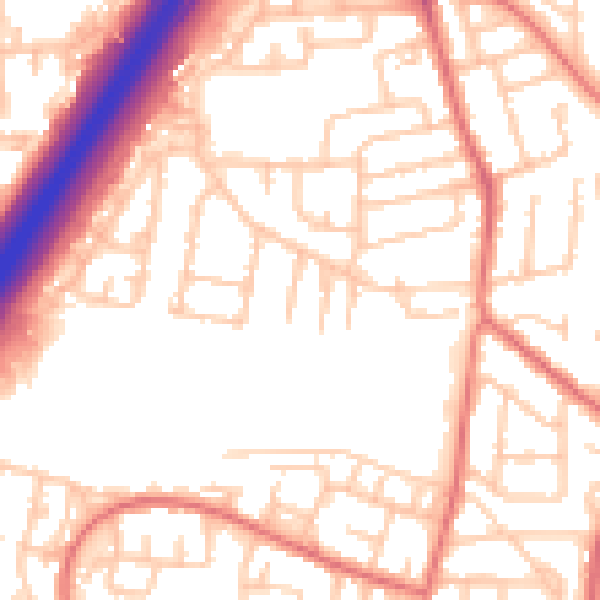
Daytime· 07:00 – 23:00
54.0dB

Night-time· 23:00 – 07:00
42.8dB