18 Kersey, Stantonbury, Milton Keynes, MK14 6AF
About 18 Kersey
18 Kersey is a four-bedroom semi-detached house in Stantonbury, Milton Keynes, Milton Keynes (MK14 6AF). It has a recorded floor area of 103 m² (around 1109 sq ft), construction records dating it to 1976-1982 and council tax band B. The latest certificate (October 2021) shows a C (score 71). When first surveyed in November 2011 the rating was D, the property has climbed 1 band since. Between certificates, hot-water efficiency went from Average to Good and lighting went from Poor to Very Good; while wall efficiency dropped from Good to Average and window efficiency dropped from Good to Average. The recommended improvements would push it to B (score 84). Other recorded features include a conservatory.
It hasn't traded since February 1995, a hold of 31 years that's notably long for the area. Only one transfer is on record with HM Land Registry, suggesting it has stayed in the same hands for a long time. Today's modelled estimate of £324,000 sits 1106.7% above the 1995 sale of £26,850. On a £-per-square-foot basis, the last sale (£24/sq ft) was about 82.1% below the postcode norm. One planning record on file: an extension approved in 2004. Past consents include an extension, meaningful when judging how the property has evolved. At 103 m² it's 19.8% larger than the typical home in the postcode (86 m² median across 23 EPCs).
Know exactly what you're buying at 18 Kersey
Before you offer, see what the listing won't tell you, the true value, the red flags and the full history.
Valuation
against the asking price
Risks
planning & flood
Sold prices
similar homes nearby
Trends
the local market
What this property has
Inside
- Bedrooms4
- Bathrooms2
- Dining roomYes
- EnsuiteYes
- ConservatoryYes
Outside
- Private gardenRear
- GarageYes
Energy performance
EPC Rating
Property Improvements
Changes detected from historical EPC data
Hot water efficiency improved
More low energy lighting installed
Planning history
18 Kersey has an approved side extension on the planning record.
- Jul 2004ExtensionFullIn report
Extension: Side of property
TWO STOREY SIDE EXTENSION
- Documents
- 1 doc on file
- Reference
- 04/00776/FUL
What's in 18 Kersey, Stantonbury, Milton Keynes, MK14 6AF's planning history?
Refusals, disputes and full decisions on this property and nearby, in the report.
Sales history & valuation
18 Kersey's modelled value sits at over four times its earliest registered sale price (1995).
£324,000
Modelled from EPC, postcode comparables.
£26,850
Recorded with HM Land Registry.
Sales timeline
24 February 1995Most recent
£26,850
Median price across the last 5 sales in MK14 6AF: £205,000 (2022–2011).
Nearby sales in MK14 6AF
17 Kersey, Stantonbury, Milton Keynes, MK14 6AF
Sold Nov 2022
£305,00027 Kersey, Stantonbury, Milton Keynes, MK14 6AF
Sold May 2021
£205,00032 Kersey, Stantonbury, Milton Keynes, MK14 6AF
Sold Jul 2019
£245,00029 Kersey, Stantonbury, Milton Keynes, MK14 6AF
Sold Feb 2018
£186,00015 Kersey, Stantonbury, Milton Keynes, MK14 6AF
Sold Jun 2005
£127,000
Everything we know about 18 Kersey, in one report
What it's really worth, what could be wrong, and the planning, sales and area data in full.
- Am I paying too much?
- Is something wrong with it?
- Is the agent's story true?
- Will it hold its value?

Versus other Kersey homes
On price per m², 18 Kersey runs well behind the street norm.
Price per m²
£261
Street avg £1,941
Floor Area
103 m²
Street avg 88 m²
Habitable Rooms
7 rooms
Street avg 5 rooms
CO₂ Emissions
3.5 t/year
Street avg 3.0 t/year
Similar properties nearby
1 Fair Isle View, Oakridge Park
MK14 6FN
1 Constable Close, Neath Hill
MK14 6JD
1 Aran Court, Oakridge Park
MK14 6FB
1 Dyers Mews, Neath Hill
MK14 6ER
1 Dewsbury, Oakridge Park
MK14 6FW
1 Burnet, Stantonbury
MK14 6AJ
1 Byward Close, Neath Hill
MK14 6JB
1 Ashfield, Stantonbury
MK14 6AU
The neighbourhood at a glance
Daytime road noise here sits well below conversation level — a quiet pocket of the postcode.
Crime
5/mo
Steady year-on-year across the wider district.
Nearest stop
0.1 km
Lincoln — bus stop.
Closest school
0.6 km
Stanton School. 20 schools nearby.
Go deeper on the local area
The full report breaks down crime, transport links, schools and air quality in depth.
Road noise across the postcode
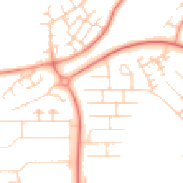
Daytime· 07:00 – 23:00
49.4dB

Night-time· 23:00 – 07:00
37.9dB