56 Birchside, Dunstable, LU6 3EH
About 56 Birchside
56 Birchside is a three-bedroom mid-terrace house in Dunstable (LU6 3EH). It has a recorded floor area of 83 m² (around 893 sq ft), construction records dating it to 1976-1982 and council tax band C. The latest certificate (September 2024) shows a C (score 72). The recommended improvements would push it to B (score 86). The home occupies a cul-de-sac position.
A recent sale: £317,500 in February 2025. Across 1997–2025, sale prices on this property compounded at 5.8% per year. On a £-per-square-foot basis, the last sale (£355/sq ft) was about 86.8% above the typical sold price in the postcode.
What this property has
Inside
- Bedrooms3
- Bathrooms1
- Open-plan layoutYes
- Dining roomYes
Outside
- Private gardenSouth-west-facing
- GarageEn bloc
- Cul-de-sacYes
Everything you need to know about 56 Birchside
The true value, the hidden risks and the full sale history, in one report.
30-day money-back guarantee

The data behind every report


Energy performance
EPC Rating
Planning history
56 Birchside has no planning applications on record.
Notable planning nearby
7applications of note in the surrounding area
We flagged 2 things worth checking at 56 Birchside
Independent checks surfaced things a buyer would want to understand before offering. The report explains each one in full, with the underlying data and what to ask.
- Signs of HMO activity in the area
- Larger development activity nearby
30-day money-back guarantee
Sales history & valuation
Price for 56 Birchside has grown more than fourfold since the 1997 starting point.
£331,000
Modelled from EPC, postcode comparables and a sale-price growth of 5.8% per year over 28 years.
£317,500
Growth on file: 5.8% per year over 28 years.
Sales timeline
17 February 2025Most recent
£317,500
+98.4%over 20 years10 January 2005
£159,995
+140.6%over 7 years12 June 1997
£66,500
Median price across the last 5 sales in LU6 3EH: £321,000 (2025–2023).
Versus other Birchside homes
56 Birchside is notably below the street on habitable rooms.
Price per m²
£3,825
Street avg £2,867
Floor Area
83 m²
Street avg 83 m²
Habitable Rooms
3 rooms
Street avg 4 rooms
CO₂ Emissions
2.9 t/year
Street avg 3.6 t/year
Everything you need to know about 56 Birchside
The true value, the hidden risks and the full sale history, in one report.
30-day money-back guarantee
The data behind every report
Similar properties nearby
1 Burges Close
LU6 3EU
1 Buttercup Close
LU6 3LA
1 Beech Road
LU6 3LY
1 Canesworde Road
LU6 3JJ
1 Buttermere Avenue
LU6 3PD
1 Bowland Crescent
LU6 3QD
1 Appleby Gardens
LU6 3DB
1 Crosby Close
LU6 3BZ
The neighbourhood at a glance
Crime
3/mo
Steady year-on-year across the wider district.
Nearest stop
0.2 km
Southfields Road — bus stop.
Closest school
0.5 km
Ardley Hill Academy. 19 schools nearby.
Go deeper on the local area
The full report breaks down crime, transport links, schools and air quality in depth.
Road noise across the postcode
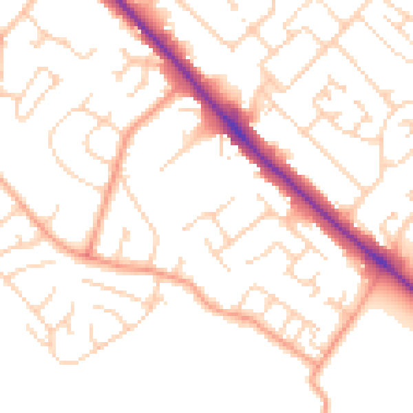
Daytime· 07:00 – 23:00
50.5dB

Night-time· 23:00 – 07:00
39.9dB