Are you a property professional?Get qualified leads from motivated homeowners.
Get started19 Beardsley Road, Quorn, Loughborough, LE12 8UX
6 sales on record
About 19 Beardsley Road
A plain-English summary derived from public records, EPC certificates, sold prices and local data.
19 Beardsley Road is a three-bedroom detached house in Quorn, Loughborough, Loughborough (LE12 8UX). It has a recorded floor area of 85 m² (around 915 sq ft), construction records dating it to 1983-1990 and council tax band D. The latest certificate (June 2013) shows a D (score 63), on the cusp of jumping into the C band. The recommended improvements would push it to C (score 79). The latest certificate is from June 2013, so improvements made since then won't be reflected. The home occupies a cul-de-sac position.
Sale prices here have outpaced England HPI: 6.2% per year against 0% for the wider region. Today's modelled estimate of £367,000 is 14.7% above the 2021 sale price. On a £-per-square-foot basis, the last sale (£350/sq ft) was about 78.1% above the typical sold price in the postcode. Sold July 2021 for £320,000. Across the public record there are 6 sales, relatively high churn for a single property. That sale was during the post-pandemic price surge, when transactions cleared materially above pre-2020 trend. At 85 m² it's 19.5% larger than the typical home in the postcode (71 m² median across 26 EPCs). One historical planning record sits against the property in 2022.
What this property has
Pulled from EPC certificates, claim submissions and our property model. Empty categories are hidden — we only show what's known.
Inside
- Bedrooms3
- Bathrooms1
- Dining roomYes
- Utility roomYes
Energy performance
Every EPC certificate filed against this property — current rating, recorded improvements, and where there's headroom to reach a higher band.
19 Beardsley Road's EPC is over a decade old — improvements since won't be reflected.
EPC Expired
This certificate is over 10 years old and is no longer valid.Expired 28 Jun 2023
Planning history
Applications and permits filed against 19 Beardsley Road, Quorn, Loughborough, LE12 8UX, sourced from the PlanIt planning register.
- May 2022Garage ConversionOutlineCERTIFICATE OF LAWFUL PROPOSED DEVELOPMENT
Certificate of lawful (proposed) development for garage conversion and associated works, including replacement front door.
Sales history & valuation
Recorded transactions, our model's current estimate, and a quick read on what neighbouring properties have sold for.
19 Beardsley Road has more than quadrupled in price since its earliest registered sale in 1997.
Current estimate
See how we calculated this£367,000
Modelled from EPC, postcode comparables and a sale-price growth of 6.2% per year over 24 years.
Last sold (2021)
£320,000
Growth on file: 6.2% per year over 24 years.
Sales timeline
Versus other Beardsley Road homes
Four headline reads against 26 similar houses on this street, drawn from the latest EPC and Land Registry data.
Price per m² for 19 Beardsley Road runs comfortably ahead of the street norm.
Price per m²
£3,765
Street avg £2,745
Floor Area
85 m²
Street avg 77 m²
Habitable Rooms
5 rooms
Similar properties nearby
A handful of close matches in the same postcode area, ranked by likeness on bedrooms, type and floor area.
The neighbourhood at a glance
A condensed read of the local area. Each tile links through to the full breakdown on the Loughborough district page.
Rail-style transport is unusually close for this postcode.
Crime
2/mo
Steady year-on-year across the wider district.
Nearest stop
0.1 km
Farley Way — bus stop.
Road noise across the postcode
Modelled day and night-time noise levels around LE12 8UX from Defra's strategic mapping. The pin marks this postcode's centroid.
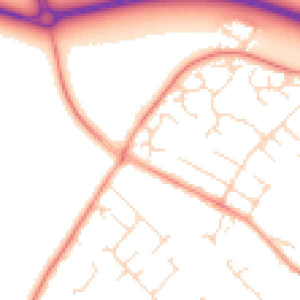
Daytime· 07:00 – 23:00
51.0dB

Everything within walking distance
Schools, transport stops and scenic spots near this property — 38 points of interest in total.
Beautiful places to visit nearby
Curated scenic spots within reach of this postcode, served by Beautifulplaces.ai. Photography and tagging come from their open dataset.
Common questions
The questions buyers, sellers and homeowners most often ask about 19 Beardsley Road, Quorn, Loughborough, LE12 8UX. Each answer is also embedded as structured data for search engines.