9 Richard Kelly Place, Liverpool, L4 8TX
About 9 Richard Kelly Place
9 Richard Kelly Place is an end-of-terrace house in Liverpool (L4 8TX). It has a recorded floor area of 93 m² (around 1001 sq ft), construction records dating it to 1930-1949 and council tax band A. The latest certificate (October 2021) shows a D (score 60), on the cusp of jumping into the C band. The recommended improvements would push it to C (score 78).
At 93 m² it's 18.5% larger than the typical home in the postcode (79 m² median across 8 EPCs). One historical planning record sits against the property in 2022.
Know exactly what you're buying at 9 Richard Kelly Place
Before you offer, see what the listing won't tell you, the true value, the red flags and the full history.
Valuation
against the asking price
Risks
planning & flood
Sold prices
similar homes nearby
Trends
the local market
Energy performance
EPC Rating
Planning history
- Jul 2022FullIn report
Installation of external wall insulation with silicone render finish.
- Documents
- 6 docs on file
- Reference
- 22H/0824
What's in 9 Richard Kelly Place, Liverpool, L4 8TX's planning history?
Refusals, disputes and full decisions on this property and nearby, in the report.
Sales history & valuation
9 Richard Kelly Place has no Land Registry sales on file, suggesting it has stayed in the same hands since registration began.
£147,000
Modelled from EPC, postcode comparables.
No sales recorded with HM Land Registry
That can mean the property has never traded since the registry began publishing in 1995, was a new build that hasn't been registered yet, or is held in the same hands long-term.
Median price across the last 5 sales in L4 8TX: £73,000 (2023–2005).
Everything we know about 9 Richard Kelly Place, in one report
What it's really worth, what could be wrong, and the planning, sales and area data in full.
- Am I paying too much?
- Is something wrong with it?
- Is the agent's story true?
- Will it hold its value?

Versus other Richard Kelly Place homes
9 Richard Kelly Place outperforms the street on floor area by a wide margin.
EPC Rating
60 (D)
Street avg 72 (C)
Floor Area
93 m²
Street avg 78 m²
CO₂ Emissions
4.6 t/year
Street avg 3.0 t/year
Habitable Rooms
5 rooms
Street avg 5 rooms
Similar properties nearby
The neighbourhood at a glance
Reported crime in the wider district is trending notably upward year-on-year.
Crime
11/mo
Rising year-on-year across the wider district.
Nearest stop
0.1 km
Cherry Lane — bus stop.
Closest school
0.2 km
St Matthew's Catholic Primary School. 49 schools nearby.
Go deeper on the local area
The full report breaks down crime, transport links, schools and air quality in depth.
Road noise across the postcode
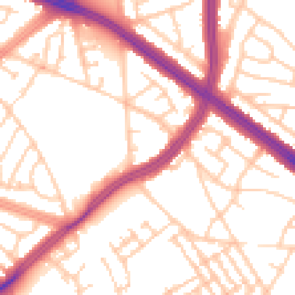
Daytime· 07:00 – 23:00
53.7dB

Night-time· 23:00 – 07:00
43.9dB