17 Keble Road, Bootle, L20 7ED
About 17 Keble Road
17 Keble Road is a semi-detached house in Bootle (L20 7ED). It has a recorded floor area of 68 m² (around 732 sq ft), construction records dating it to 2007 onwards and council tax band B. The latest certificate (June 2021) shows a C (score 77), near the top of the C band. Earlier certificates rated it B (November 2011); the latest reading is one band lower. Between certificates, window efficiency dropped from Very Good to Good and hot-water efficiency dropped from Very Good to Good. The recommended improvements would push it to B (score 90).
It lags the bulk of the postcode on energy efficiency (less efficient than 73% of similar EPCs). Last changed hands 15 years ago, in November 2011. Today's modelled estimate of £147,000 is 45.9% above the 2011 sale price.
Everything you need to know about 17 Keble Road
The true value, the hidden risks and the full sale history, in one report.
30-day money-back guarantee

The data behind every report


Energy performance
EPC Rating
Property Improvements
Changes detected from historical EPC data
Heating controls changed
Hot water system changed
More low energy lighting installed
Heating controls upgraded for better temperature management
Hot water system upgraded
More low energy lighting installed
Solar water heating installed
Hot water system changed
Wall insulation improved
Roof insulation improved
Planning history
17 Keble Road has no planning applications on record.
Notable planning nearby
3applications of note in the surrounding area
Sales history & valuation
17 Keble Road valuation sits well clear of the typical sold price in this postcode.
£147,000
Modelled from EPC, postcode comparables.
£100,766
Recorded with HM Land Registry.
Sales timeline
11 November 2011Most recent
£100,766
Median price across the last 5 sales in L20 7ED: £135,000 (2025–2021).
Versus other Keble Road homes
17 Keble Road outperforms the street on years held by a wide margin.
Price per m²
£1,482
Street avg £1,569
Floor Area
68 m²
Street avg 74 m²
Habitable Rooms
5 rooms
Street avg 4 rooms
CO₂ Emissions
1.8 t/year
Street avg 1.3 t/year
Everything you need to know about 17 Keble Road
The true value, the hidden risks and the full sale history, in one report.
30-day money-back guarantee
The data behind every report
Similar properties nearby
The neighbourhood at a glance
Rail-style transport is unusually close for this postcode.
Crime
7/mo
Rising year-on-year across the wider district.
Nearest stop
0.2 km
Marble Close — bus stop.
Closest school
0.3 km
Hugh Baird College. 34 schools nearby.
Go deeper on the local area
The full report breaks down crime, transport links, schools and air quality in depth.
Road noise across the postcode
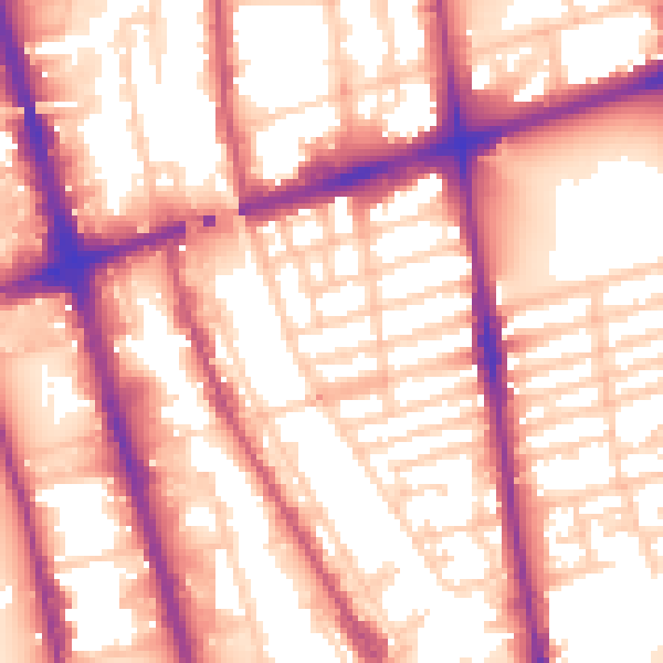
Daytime· 07:00 – 23:00
57.7dB
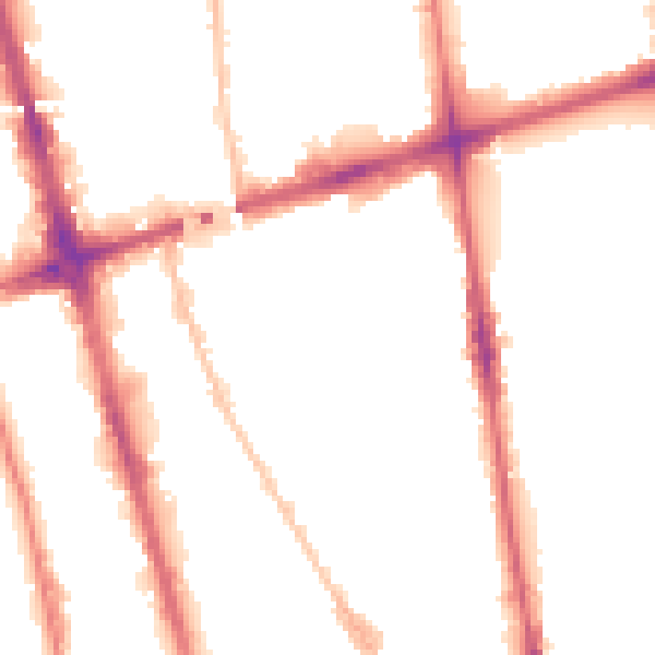
Night-time· 23:00 – 07:00
49.5dB