3 Meldrum Road, Liverpool, L15 6TX
About 3 Meldrum Road
3 Meldrum Road is a three-bedroom semi-detached house in Liverpool (L15 6TX). It has a recorded floor area of 87 m² (around 936 sq ft), construction records dating it to 1930-1949 and council tax band C. The latest certificate (February 2019) shows a D (score 61), on the cusp of jumping into the C band. The recommended improvements would lift it to B (score 85), a 2-band jump.
Today's modelled estimate of £302,000 sits 58.5% above the 2019 sale of £190,500. Most recent transfer: February 2019 at £190,500.
Know exactly what you're buying at 3 Meldrum Road
Before you offer, see what the listing won't tell you, the true value, the red flags and the full history.
Valuation
against the asking price
Risks
planning & flood
Sold prices
similar homes nearby
Trends
the local market
What this property has
Inside
- Bedrooms3
- Bathrooms1
- Open-plan layoutYes
- Dining roomYes
Outside
- Private gardenYes
- GarageYes
Building
- RefurbishedYes
Energy performance
Recommended upgrades on file would lift this property by multiple EPC bands.
EPC Rating
Planning history
3 Meldrum Road has no planning applications on record.
The full report still covers planning activity across the surrounding area.
Sales history & valuation
3 Meldrum Road valuation sits well clear of the typical sold price in this postcode.
£302,000
Modelled from EPC, postcode comparables.
£190,500
Recorded with HM Land Registry.
Sales timeline
18 February 2019Most recent
£190,500
Median price across the last 5 sales in L15 6TX: £192,500 (2019–2007).
Everything we know about 3 Meldrum Road, in one report
What it's really worth, what could be wrong, and the planning, sales and area data in full.
- Am I paying too much?
- Is something wrong with it?
- Is the agent's story true?
- Will it hold its value?

Versus other Meldrum Road homes
Floor Area for 3 Meldrum Road lags the street by a wide margin.
Price per m²
£2,190
Street avg £2,073
Floor Area
87 m²
Street avg 106 m²
Habitable Rooms
6 rooms
Street avg 6 rooms
CO₂ Emissions
4.1 t/year
Street avg 4.7 t/year
Similar properties nearby
The neighbourhood at a glance
Reported crime in the wider district is trending notably upward year-on-year.
Crime
6/mo
Rising year-on-year across the wider district.
Nearest stop
0.1 km
Loreburn Road — bus stop.
Closest school
0.1 km
Mosspits Lane Primary School. 43 schools nearby.
Go deeper on the local area
The full report breaks down crime, transport links, schools and air quality in depth.
Road noise across the postcode
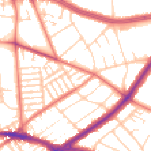
Daytime· 07:00 – 23:00
53.7dB

Night-time· 23:00 – 07:00
43.0dB