Are you a property professional?Get qualified leads from motivated homeowners.
Get started4 Bourne Firs, Lower Bourne, Farnham, GU10 3QD
3 sales on record
About 4 Bourne Firs
A plain-English summary derived from public records, EPC certificates, sold prices and local data.
4 Bourne Firs is a four-bedroom detached house in Lower Bourne, Farnham, Farnham (GU10 3QD). It has a recorded floor area of 186 m² (around 2002 sq ft), construction records dating it to 1967-1975 and council tax band G. The latest certificate (March 2015) shows a D (score 64), on the cusp of jumping into the C band. The recommended improvements would lift it to B (score 83), a 2-band jump. The latest certificate is from March 2015, so improvements made since then won't be reflected. Other recorded features include attached land beyond the plot.
Sale prices here have outpaced England HPI: 4% per year against 0% for the wider region. On a £-per-square-foot basis, the last sale (£470/sq ft) was about 48.3% above the typical sold price in the postcode. 5 planning records sit against the property, 2 approved, 0 refused. Past consents include tree works, meaningful when judging how the property has evolved. At 186 m² it's 15.9% larger than the typical home in the postcode (161 m² median across 18 EPCs). Last sale on file: £940,000 in August 2023.
What this property has
Pulled from EPC certificates, claim submissions and our property model. Empty categories are hidden — we only show what's known.
Inside
- Bedrooms4
- Bathrooms2
- Dining roomYes
- Utility roomYes
Energy performance
Every EPC certificate filed against this property — current rating, recorded improvements, and where there's headroom to reach a higher band.
4 Bourne Firs's carbon output runs well above what efficient homes in the postcode produce.
EPC Expired
This certificate is over 10 years old and is no longer valid.Expired 01 Mar 2025
Planning history
Applications and permits filed against 4 Bourne Firs, Lower Bourne, Farnham, GU10 3QD, sourced from the PlanIt planning register.
Planning history at 4 Bourne Firs is exclusively tree-management applications — typical for a property with mature trees on or near the plot.
- Aug 2017Tree WorksTreesTPO Consent
Application for works to tree subject of tree preservation order 02/00tree identification in accordance with submittted annotated plant1 scots pine - remove back to stem 1x lowest extended branch over eastern boundary.
Sales history & valuation
Recorded transactions, our model's current estimate, and a quick read on what neighbouring properties have sold for.
4 Bourne Firs has more than doubled in price since the earliest registered sale in 2001.
Current estimate
See how we calculated this£959,000
Modelled from EPC, postcode comparables and a sale-price growth of 4.0% per year over 22 years.
Last sold (2023)
£940,000
Growth on file: 4.0% per year over 22 years.
Sales timeline
Versus other Bourne Firs homes
Four headline reads against 18 similar houses on this street, drawn from the latest EPC and Land Registry data.
4 Bourne Firs is notably below the street on years held.
Price per m²
£5,054
Street avg £4,298
Floor Area
186 m²
Street avg 169 m²
Habitable Rooms
8 rooms
Street avg 8 rooms
Similar properties nearby
A handful of close matches in the same postcode area, ranked by likeness on bedrooms, type and floor area.
The neighbourhood at a glance
A condensed read of the local area. Each tile links through to the full breakdown on the Farnham district page.
Daytime road noise here sits well below conversation level — a quiet pocket of the postcode.
Crime
3/mo
Steady year-on-year across the wider district.
Nearest stop
0.1 km
Road noise across the postcode
Modelled day and night-time noise levels around GU10 3QD from Defra's strategic mapping. The pin marks this postcode's centroid.
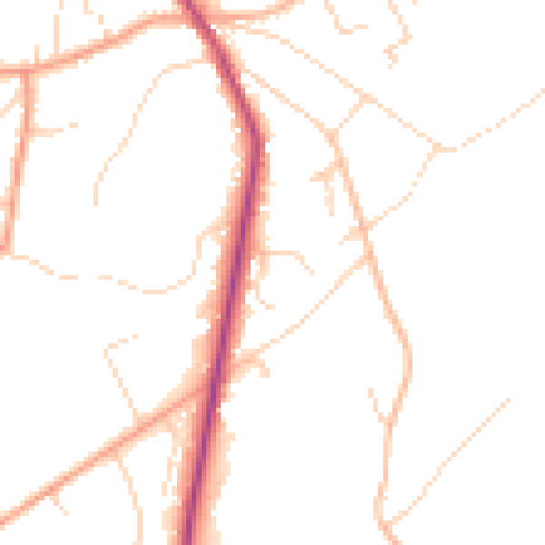
Daytime· 07:00 – 23:00
48.0dB

Everything within walking distance
Schools, transport stops and scenic spots near this property — 41 points of interest in total.
Beautiful places to visit nearby
Curated scenic spots within reach of this postcode, served by Beautifulplaces.ai. Photography and tagging come from their open dataset.
Common questions
The questions buyers, sellers and homeowners most often ask about 4 Bourne Firs, Lower Bourne, Farnham, GU10 3QD. Each answer is also embedded as structured data for search engines.