Are you a property professional?Get qualified leads from motivated homeowners.
Get started11 Bourne Firs, Lower Bourne, Farnham, GU10 3QD
1 planning record
About 11 Bourne Firs
A plain-English summary derived from public records, EPC certificates, sold prices and local data.
11 Bourne Firs is a four-bedroom detached house in Lower Bourne, Farnham, Farnham (GU10 3QD). It has a recorded floor area of 128 m² (around 1378 sq ft), construction records dating it to 1976-1982 and council tax band G. The latest certificate (September 2013) shows a C (score 72). The recommended improvements would push it to B (score 85). The latest certificate is from September 2013, so improvements made since then won't be reflected.
At 128 m² it's 20.7% smaller than the typical home in the postcode (162 m² median across 18 EPCs). Its energy rating outperforms most of the postcode (better than 72% of similar EPCs). Today's modelled estimate of £878,000 is 20.8% above the 2020 sale price. On a £-per-square-foot basis, the last sale (£528/sq ft) was about 66.6% above the typical sold price in the postcode. Last sale on file: £727,000 in December 2020. One historical planning record sits against the property in 2011.
What this property has
Pulled from EPC certificates, claim submissions and our property model. Empty categories are hidden — we only show what's known.
Inside
- Bedrooms4
- Bathrooms2
- Dining roomYes
- EnsuiteYes
Energy performance
Every EPC certificate filed against this property — current rating, recorded improvements, and where there's headroom to reach a higher band.
11 Bourne Firs's EPC is over a decade old — improvements since won't be reflected.
EPC Expired
This certificate is over 10 years old and is no longer valid.Expired 13 Sept 2023
Planning history
Applications and permits filed against 11 Bourne Firs, Lower Bourne, Farnham, GU10 3QD, sourced from the PlanIt planning register.
- Apr 2011Tree WorksTreesTPO Consent
Application for works to trees subject of tree preservation order 2/00 group five consisting of three norway maple.Numbers referred to refer to the application.1) Minor crown reduction no greater than 20% (estimated 3m in height maximum) of one twin-sp
Sales history & valuation
Recorded transactions, our model's current estimate, and a quick read on what neighbouring properties have sold for.
The latest sale landed in the post-pandemic price surge — useful context when reading the figure.
Current estimate
See how we calculated this£878,000
Modelled from EPC, postcode comparables.
Last sold (2020)
£727,000
Recorded with HM Land Registry.
Sales timeline
Versus other Bourne Firs homes
Four headline reads against 18 similar houses on this street, drawn from the latest EPC and Land Registry data.
11 Bourne Firs outperforms the street on price per m² by a wide margin.
Price per m²
£5,680
Street avg £4,257
Floor Area
128 m²
Street avg 172 m²
Habitable Rooms
6 rooms
Similar properties nearby
A handful of close matches in the same postcode area, ranked by likeness on bedrooms, type and floor area.
The neighbourhood at a glance
A condensed read of the local area. Each tile links through to the full breakdown on the Farnham district page.
Daytime road noise here sits well below conversation level — a quiet pocket of the postcode.
Crime
3/mo
Steady year-on-year across the wider district.
Nearest stop
0.1 km
Road noise across the postcode
Modelled day and night-time noise levels around GU10 3QD from Defra's strategic mapping. The pin marks this postcode's centroid.
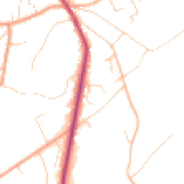
Daytime· 07:00 – 23:00
48.0dB

Everything within walking distance
Schools, transport stops and scenic spots near this property — 41 points of interest in total.
Beautiful places to visit nearby
Curated scenic spots within reach of this postcode, served by Beautifulplaces.ai. Photography and tagging come from their open dataset.
Common questions
The questions buyers, sellers and homeowners most often ask about 11 Bourne Firs, Lower Bourne, Farnham, GU10 3QD. Each answer is also embedded as structured data for search engines.