18 Chantry Close, Lydney, GL15 5TH
About 18 Chantry Close
18 Chantry Close is a three-bedroom detached house in Lydney (GL15 5TH). It has a recorded floor area of 104 m² (around 1119 sq ft), construction records dating it to 1996-2002 and council tax band C. The latest certificate (March 2024) shows a C (score 72). The recommended improvements would push it to B (score 82). Records show the property has been extended at some point in its history.
One planning record on file: an extension approved in 2005. Past consents include an extension, meaningful when judging how the property has evolved. Across 1998–2024, sale prices on this property compounded at 5.7% per year. On a £-per-square-foot basis, the last sale (£301/sq ft) was about 108.4% above the typical sold price in the postcode. Last sale on file: £337,000 in September 2024.
What this property has
Inside
- Bedrooms3
- Bathrooms3
- CloakroomYes
- EnsuiteYes
Building
- Previously extendedYes
Everything you need to know about 18 Chantry Close
The true value, the hidden risks and the full sale history, in one report.
30-day money-back guarantee

The data behind every report


Energy performance
EPC Rating
Planning history
- Sept 2005ExtensionFullIn report
Alterations and extension to dwelling.
- Reference
- P1239/05/FUL
We flagged 1 thing worth checking at 18 Chantry Close
Independent checks surfaced things a buyer would want to understand before offering. The report explains each one in full, with the underlying data and what to ask.
- Larger development activity nearby
30-day money-back guarantee
Sales history & valuation
18 Chantry Close has more than quadrupled in price since its earliest registered sale in 1998.
£361,000
Modelled from EPC, postcode comparables and a sale-price growth of 5.7% per year over 26 years.
£337,000
Growth on file: 5.7% per year over 26 years.
Sales timeline
1 September 2024Most recent
£337,000
+188.0%over 22 years2 May 2002
£117,000
+52.0%over 4 years13 March 1998
£76,950
Median price across the last 5 sales in GL15 5TH: £285,000 (2024–2018).
Versus other Chantry Close homes
On years held, 18 Chantry Close runs well behind the street norm.
Price per m²
£3,240
Street avg £2,439
Floor Area
104 m²
Street avg 101 m²
Habitable Rooms
6 rooms
Street avg 6 rooms
CO₂ Emissions
3.3 t/year
Street avg 3.6 t/year
Everything you need to know about 18 Chantry Close
The true value, the hidden risks and the full sale history, in one report.
30-day money-back guarantee
The data behind every report
Similar properties nearby
The neighbourhood at a glance
Rail-style transport is unusually close for this postcode.
Crime
2/mo
Steady year-on-year across the wider district.
Nearest stop
0.1 km
Cemetery — bus stop.
Closest school
0.3 km
The Dean Academy. 5 schools nearby.
Go deeper on the local area
The full report breaks down crime, transport links, schools and air quality in depth.
Road noise across the postcode
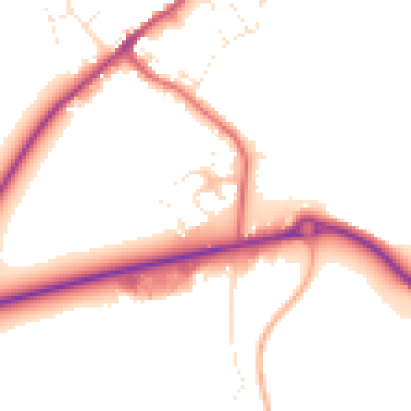
Daytime· 07:00 – 23:00
50.6dB

Night-time· 23:00 – 07:00
42.9dB