15 Kennedy Avenue, Enfield, EN3 4PA
About 15 Kennedy Avenue
15 Kennedy Avenue is a semi-detached house in Enfield (EN3 4PA). It has a recorded floor area of 65 m² (around 700 sq ft), construction records dating it to 1967-1975 and council tax band C. At 65 m² this is the 22nd smallest of 25 units on EPC record in the building, where floor areas span 52–82 m². The building's EPC ratings span D to C, with this unit at the top. The latest certificate (May 2025) shows a C (score 77), near the top of the C band. When first surveyed in July 2019 the rating was D, the property has climbed 1 band since. Between certificates, lighting went from Good to Very Good.
At 65 m² it's 16.1% larger than the typical home in the postcode (56 m² median across 24 EPCs). Today's modelled estimate of £302,000 is 11.9% above the 2019 sale price. On a £-per-square-foot basis, the last sale (£386/sq ft) was about 69.9% above the typical sold price in the postcode. Last sale on file: £270,000 in September 2019.
Everything you need to know about 15 Kennedy Avenue
The true value, the hidden risks and the full sale history, in one report.
30-day money-back guarantee

The data behind every report


Energy performance
EPC Rating
Property Improvements
Changes detected from historical EPC data
Heating controls upgraded for better temperature management
More low energy lighting installed
Planning history
15 Kennedy Avenue has no planning applications on record.
Notable planning nearby
39applications of note in the surrounding area
We flagged 1 thing worth checking at 15 Kennedy Avenue
Independent checks surfaced things a buyer would want to understand before offering. The report explains each one in full, with the underlying data and what to ask.
- Signs of HMO activity in the area
30-day money-back guarantee
Sales history & valuation
15 Kennedy Avenue valuation sits well clear of the typical sold price in this postcode.
£302,000
Modelled from EPC, postcode comparables.
£270,000
Recorded with HM Land Registry.
Sales timeline
16 September 2019Most recent
£270,000
Median price across the last 5 sales in EN3 4PA: £310,000 (2024–2022).
Nearby sales in EN3 4PA
Versus other Kennedy Avenue homes
On epc rating, 15 Kennedy Avenue stands well clear of the street.
Price per m²
£4,154
Street avg £3,885
Floor Area
65 m²
Street avg 58 m²
Habitable Rooms
3 rooms
Street avg 3 rooms
CO₂ Emissions
1.7 t/year
Street avg 2.3 t/year
Everything you need to know about 15 Kennedy Avenue
The true value, the hidden risks and the full sale history, in one report.
30-day money-back guarantee
The data behind every report
Similar properties nearby
The neighbourhood at a glance
Rail-style transport is unusually close for this postcode.
Crime
8/mo
Rising year-on-year across the wider district.
Nearest stop
0.2 km
Orchard Road (EN3) — bus stop.
Closest school
0.3 km
St Matthew's CofE Primary School. 44 schools nearby.
Go deeper on the local area
The full report breaks down crime, transport links, schools and air quality in depth.
Road noise across the postcode
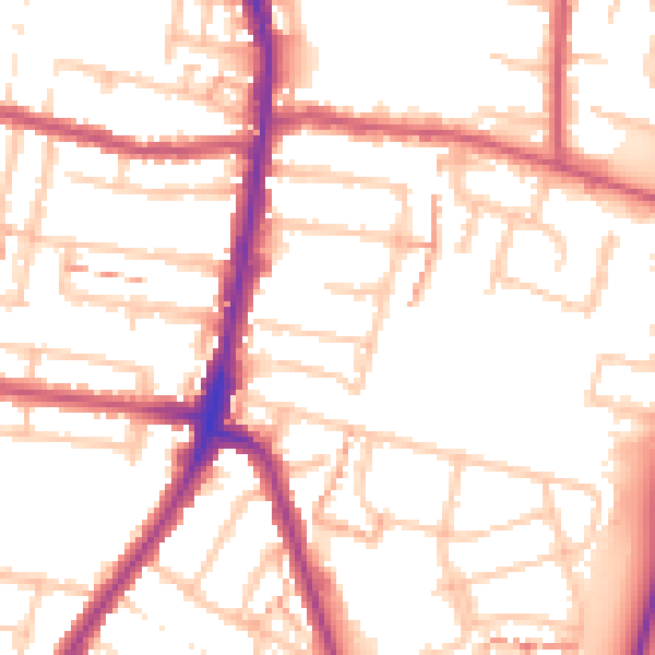
Daytime· 07:00 – 23:00
53.3dB

Night-time· 23:00 – 07:00
42.7dB