3 Cleeve Workshops, Boundary Street, Hackney, London, E2 7JD
About 3 Cleeve Workshops
3 Cleeve Workshops is a mid-terrace house in Hackney, London, London (E2 7JD). It has a recorded floor area of 9 m² (around 100 sq ft) and construction records dating it to before 1900. At 9 m² this is the smallest unit on EPC record across the building (9–9 m²). On EPC score it ranks last in the building (56 versus a best of 56). The latest certificate (December 2009) shows a D (score 56), a step below the typical UK home. Main heating runs on to be used only when there is no heating/hot. The latest certificate is from December 2009, so improvements made since then won't be reflected.
Know exactly what you're buying at 3 Cleeve Workshops
Before you offer, see what the listing won't tell you, the true value, the red flags and the full history.
Already flagged here
Valuation
against the asking price
Risks
planning & flood
Sold prices
similar homes nearby
Trends
the local market
Energy performance
3 Cleeve Workshops's carbon output is low for the local stock.
EPC Expired
This certificate is over 10 years old and is no longer valid.Expired 11 Dec 2019
EPC Rating
Planning history
3 Cleeve Workshops has no planning applications on record.
Notable planning nearby
12applications of note in the surrounding area
We flagged 1 thing worth checking at 3 Cleeve Workshops
Independent checks surfaced things a buyer would want to understand before offering. The report explains each one in full, with the underlying data and what to ask.
- Signs of HMO activity in the area
30-day money-back guarantee
Everything we know about 3 Cleeve Workshops, in one report
What it's really worth, what could be wrong, and the planning, sales and area data in full.
What we flagged
- Signs of HMO activity in the area

Versus other Cleeve Workshops homes
EPC Rating
56 (D)
Street avg 56 (D)
Floor Area
9 m²
Street avg 9 m²
CO₂ Emissions
1.3 t/year
Street avg 1.3 t/year
Habitable Rooms
1 rooms
Street avg 1 rooms
Similar properties nearby
1 11, Shacklewell Street, Tower Hamlets
E2 7EG
1 1a, Flat 10, Old Nichol Street, Tower Hamlets
E2 7HR
1 Arnold Circus, Tower Hamlets
E2 7ES
1 Baroness Road, Tower Hamlets
E2 7PW
1 Blackbird Yard, Tower Hamlets
E2 7RP
1 Boundary Street, Tower Hamlets
E2 7JE
1 Chambord Street, Tower Hamlets
E2 7NJ
1 Delta Point, Delta Street, Tower Hamlets
E2 7BF
The neighbourhood at a glance
Rail-style transport is unusually close for this postcode.
Crime
11/mo
Falling year-on-year across the wider district.
Nearest stop
0.0 km
Calvert Avenue / Shoreditch — bus stop.
Closest school
0.1 km
Virginia Primary School. 109 schools nearby.
Go deeper on the local area
The full report breaks down crime, transport links, schools and air quality in depth.
Road noise across the postcode
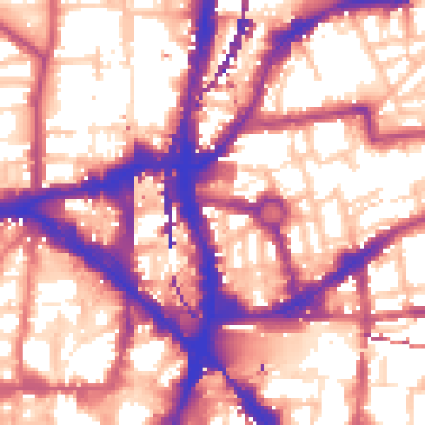
Daytime· 07:00 – 23:00
59.9dB
Night-time· 23:00 – 07:00
50.5dB