1 Chartfield Drive, Kirby Le Soken, Frinton On Sea, CO13 0DR
About 1 Chartfield Drive
1 Chartfield Drive is a three-bedroom detached house in Kirby-Le-Soken, Frinton-On-Sea, Frinton On Sea (CO13 0DR). It has a recorded floor area of 95 m² (around 1028 sq ft), construction records dating it to 1976-1982 and council tax band E. The latest certificate (May 2010) shows an E (score 54), well below the UK norm with real room to improve. The recommended improvements would lift it to C (score 69), a 2-band jump. The latest certificate is from May 2010, so improvements made since then won't be reflected. Other recorded features include attached land beyond the plot. It has already been extended once and our model flags further extension potential, a sign of buyer flexibility.
Across 1998–2014, sale prices on this property compounded at 3.8% per year. Today's modelled estimate of £432,000 sits 64.3% above the 2014 sale of £263,000. At 95 m² it sits well below the postcode median (187 m² across 19 EPCs), making it one of the more compact homes locally. It lags the bulk of the postcode on energy efficiency (less efficient than 84% of similar EPCs). 12 years since the last transfer (May 2014).
Know exactly what you're buying at 1 Chartfield Drive
Before you offer, see what the listing won't tell you, the true value, the red flags and the full history.
Already flagged here
Valuation
against the asking price
Risks
planning & flood
Sold prices
similar homes nearby
Trends
the local market
What this property has
Inside
- Bedrooms3
Outside
- LandYes
Building
- Previously extendedYes
- Extension potentialPossible
Energy performance
1 Chartfield Drive's carbon output runs well above what efficient homes in the postcode produce.
EPC Expired
This certificate is over 10 years old and is no longer valid.Expired 31 May 2020
EPC Rating
Planning history
1 Chartfield Drive has no planning applications on record.
Notable planning nearby
2applications of note in the surrounding area
We flagged 1 thing worth checking at 1 Chartfield Drive
Independent checks surfaced things a buyer would want to understand before offering. The report explains each one in full, with the underlying data and what to ask.
- Larger development activity nearby
30-day money-back guarantee
Sales history & valuation
£432,000
Modelled from EPC, postcode comparables and a sale-price growth of 3.8% per year over 15 years.
£263,000
Growth on file: 3.8% per year over 15 years.
Sales timeline
1 May 2014Most recent
£263,000
+69.7%over 12 years24 June 2001
£155,000
+5.1%over 2 years11 December 1998
£147,500
Median price across the last 5 sales in CO13 0DR: £690,000 (2025–2022).
Nearby sales in CO13 0DR
12 Chartfield Drive, Kirby Le Soken, Frinton On Sea, CO13 0DR
Sold Aug 2025
£640,00017 Chartfield Drive, Kirby Le Soken, Frinton On Sea, CO13 0DR
Sold Oct 2023
£655,00023 Chartfield Drive, Kirby Le Soken, Frinton On Sea, CO13 0DR
Sold Apr 2023
£690,00025 Chartfield Drive, Kirby Le Soken, Frinton On Sea, CO13 0DR
Sold Mar 2023
£710,0008 Chartfield Drive, Kirby Le Soken, Frinton On Sea, CO13 0DR
Sold Nov 2022
£715,000
Everything we know about 1 Chartfield Drive, in one report
What it's really worth, what could be wrong, and the planning, sales and area data in full.
What we flagged
- Larger development activity nearby

Versus other Chartfield Drive homes
Years Held for 1 Chartfield Drive runs comfortably ahead of the street norm.
Price per m²
£2,754
Street avg £3,131
Floor Area
95 m²
Street avg 191 m²
Habitable Rooms
5 rooms
Street avg 7 rooms
CO₂ Emissions
6.1 t/year
Street avg 4.6 t/year
Similar properties nearby
1 Ashmole Drive, Kirby Cross
CO13 0RX
1 Bardfield Way
CO13 0AN
1 Brent Close
CO13 0UT
1 Bellamy Close, Kirby Cross
CO13 0PQ
1 Beverley Drive, Kirby Cross
CO13 0UE
1 Capel Park, Kirby Cross
CO13 0UA
1 Bushell Way, Kirby Cross
CO13 0TW
1 Avocet Close
CO13 0UX
The neighbourhood at a glance
Daytime road noise here sits well below conversation level — a quiet pocket of the postcode.
Crime
1/mo
Steady year-on-year across the wider district.
Nearest stop
0.2 km
Devereux Farm — bus stop.
Closest school
1.0 km
Lift Hamford. 5 schools nearby.
Go deeper on the local area
The full report breaks down crime, transport links, schools and air quality in depth.
Road noise across the postcode
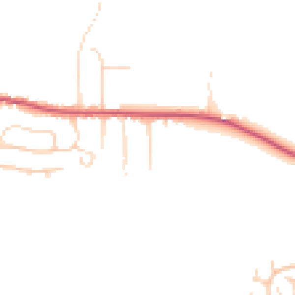
Daytime· 07:00 – 23:00
43.9dB

Night-time· 23:00 – 07:00
37.0dB