4 St Michaels Park, Wirral, CH62 4RJ
About 4 St Michaels Park
4 St Michaels Park is a three-bedroom mid-terrace house in Wirral (CH62 4RJ). It has a recorded floor area of 80 m² (around 861 sq ft), construction records dating it to 2003-2006 and council tax band B. The latest certificate (September 2019) shows a C (score 77), near the top of the C band. Earlier certificates rated it B (October 2008); the latest reading is one band lower. The recommended improvements would lift it to A (score 92), a 2-band jump.
Held since November 2006 — that's 20 years off the open market, well above the local norm. Today's modelled estimate of £185,000 sits 54.2% above the 2006 sale of £120,000. On a £-per-square-foot basis, the last sale (£139/sq ft) was about 18.2% below the postcode norm.
Know exactly what you're buying at 4 St Michaels Park
Before you offer, see what the listing won't tell you, the true value, the red flags and the full history.
Launch offer · save £5
Valuation
against the asking price
Risks
planning & flood
Sold prices
similar homes nearby
Trends
the local market
What this property has
Inside
- Bedrooms3
- Dining roomYes
- CloakroomYes
Outside
- Private gardenrear
- DrivewayYes
Building
- Central heatingYes
Energy performance
Recommended upgrades on file would lift this property by multiple EPC bands.
EPC Rating
Property Improvements
Changes detected from historical EPC data
More low energy lighting installed
Planning history
4 St Michaels Park has no planning applications on record.
The full report still covers planning activity across the surrounding area.
Sales history & valuation
4 St Michaels Park valuation sits well clear of the typical sold price in this postcode.
£185,000
Modelled from EPC, postcode comparables.
£120,000
Recorded with HM Land Registry.
Sales timeline
28 November 2006Most recent
£120,000
Median price across the last 5 sales in CH62 4RJ: £138,000 (2022–2019).
Nearby sales in CH62 4RJ
Everything we know about 4 St Michaels Park, in one report
What it's really worth, what could be wrong, and the planning, sales and area data in full.
- Am I paying too much?
- Is something wrong with it?
- Is the agent's story true?
- Will it hold its value?

Versus other St Michaels Park homes
On price per m², 4 St Michaels Park runs well behind the street norm.
Price per m²
£1,500
Street avg £1,820
Floor Area
80 m²
Street avg 76 m²
Habitable Rooms
5 rooms
Street avg 4 rooms
CO₂ Emissions
2.0 t/year
Street avg 2.5 t/year
Similar properties nearby
1 Bolton Road East
CH62 4RU
1 Marshall Close, Bromborough Pool
CH62 4WA
1 William Burton Place, Bromborough Pool
CH62 4AF
1 Cross Street, Port Sunlight
CH62 4UN
1 Gorsey Vale, Bromborough Pool
CH62 4AE
1 Boniface Close, Bromborough Pool
CH62 4UG
1 The Moorings, Bromborough Pool
CH62 4ST
1 Bridge Street, Port Sunlight
CH62 4UW
The neighbourhood at a glance
Rail-style transport is unusually close for this postcode.
Crime
3/mo
Steady year-on-year across the wider district.
Nearest stop
0.1 km
Willowbank Road — bus stop.
Closest school
0.3 km
Church Drive Primary School. 21 schools nearby.
Go deeper on the local area
The full report breaks down crime, transport links, schools and air quality in depth.
Road noise across the postcode
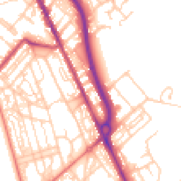
Daytime· 07:00 – 23:00
53.4dB
Night-time· 23:00 – 07:00
43.2dB