Are you a property professional?Get qualified leads from motivated homeowners.
Get started33 Beaufort Road, Downend, Bristol, BS16 6UQ
About 33 Beaufort Road
A plain-English summary derived from public records, EPC certificates, sold prices and local data.
33 Beaufort Road is a three-bedroom mid-terrace house in Downend, Bristol, Bristol (BS16 6UQ). It has a recorded floor area of 86 m² (around 926 sq ft), construction records dating it to 1950-1966 and council tax band B. The latest certificate (April 2025) shows a C (score 72). When first surveyed in July 2014 the rating was E, the property has climbed 2 bands since. Between certificates, wall efficiency went from Poor to Average, window efficiency went from Average to Good and hot-water efficiency went from Very Poor to Good. The recommended improvements would push it to B (score 86).
Today's modelled estimate of £302,000 sits 94.8% above the 2014 sale of £155,000. On the market in November 2014 and unlisted since — roughly 12 years.
What this property has
Pulled from EPC certificates, claim submissions and our property model. Empty categories are hidden — we only show what's known.
Inside
- Bedrooms3
- Bathrooms1
Outside
- Private gardenYes
Energy performance
Every EPC certificate filed against this property — current rating, recorded improvements, and where there's headroom to reach a higher band.
Current Certificate(1 of 3)
Apr 2025
EPC Rating
A
B
C
C72
D
E
F
G
Main Heating
Gas
Main Fuel
Gas
Hot Water
Good
Windows
Good
CO2 Emissions
2.6 t/year
Occupancy
Owner Occupied
Sales history & valuation
Recorded transactions, our model's current estimate, and a quick read on what neighbouring properties have sold for.
33 Beaufort Road valuation sits well clear of the typical sold price in this postcode.
Current estimate
See how we calculated this£302,000
Modelled from EPC, postcode comparables.
Last sold (2014)
£155,000
Recorded with HM Land Registry.
Sales timeline
Full property reportLaunch offer · 33% off
The complete analysis of 33 Beaufort Road, Downend, Bristol, BS16 6UQ
Everything we know about this property, compiled into one in-depth, downloadable report.
Detailed AI analysis
Versus other Beaufort Road homes
Four headline reads against 7 similar houses on this street, drawn from the latest EPC and Land Registry data.
On epc rating, 33 Beaufort Road stands well clear of the street.
Price per m²
£1,802
Street avg £2,311
Floor Area
86 m²
Street avg 82 m²
Habitable Rooms
4 rooms
Similar properties nearby
A handful of close matches in the same postcode area, ranked by likeness on bedrooms, type and floor area.
The neighbourhood at a glance
A condensed read of the local area. Each tile links through to the full breakdown on the Bristol district page.
Reported crime in the wider district is trending notably upward year-on-year.
Crime
5/mo
Rising year-on-year across the wider district.
Nearest stop
0.1 km
Beaufort Road — bus stop.
Road noise across the postcode
Modelled day and night-time noise levels around BS16 6UQ from Defra's strategic mapping. The pin marks this postcode's centroid.
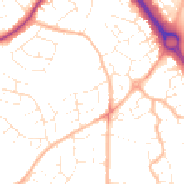
Daytime· 07:00 – 23:00
50.9dB

Everything within walking distance
Schools, transport stops and scenic spots near this property — 49 points of interest in total.
Common questions
The questions buyers, sellers and homeowners most often ask about 33 Beaufort Road, Downend, Bristol, BS16 6UQ. Each answer is also embedded as structured data for search engines.