6 Bennetts Copse, Chislehurst, BR7 5SG
About 6 Bennetts Copse
6 Bennetts Copse is a one-bedroom detached house in Chislehurst (BR7 5SG). It has a recorded floor area of 293 m² (around 3154 sq ft), construction records dating it to 1967-1975 and council tax band H. The latest certificate (July 2018) shows a C (score 78), near the top of the C band. When first surveyed in February 2017 the rating was F, the property has climbed 3 bands since. Between certificates, wall efficiency went from Poor to Good, roof efficiency went from Poor to Good and window efficiency went from Very Poor to Average. The recommended improvements would push it to B (score 82).
At 293 m² the property is well over the postcode median (160 m² across 3 EPCs), placing it in the larger end of the local stock. 1 bedrooms is on the smaller side for this postcode, where 5 is the typical count. 7 planning records sit against the property, 5 approved, 0 refused. Past consents include an extension and a porch, meaningful when judging how the property has evolved. Today's modelled estimate of £1,715,000 is 42.9% above the 2017 sale price. On a £-per-square-foot basis, the last sale (£380/sq ft) was about 27.4% below the postcode norm. On the market in August 2017 and unlisted since — roughly 9 years.
Know exactly what you're buying at 6 Bennetts Copse
Before you offer, see what the listing won't tell you, the true value, the red flags and the full history.
Already flagged here
Valuation
against the asking price
Risks
planning & flood
Sold prices
similar homes nearby
Trends
the local market
What this property has
Inside
- Bedrooms1
- Bathrooms1
Energy performance
EPC Rating
Property Improvements
Changes detected from historical EPC data
Heating system upgraded to a more efficient system
Changed to a more efficient fuel source
Heating controls changed
Hot water system changed
Single glazing replaced with double or better glazing
Cavity wall insulation installed
More low energy lighting installed
Ventilation system changed
Connected to mains gas supply
Heating controls upgraded for better temperature management
Hot water system upgraded
Window efficiency improved
Loft insulation upgraded to recommended levels
Floor insulation added or improved
Low energy lighting percentage decreased
Wall insulation improved
More low energy lighting installed
Planning history
6 Bennetts Copse has been extended on multiple sides of the property across separate planning applications.
- Nov 2017PorchFullIn report
Extension: Two storey · Rear of property
Two storey rear extension & enlarged canopy over front entrance
- Agent
- Keith Chandler Ltd
Extension- Documents
- 12 docs on file
- Reference
- 17/04500/FULL6
- Nov 2017Tree WorksTreesIn report
Sweet Chestnut - Coppice.SUBJECT TO TPO 78 (A1)
- Documents
- 4 docs on file
- Reference
- 17/04619/TPO
We flagged 1 thing worth checking at 6 Bennetts Copse
Independent checks surfaced things a buyer would want to understand before offering. The report explains each one in full, with the underlying data and what to ask.
- Larger development activity nearby
30-day money-back guarantee
Sales history & valuation
Latest sale on 6 Bennetts Copse was the highest on Land Registry record across the postcode.
£1,715,000
Modelled from EPC, postcode comparables.
£1,200,000
Recorded with HM Land Registry.
Sales timeline
16 August 2017Most recent
£1,200,000
Median price across the last 5 sales in BR7 5SG: £800,000 (2023–2003).
Everything we know about 6 Bennetts Copse, in one report
What it's really worth, what could be wrong, and the planning, sales and area data in full.
What we flagged
- Larger development activity nearby

Versus other Bennetts Copse homes
On epc rating, 6 Bennetts Copse stands well clear of the street.
EPC Rating
78 (C)
Street avg 60 (D)
Floor Area
293 m²
Street avg 201 m²
CO₂ Emissions
5.9 t/year
Street avg 8.4 t/year
Habitable Rooms
7 rooms
Street avg 6 rooms
Similar properties nearby
The neighbourhood at a glance
Rail-style transport is unusually close for this postcode.
Crime
3/mo
Steady year-on-year across the wider district.
Nearest stop
0.1 km
Elmstead Woods — railway station.
Closest school
0.7 km
Elmstead Wood Primary School. 29 schools nearby.
Go deeper on the local area
The full report breaks down crime, transport links, schools and air quality in depth.
Road noise across the postcode
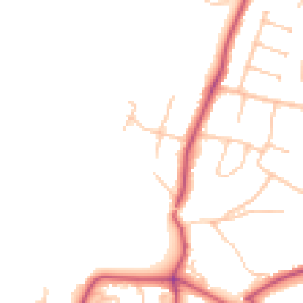
Daytime· 07:00 – 23:00
46.2dB

Night-time· 23:00 – 07:00
37.1dB