2 Barn Close, Wick, Littlehampton, BN17 6JU
About 2 Barn Close
2 Barn Close is a detached house in Wick, Littlehampton, Littlehampton (BN17 6JU). It has a recorded floor area of 122 m² (around 1313 sq ft), construction records dating it to 2019 and council tax band E. The latest certificate (December 2021) returns a high B (score 85), putting the home a stone's throw from an A rating. The recommended improvements would push it to A (score 94).
Held since July 1995 — that's 31 years off the open market, well above the local norm. Only one transfer is on record with HM Land Registry, suggesting it has stayed in the same hands for a long time. Today's modelled estimate of £472,000 sits 589.1% above the 1995 sale of £68,500. On a £-per-square-foot basis, the last sale (£52/sq ft) was about 77.5% below the postcode norm.
Everything you need to know about 2 Barn Close
The true value, the hidden risks and the full sale history, in one report.
30-day money-back guarantee

The data behind every report


Energy performance
EPC Rating
Planning history
2 Barn Close has no planning applications on record.
Notable planning nearby
10applications of note in the surrounding area
We flagged 1 thing worth checking at 2 Barn Close
Independent checks surfaced things a buyer would want to understand before offering. The report explains each one in full, with the underlying data and what to ask.
- Signs of HMO activity in the area
30-day money-back guarantee
Sales history & valuation
Latest sale on 2 Barn Close was the lowest on Land Registry record across the postcode.
£472,000
Modelled from EPC, postcode comparables.
£68,500
Recorded with HM Land Registry.
Sales timeline
13 July 1995Most recent
£68,500
Median price across the last 5 sales in BN17 6JU: £410,000 (2022–2017).
Nearby sales in BN17 6JU
Barn Cottage, Barn Close, Wick, Littlehampton, BN17 6JU
Sold Aug 2022
£441,0007 Barn Close, Wick, Littlehampton, BN17 6JU
Sold May 2022
£410,0005 Barn Close, Wick, Littlehampton, BN17 6JU
Sold Oct 2018
£420,0003 Barn Close, Wick, Littlehampton, BN17 6JU
Sold Oct 2017
£275,0001 Barn Close, Wick, Littlehampton, BN17 6JU
Sold Jan 2004
£275,000
Versus other Barn Close homes
On price per m², 2 Barn Close runs well behind the street norm.
Price per m²
£561
Street avg £2,890
Floor Area
122 m²
Street avg 117 m²
CO₂ Emissions
1.6 t/year
Street avg 2.1 t/year
Years Held
31 years
Street avg 13 years
Everything you need to know about 2 Barn Close
The true value, the hidden risks and the full sale history, in one report.
30-day money-back guarantee
The data behind every report
Similar properties nearby
The neighbourhood at a glance
Crime
5/mo
Steady year-on-year across the wider district.
Nearest stop
0.6 km
Cemetery — bus stop.
Closest school
0.7 km
Lyminster Primary School. 8 schools nearby.
Go deeper on the local area
The full report breaks down crime, transport links, schools and air quality in depth.
Road noise across the postcode
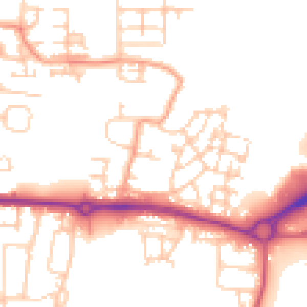
Daytime· 07:00 – 23:00
51.8dB

Night-time· 23:00 – 07:00
41.9dB