Are you a property professional?Get qualified leads from motivated homeowners.
Get startedFlat 1, 51 Ennismore Gardens, London, SW7 1AH
3 sales on record
About Flat 1
A plain-English summary derived from public records, EPC certificates, sold prices and local data.
Flat 1 is a one-bedroom mid-terrace house in London (SW7 1AH). It has a recorded floor area of 74 m² (around 796 sq ft), construction records dating it to before 1900 and council tax band F. At 74 m² this is the 2nd smallest of 4 units on EPC record in the building, where floor areas span 64–103 m². The building's EPC ratings span E to C, with this unit at the bottom. On EPC score it ranks last in the building (52 versus a best of 72). The latest certificate (July 2011) shows an E (score 52), well below the UK norm with real room to improve. The recommended improvements would push it to D (score 57). The latest certificate is from July 2011, so improvements made since then won't be reflected.
Sale prices here have outpaced London HPI: 10.6% per year against 0% for the wider region. On a £-per-square-foot basis, the last sale (£1,295/sq ft) was about 42.3% above the typical sold price in the postcode. 2 planning records sit against the property, 2 approved, 0 refused. Past consents include new windows, meaningful when judging how the property has evolved. The record references listed-building consent, which constrain future alterations. Last sold in March 2016, so it's been off the market for around 10 years. At 74 m² it's 22.6% smaller than the typical home in the postcode (96 m² median across 16 EPCs).
What this property has
Pulled from EPC certificates, claim submissions and our property model. Empty categories are hidden — we only show what's known.
Inside
- Bedrooms1
Energy performance
Every EPC certificate filed against this property — current rating, recorded improvements, and where there's headroom to reach a higher band.
Flat 1's EPC is over a decade old — improvements since won't be reflected.
EPC Expired
This certificate is over 10 years old and is no longer valid.Expired 13 Jul 2021
Planning history
Applications and permits filed against Flat 1, 51 Ennismore Gardens, London, SW7 1AH, sourced from the PlanIt planning register.
Flat 1 has a listed-building consent on record — alterations to a listed property are tightly controlled.
- Nov 2016RenovationHeritageGranted
Alterations of the interior of the flat with removal and addition of partitions, replacement of the front and rear doors (linked to 16/08820/FULL).
Sales history & valuation
Recorded transactions, our model's current estimate, and a quick read on what neighbouring properties have sold for.
Flat 1 has more than quadrupled in price since its earliest registered sale in 2001.
Current estimate
See how we calculated this£1,063,000
Modelled from EPC, postcode comparables and a sale-price growth of 10.6% per year over 15 years.
Last sold (2016)
£1,030,000
Growth on file: 10.6% per year over 15 years.
Sales timeline
Full property reportLaunch offer · 33% off
The complete analysis of Flat 1, 51 Ennismore Gardens, London, SW7 1AH
Everything we know about this property, compiled into one in-depth, downloadable report.
Detailed AI analysis
Versus other Ennismore Gardens homes
Four headline reads against 15 similar flats on this street, drawn from the latest EPC and Land Registry data.
Flat 1 is notably below the street on habitable rooms.
Price per m²
£13,934
Street avg £17,482
Floor Area
74 m²
Street avg 108 m²
Habitable Rooms
2 rooms
Street avg 3 rooms
Similar properties nearby
A handful of close matches in the same postcode area, ranked by likeness on bedrooms, type and floor area.
The neighbourhood at a glance
A condensed read of the local area. Each tile links through to the full breakdown on the London district page.
Rail-style transport is unusually close for this postcode.
Crime
10/mo
Rising year-on-year across the wider district.
Nearest stop
0.2 km
Prince Of Wales Gate — bus stop.
Road noise across the postcode
Modelled day and night-time noise levels around SW7 1AH from Defra's strategic mapping. The pin marks this postcode's centroid.
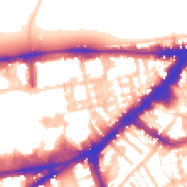
Daytime· 07:00 – 23:00
57.0dB

Everything within walking distance
Schools, transport stops and scenic spots near this property — 90 points of interest in total.
Common questions
The questions buyers, sellers and homeowners most often ask about Flat 1, 51 Ennismore Gardens, London, SW7 1AH. Each answer is also embedded as structured data for search engines.