Are you a property professional?Get qualified leads from motivated homeowners.
Get startedPitts Walk, Bowling Green Close, Wandsworth, London, SW15 3TE
5 planning records
About Pitts Walk
A plain-English summary derived from public records, EPC certificates, sold prices and local data.
Pitts Walk is a detached house in Wandsworth, London, London (SW15 3TE). It has a recorded floor area of 286 m² (around 3078 sq ft), construction records dating it to 1900-1929 and council tax band G. The latest certificate (February 2013) shows an E (score 50), well below the UK norm with real room to improve. The recommended improvements would lift it to C (score 71), a 2-band jump. The latest certificate is from February 2013, so improvements made since then won't be reflected.
Held since December 1995 — that's 30 years off the open market, well above the local norm. Only one transfer is on record with HM Land Registry, suggesting it has stayed in the same hands for a long time. Today's modelled estimate of £2,222,000 sits 304% above the 1995 sale of £550,000. On a £-per-square-foot basis, the last sale (£179/sq ft) was about 76.3% below the postcode norm. At 286 m² it's 29.7% larger than the typical home in the postcode (221 m² median across 4 EPCs). 5 planning records sit against the property, 0 approved, 0 refused.
Energy performance
Every EPC certificate filed against this property — current rating, recorded improvements, and where there's headroom to reach a higher band.
Pitts Walk's carbon output runs well above what efficient homes in the postcode produce.
EPC Expired
This certificate is over 10 years old and is no longer valid.Expired 20 Feb 2023
Planning history
Applications and permits filed against Pitts Walk, Bowling Green Close, Wandsworth, London, SW15 3TE, sourced from the PlanIt planning register.
Planning history at Pitts Walk is exclusively tree-management applications — typical for a property with mature trees on or near the plot.
- Aug 2025Tree WorksTreesAllow Works, No Tree Preservation Order
T1 Holm Oak = Prune back from the willow by 2 metres Dimensions after Pruning H 17m W 12m H1 Cypress screen Prune back from the willow by 2 metres Dimensions after Pruning H 17m W 12m L 10m T2 Holly - Prune back over the lawn by approximately 1.5 metres. Dimensions after Pruning H 10m W6m
Sales history & valuation
Recorded transactions, our model's current estimate, and a quick read on what neighbouring properties have sold for.
Pitts Walk's modelled value sits at over four times its earliest registered sale price (1995).
Current estimate
See how we calculated this£2,222,000
Modelled from EPC, postcode comparables.
Last sold (1995)
£550,000
Recorded with HM Land Registry.
Sales timeline
Versus other Bowling Green Close homes
Four headline reads against 4 similar houses on this street, drawn from the latest EPC and Land Registry data.
Price per m² for Pitts Walk lags the street by a wide margin.
Price per m²
£1,923
Street avg £7,472
Floor Area
286 m²
Street avg 244 m²
Habitable Rooms
9 rooms
Similar properties nearby
A handful of close matches in the same postcode area, ranked by likeness on bedrooms, type and floor area.
The neighbourhood at a glance
A condensed read of the local area. Each tile links through to the full breakdown on the London district page.
Reported crime in the wider district is trending notably upward year-on-year.
Crime
7/mo
Rising year-on-year across the wider district.
Nearest stop
0.3 km
Telegraph Road — bus stop.
Road noise across the postcode
Modelled day and night-time noise levels around SW15 3TE from Defra's strategic mapping. The pin marks this postcode's centroid.
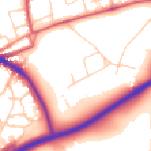
Daytime· 07:00 – 23:00
56.0dB

Everything within walking distance
Schools, transport stops and scenic spots near this property — 63 points of interest in total.
Beautiful places to visit nearby
Curated scenic spots within reach of this postcode, served by Beautifulplaces.ai. Photography and tagging come from their open dataset.
Common questions
The questions buyers, sellers and homeowners most often ask about Pitts Walk, Bowling Green Close, Wandsworth, London, SW15 3TE. Each answer is also embedded as structured data for search engines.