Are you a property professional?Get qualified leads from motivated homeowners.
Get startedBest EPC on StreetExtended TwiceLong-term Owner
62 Elizabeth Drive, Wickford, SS12 0DS
This 125 square metre property in Wickford carries an energy performance rating of C, which is above the national average. It is heated by a gas central heating system and is currently listed as owner-occupied. Records show the property last changed hands for £250,000 back in 2009.
Property Type
Semi-Detached House
Bedrooms
3
Bathrooms
2
Floor Area
125 m²
Council Tax
Band D
Property Features
Built 1950–1966
Detached Garage
Off-street covered parking
Driveway
Off-street parking
En-suite Bathroom
Private bathroom attached to bedroom
Dining Room
Separate dining space
Cloakroom
Downstairs WC
Corner Plot
Positioned on a corner with extra frontage
Get started
Ready to take the next step? Find the right professionals for your property journey.
Energy Performance
EPC rating and efficiency details
EPC Rating
A
B
C
C75
D
E
F
G
Main Heating
Gas
Main Fuel
Gas
Hot Water
Good
Windows
Good
CO2 Emissions
3.1 t/year
Tenure
Owner Occupied
Price & History
Transactions and market trends
Estimated value
£489,000
How our AI predicts property prices · Accurate to within 10%
Automated estimate only. For an accurate valuation, consult a surveyor or estate agent.
Transaction history
£250,000Latest
Aug 2009Source: HM Land Registry
Nearby in SS12 0DS
121 Elizabeth Drive Wickford SS12 0DS
Jun 2025
£520,000
64 Elizabeth Drive Wickford SS12 0DS
Oct 2024
£452,000
125 Elizabeth Drive Wickford SS12 0DS
Aug 2024
£340,000
97 Elizabeth Drive Wickford SS12 0DS
Jan 2023
£425,000
101 Elizabeth Drive Wickford SS12 0DS
Jun 2021
£400,000
58 Elizabeth Drive Wickford SS12 0DS
Jul 2020
£305,000
1 / 3
House Price Index
England+1.5%
101.6
Jan 26
UK HPI from HM Land Registry. Baseline: Jan 2015 = 100.
How This Property Compares on Elizabeth Drive
See how this property stacks up against others nearby
Comparing to 12 other houses on this street
Price per m²
Property value per square metre of floor space
£2,000/£3,596 avg
LowerHigher
Lowest among similar properties
Years Held
Time since last sale — indicates ownership stability
17 years/7 years avg
ShorterLonger
Held longer than 92% of similar properties
EPC Rating
Government energy efficiency score (1–100)
75 (C)/60 (D) avg
Less efficientMore efficient
More efficient than all similar properties
Floor Area
Total internal floor space
125 m²/100 m² avg
SmallerLarger
Larger than 83% of similar properties
CO₂ Emissions
Annual carbon output from heating, hot water & lighting
3.1 t/year/4.6 t/year avg
Higher emissionsLower emissions
Lower emissions than 75% of similar properties
Habitable Rooms
Living spaces like bedrooms & living rooms
4 rooms/5 rooms avg
FewerMore
More rooms than only 17% of similar properties
Comparisons are based on the most recent EPC data for each property in this postcode. Only similar property types (houses) are compared.
Get alerts for SS12 0DS
New sales, price changes, and market updates in this area
Places to visit
Road Noise
Average road noise levels for this postcode
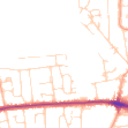
Daytime
07:00 – 23:00
47.6dB
Low
Night-time
23:00 – 07:00
38.9dB
Low55 dB
60 dB
65 dB
70 dB
75 dB
80 dB
Defra Road Noise Strategic Mapping, Round 4Crime Analysis
7 months of data for Wickford
Total Crimes
16
Monthly Avg
2
Recent Trend
Stable
Most Common
Violence & Sexual
Crime by Category
Violence & Sexual5(31%)
Criminal Damage & Arson4(25%)
Other Theft4(25%)
Vehicle Crime3(19%)
Recent Incidents
Violence & Sexual
Nov 2025On or near Farnes Avenue
Vehicle Crime
Oct 2025On or near Farnes Avenue
Violence & Sexual
Oct 2025On or near Iona Way
Criminal Damage & Arson
Oct 2025On or near Bridge House Close
Other Theft
Oct 2025On or near Irvon Hill Road
Violence & Sexual
Oct 2025On or near Irvon Hill Road
Data from Police UK • Updated monthly
Local Amenities
Schools and transport links nearby
Nearby Schools
13 within 3kmP
Wickford Primary School
291m
4 mins
P
North Crescent Primary School
828m
10 mins
P
Grange Primary School
999m
12 mins
S
The Bromfords School
1.1km
14 mins
S
Beauchamps High School
2.0km
24 mins
Transport Links
30 within 3kmWickford Rail Station
Rail374m
5 mins
Deirdre Avenue
Bus Stop426m
5 mins
Station Avenue
Bus Stop446m
5 mins
Railway Station
Bus Stop453m
5 mins
Guernsey Gardens Lr
Bus Stop492m
6 mins
Halls Corner
Bus Stop534m
6 mins
School data from Dept. for Education • Transport data from NaPTAN
Nearby Property Businesses
Local professionals serving this area
Map
43 points of interest nearby
Map data from OpenStreetMap • Transport data from NaPTAN • School data from Dept. for Education • Scenic data from Beautifulplaces.ai
Frequently Asked Questions
Common questions about this property