Are you a property professional?Get qualified leads from motivated homeowners.
Get startedGround Floor
47 Azalea Avenue, Wickford, SS12 0BQ
This 42 square metre property in Wickford carries an energy performance rating of C, which is above the national average. It is heated by a gas central heating system and is currently listed as social housing.
Property Type
Ground Floor Flat
Bedrooms
1
Floor Area
42 m²
Council Tax
Band B
Property Features
Built 1950–1966
Get started
Ready to take the next step? Find the right professionals for your property journey.
Energy Performance
EPC rating and efficiency details
EPC Expired
This certificate is over 10 years old and is no longer valid.Expired 24 Nov 2021
Current Certificate(1 of 2)
Nov 2011
EPC Rating
A
B
C
C70
D
E
F
G
Main Heating
Gas
Main Fuel
Gas
Hot Water
Good
Windows
Average
CO2 Emissions
1.7 t/year
Tenure
Rented
Property Improvements
Changes detected from historical EPC data
Nov 2011from Feb 2009
Heating Controls
Prog + StatFull
Heating controls upgraded for better temperature management
Low Energy Lighting
40%20%
Low energy lighting percentage decreased
Are we missing something? Tell us about home improvements to help adjust your valuation.
Price & History
Transactions and market trends
Estimated value
£177,000
How our AI predicts property prices · Accurate to within 10%
Automated estimate only. For an accurate valuation, consult a surveyor or estate agent.
Transaction history
No sales history found
Nearby in SS12 0BQ
43 Azalea Avenue Wickford SS12 0BQ
Dec 2024
£380,000
21 Azalea Avenue Wickford SS12 0BQ
Jan 2024
£325,000
35 Azalea Avenue Wickford SS12 0BQ
Nov 2022
£355,000
31 Azalea Avenue Wickford SS12 0BQ
Jul 2022
£360,000
20 Azalea Avenue Wickford SS12 0BQ
Feb 2022
£400,000
23 Azalea Avenue Wickford SS12 0BQ
Sept 2019
£330,000
1 / 3
House Price Index
England+1.5%
101.6
Jan 26
UK HPI from HM Land Registry. Baseline: Jan 2015 = 100.
How This Property Compares on Azalea Avenue
See how this property stacks up against others nearby
Comparing to 3 other flats on this street
EPC Rating
Government energy efficiency score (1–100)
70 (C)/71 (C) avg
Less efficientMore efficient
More efficient than only 33% of similar properties
Floor Area
Total internal floor space
42 m²/42 m² avg
SmallerLarger
Around average
CO₂ Emissions
Annual carbon output from heating, hot water & lighting
1.7 t/year/1.6 t/year avg
Higher emissionsLower emissions
Lower emissions than only 33% of similar properties
Habitable Rooms
Living spaces like bedrooms & living rooms
2 rooms/2 rooms avg
FewerMore
Around average
Comparisons are based on the most recent EPC data for each property in this postcode. Only similar property types (flats) are compared.
Get alerts for SS12 0BQ
New sales, price changes, and market updates in this area
Places to visit
Road Noise
Average road noise levels for this postcode
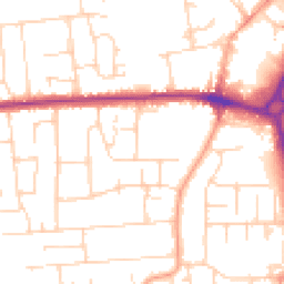
Daytime
07:00 – 23:00
51.1dB
Low
Night-time
23:00 – 07:00
41.1dB
Low55 dB
60 dB
65 dB
70 dB
75 dB
80 dB
Defra Road Noise Strategic Mapping, Round 4Crime Analysis
7 months of data for Wickford
Total Crimes
16
Monthly Avg
2
Recent Trend
Stable
Most Common
Violence & Sexual
Crime by Category
Violence & Sexual5(31%)
Criminal Damage & Arson4(25%)
Other Theft4(25%)
Vehicle Crime3(19%)
Recent Incidents
Violence & Sexual
Nov 2025On or near Farnes Avenue
Vehicle Crime
Oct 2025On or near Farnes Avenue
Violence & Sexual
Oct 2025On or near Iona Way
Criminal Damage & Arson
Oct 2025On or near Bridge House Close
Other Theft
Oct 2025On or near Irvon Hill Road
Violence & Sexual
Oct 2025On or near Irvon Hill Road
Data from Police UK • Updated monthly
Local Amenities
Schools and transport links nearby
Nearby Schools
12 within 3kmP
Wickford Primary School
389m
5 mins
P
North Crescent Primary School
406m
5 mins
P
Grange Primary School
672m
8 mins
S
The Bromfords School
749m
9 mins
S
Beauchamps High School
1.9km
22 mins
Transport Links
30 within 3kmLaburnum Avenue
Bus Stop297m
4 mins
Halls Corner
Bus Stop308m
4 mins
Deirdre Avenue
Bus Stop431m
5 mins
Park Drive
Bus Stop528m
6 mins
Wickford Rail Station
Rail589m
7 mins
Castledon Road
Bus Stop635m
8 mins
School data from Dept. for Education • Transport data from NaPTAN
Nearby Property Businesses
Local professionals serving this area
Map
42 points of interest nearby
Map data from OpenStreetMap • Transport data from NaPTAN • School data from Dept. for Education • Scenic data from Beautifulplaces.ai
Frequently Asked Questions
Common questions about this property