Are you a property professional?Get qualified leads from motivated homeowners.
Get started8 The Green, Charlton, Andover, SP10 4AZ
3 sales on record
About 8 The Green
A plain-English summary derived from public records, EPC certificates, sold prices and local data.
8 The Green is a property in Charlton, Andover, Andover (SP10 4AZ). It has a recorded floor area of 70 m² (around 754 sq ft), construction records dating it to 1976-1982 and council tax band B. At 70 m² this is the 8th smallest of 12 units on EPC record in the building, where floor areas span 55–72 m². The building's EPC ratings span E to C, with this unit at the top. The latest certificate (March 2010) shows a C (score 77), near the top of the C band. The recommended improvements would push it to B (score 83). The latest certificate is from March 2010, so improvements made since then won't be reflected.
Sale prices here have outpaced England HPI: 6.8% per year against 0% for the wider region. Today's modelled estimate of £200,000 is 25% above the 2015 sale price. On a £-per-square-foot basis, the last sale (£212/sq ft) was about 15.9% above the typical sold price in the postcode. Last changed hands 11 years ago, in April 2015.
Energy performance
Every EPC certificate filed against this property — current rating, recorded improvements, and where there's headroom to reach a higher band.
8 The Green's EPC is over a decade old — improvements since won't be reflected.
EPC Expired
This certificate is over 10 years old and is no longer valid.Expired 19 Mar 2020
Sales history & valuation
Recorded transactions, our model's current estimate, and a quick read on what neighbouring properties have sold for.
Sale price has at least doubled since 1999.
Current estimate
See how we calculated this£200,000
Modelled from EPC, postcode comparables and a sale-price growth of 6.8% per year over 16 years.
Last sold (2015)
£160,000
Growth on file: 6.8% per year over 16 years.
Sales timeline
Launch offer · 33% off
Buying 8 The Green, Charlton, Andover, SP10 4AZ? Know what you're getting into
Everything a buyer needs to know about this property, compiled into one in-depth report so there are no surprises after you offer.
Spot red flags before you buy
An AI-written breakdown of everything that matters
Versus other The Green homes
Four headline reads against 11 similar flats on this street, drawn from the latest EPC and Land Registry data.
On epc rating, 8 The Green stands well clear of the street.
Price per m²
£2,283
Street avg £2,255
Floor Area
70 m²
Street avg 66 m²
Habitable Rooms
3 rooms
Street avg 3 rooms
Similar properties nearby
A handful of close matches in the same postcode area, ranked by likeness on bedrooms, type and floor area.
The neighbourhood at a glance
A condensed read of the local area. Each tile links through to the full breakdown on the Andover district page.
Crime
4/mo
Steady year-on-year across the wider district.
Nearest stop
0.1 km
Royal Oak — bus stop.
Road noise across the postcode
Modelled day and night-time noise levels around SP10 4AZ from Defra's strategic mapping. The pin marks this postcode's centroid.
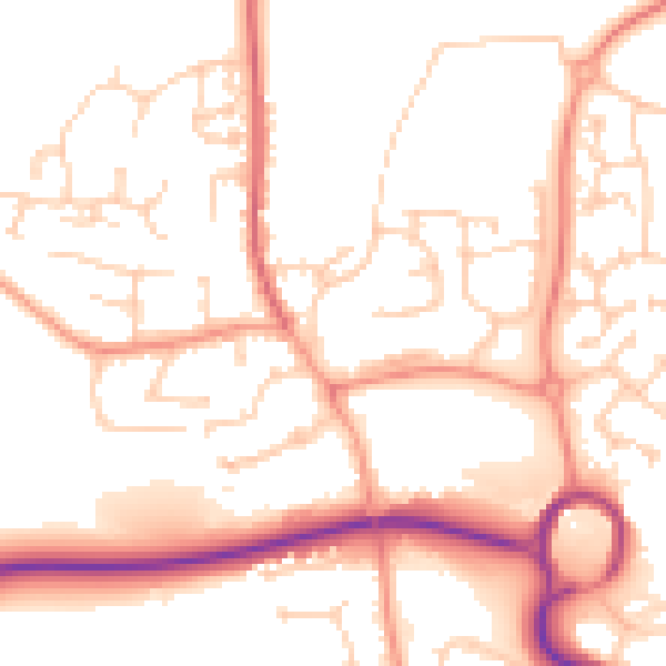
Daytime· 07:00 – 23:00
52.8dB

Everything within walking distance
Schools, transport stops and scenic spots near this property — 46 points of interest in total.
Common questions
The questions buyers, sellers and homeowners most often ask about 8 The Green, Charlton, Andover, SP10 4AZ. Each answer is also embedded as structured data for search engines.
