Are you a property professional?Get qualified leads from motivated homeowners.
Get started2 Cherry Tree Road, Andover, SP10 3DX
1 planning record
About 2 Cherry Tree Road
A plain-English summary derived from public records, EPC certificates, sold prices and local data.
2 Cherry Tree Road is an end-of-terrace house in Andover (SP10 3DX). It has a recorded floor area of 109 m² (around 1173 sq ft), construction records dating it to 1950-1966 and council tax band C. The latest certificate (August 2018) shows a D (score 66), on the cusp of jumping into the C band. The rating has held steady at D across 2 certificates since March 2016. Between certificates, roof efficiency went from Good to Very Good; while wall efficiency dropped from Good to Average. The recommended improvements would lift it to B (score 81), a 2-band jump.
Sale prices here have outpaced England HPI: 5.9% per year against 0% for the wider region. Today's modelled estimate of £321,000 is 18.9% above the 2019 sale price. On a £-per-square-foot basis, the last sale (£230/sq ft) was about 61.3% above the typical sold price in the postcode. At 109 m² it's 28.2% larger than the typical home in the postcode (85 m² median across 11 EPCs). Most recent transfer: January 2019 at £270,000. One historical planning record sits against the property in 2022.
Energy performance
Every EPC certificate filed against this property — current rating, recorded improvements, and where there's headroom to reach a higher band.
Recommended upgrades on file would lift this property by multiple EPC bands.
Current Certificate(1 of 2)
Aug 2018
EPC Rating
A
B
C
D
D66
E
F
G
Main Heating
Gas
Main Fuel
Gas
Hot Water
Good
Windows
Average
CO2 Emissions
4.3 t/year
Occupancy
Rented
Planning history
Applications and permits filed against 2 Cherry Tree Road, Andover, SP10 3DX, sourced from the PlanIt planning register.
- Apr 2022ExtensionFullPERMISSION subject to conditions & notes
Extension: Single storey · Side of property
Single storey side extension
Sales history & valuation
Recorded transactions, our model's current estimate, and a quick read on what neighbouring properties have sold for.
Latest sale on 2 Cherry Tree Road was the highest on Land Registry record across the postcode.
Current estimate
See how we calculated this£321,000
Modelled from EPC, postcode comparables and a sale-price growth of 5.9% per year over 22 years.
Last sold (2019)
£270,000
Growth on file: 5.9% per year over 22 years.
Sales timeline
Launch offer · 33% off
Buying 2 Cherry Tree Road, Andover, SP10 3DX? Know what you're getting into
Everything a buyer needs to know about this property, compiled into one in-depth report so there are no surprises after you offer.
Spot red flags before you buy
An AI-written breakdown of everything that matters
Versus other Cherry Tree Road homes
Four headline reads against 6 similar houses on this street, drawn from the latest EPC and Land Registry data.
2 Cherry Tree Road outperforms the street on habitable rooms by a wide margin.
EPC Rating
66 (D)
Street avg 59 (D)
Floor Area
109 m²
Street avg 97 m²
CO₂ Emissions
4.3 t/year
Similar properties nearby
A handful of close matches in the same postcode area, ranked by likeness on bedrooms, type and floor area.
The neighbourhood at a glance
A condensed read of the local area. Each tile links through to the full breakdown on the Andover district page.
Rail-style transport is unusually close for this postcode.
Crime
4/mo
Steady year-on-year across the wider district.
Nearest stop
0.0 km
Toll Gate Road — bus stop.
Road noise across the postcode
Modelled day and night-time noise levels around SP10 3DX from Defra's strategic mapping. The pin marks this postcode's centroid.
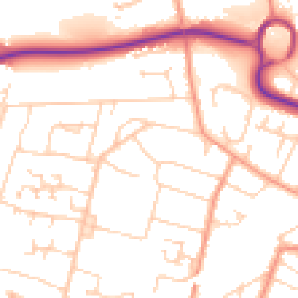
Daytime· 07:00 – 23:00
52.1dB

Everything within walking distance
Schools, transport stops and scenic spots near this property — 46 points of interest in total.
Common questions
The questions buyers, sellers and homeowners most often ask about 2 Cherry Tree Road, Andover, SP10 3DX. Each answer is also embedded as structured data for search engines.
