Are you a property professional?Get qualified leads from motivated homeowners.
Get started9 Shere Avenue, Cheam, Sutton, SM2 7JU
This property in Cheam, Sutton, Sutton. Records show the property last changed hands for £815,000 back in 2013.
Property Type
Property
Bedrooms
4
Floor Area
— m²
Council Tax
Band G
Property Features
Freehold
You own the land
Private Garden
Enclosed private garden
En-suite Bathroom
Private bathroom attached to bedroom
Dining Room
Separate dining space
Study / Home Office
Dedicated workspace
Open-plan Living
Combined kitchen and living area
Recently Refurbished
Renovated and updated
Get started
Ready to take the next step? Find the right professionals for your property journey.
Energy Performance
EPC rating and efficiency details
A
B
C
D
E
F
G
No EPC on record
This property doesn't have an Energy Performance Certificate yet. An EPC helps us give a more accurate valuation and is required to sell or let.
Price & History
Transactions and market trends
Transaction history
+12.4%(6y)
£815,000Latest
May 2013£725,000
Nov 2007Source: HM Land Registry
Nearby in SM2 7JU
12 Shere Avenue Cheam Sutton SM2 7JU
Dec 2022
£1,075,000
7 Shere Avenue Cheam Sutton SM2 7JU
Sept 2018
£1,075,000
18 Shere Avenue Cheam Sutton SM2 7JU
Jun 2013
£745,000
4 Shere Avenue Cheam Sutton SM2 7JU
Oct 2011
£500,000
1 Shere Avenue Cheam Sutton SM2 7JU
Jun 2011
£780,000
10 Shere Avenue Cheam Sutton SM2 7JU
Dec 2010
£620,000
1 / 2
House Price Index
Sutton+1.8%
98.8
Jan 26
UK HPI from HM Land Registry. Baseline: Jan 2015 = 100.
How This Property Compares on Shere Avenue
See how this property stacks up against others nearby
Not enough similar properties in this postcode to make meaningful comparisons.
Get alerts for SM2 7JU
New sales, price changes, and market updates in this area
About Cheam, Sutton
This property is located in Cheam, Sutton, SM 3, a suburb of London that blends residential streets with historic buildings and surrounding parks.
Cheam is a suburb of London, England, 11 miles (18 kilometres) southwest of Charing Cross. It is divided into North Cheam, Cheam Village and South Cheam. Cheam Village contains the listed buildings Lumley Chapel and the 16th‑century Whitehall. It is adjacent to two large parks, Nonsuch Park and Cheam Park. Nonsuch Park contains the listed Nonsuch Mansion. Parts of Cheam Park and Cheam Village are in a conservation area. Cheam is bordered by Worcester Park to the northwest, Morden to the northeast, Sutton to the east, Epsom, Ewell and Stoneleigh to the west and Banstead and Belmont to the south.
Places to visit
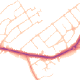
Road Noise
Average road noise levels for this postcode
Daytime
07:00 – 23:00
49.0dB
Low
Night-time
23:00 – 07:00
40.1dB
Low55 dB
60 dB
65 dB
70 dB
75 dB
80 dB
Defra Road Noise Strategic Mapping, Round 4Crime Analysis
9 months of data for Sutton
Total Crimes
64
Monthly Avg
7
Recent Trend
Stable
Most Common
Violence & Sexual
Crime by Category
Violence & Sexual25(39%)
Public Order8(13%)
Other Theft6(9%)
Drugs6(9%)
Burglary5(8%)
Theft from Person4(6%)
Shoplifting3(5%)
Vehicle Crime3(5%)
Criminal Damage & Arson2(3%)
Robbery2(3%)
Recent Incidents
Other Theft
Nov 2025On or near The Quadrant
Violence & Sexual
Nov 2025On or near The Quadrant
Shoplifting
Nov 2025On or near Petrol Station
Public Order
Nov 2025On or near Petrol Station
Public Order
Nov 2025On or near Petrol Station
Public Order
Nov 2025On or near Petrol Station
Data from Police UK • Updated monthly
Local Amenities
Schools and transport links nearby
Nearby Schools
25 within 3kmP
Cuddington Croft Primary School
973m
12 mins
P
Ewell Grove Primary and Nursery School
1.2km
14 mins
P
St Dunstan's Cheam CofE Primary School
1.4km
17 mins
S
North East Surrey College of Technology
926m
11 mins
S
Nonsuch High School for Girls
1.1km
14 mins
S
Glyn School
1.6km
19 mins
Transport Links
30 within 3kmSpringfield Road
Bus Stop236m
3 mins
Albury Avenue
Bus Stop418m
5 mins
Ewell East Rail Station
Rail572m
7 mins
Ewell East Railway Station
Bus Stop617m
7 mins
Bramley Road
Bus Stop645m
8 mins
West Drive
Bus Stop780m
9 mins
School data from Dept. for Education • Transport data from NaPTAN
Nearby Property Businesses
Local professionals serving this area

Map
55 points of interest nearby
Map data from OpenStreetMap • Transport data from NaPTAN • School data from Dept. for Education • Scenic data from Beautifulplaces.ai
Frequently Asked Questions
Common questions about this property