Are you a property professional?Get qualified leads from motivated homeowners.
Get startedLong-term Owner
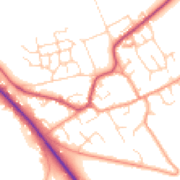
9 Watlington Road, Benson, Wallingford, OX10 6LT
This property in Benson, Wallingford, Wallingford. Records show the property last changed hands for £180,000 back in 2003.
Property Type
Property
Bedrooms
—
Floor Area
— m²
Council Tax
Band D
Flood Risk
Low
Get started
Ready to take the next step? Find the right professionals for your property journey.
Energy Performance
EPC rating and efficiency details
A
B
C
D
E
F
G
No EPC on record
This property doesn't have an Energy Performance Certificate yet. An EPC helps us give a more accurate valuation and is required to sell or let.
Price & History
Transactions and market trends
Transaction history
+106.9%(7y)
£180,000Latest
Oct 2003£87,000
Aug 1996Source: HM Land Registry
Nearby in OX10 6LT
17 Watlington Road Benson Wallingford OX10 6LT
Sept 2025
£656,500
Old British School Flat 3 5 Watlington Road Benson Wallingford OX10 6LT
May 2024
£270,000
Old British School Flat 4 5 Watlington Road Benson Wallingford OX10 6LT
Feb 2018
£194,050
7 Watlington Road Benson Wallingford OX10 6LT
Jul 2015
£405,000
Old British School Flat 1 5 Watlington Road Benson Wallingford OX10 6LT
Jun 2014
£225,000
15 Watlington Road Benson Wallingford OX10 6LT
Feb 2003
£220,000
1 / 2
House Price Index
England+1.5%
101.6
Jan 26
UK HPI from HM Land Registry. Baseline: Jan 2015 = 100.
How This Property Compares on Watlington Road
See how this property stacks up against others nearby
Not enough similar properties in this postcode to make meaningful comparisons.
Get alerts for OX10 6LT
New sales, price changes, and market updates in this area
About Benson, Wallingford
This property is located in Benson, a civil parish in South Oxfordshire, situated a short distance north of Wallingford and close to the Chiltern Hills. The village sits beside the River Thames, where the Ewelme Brook joins the Thames near Benson Lock.
Benson, Oxfordshire is a village and civil parish in South Oxfordshire, England. The 2011 Census recorded the parish population as 4,754. It lies about a mile and a half (2.4 km) north of Wallingford at the foot of the Chiltern Hills. The chalk stream Ewelme Brook joins the River Thames next to Benson Lock. The village’s setting near the Thames and the Chiltern Hills offers a rural character within a reasonable distance of nearby towns. Residents benefit from the natural scenery of the river and hills, while the proximity to Wallingford provides access to local amenities. Benson’s status as a civil parish indicates a small, close‑knit community with its own local governance structure. The village’s location near a major river and a historic lock suggests potential interest for those who appreciate heritage and waterway views. The population size reflects a modest but established community, providing a sense of stability and local identity.
Places to visit
Road Noise
Average road noise levels for this postcode
Daytime
07:00 – 23:00
51.8dB
Low
Night-time
23:00 – 07:00
42.9dB
Low55 dB
60 dB
65 dB
70 dB
75 dB
80 dB
Defra Road Noise Strategic Mapping, Round 4Crime Analysis
7 months of data for Wallingford
Total Crimes
15
Monthly Avg
2
Recent Trend
Stable
Most Common
Violence & Sexual
Crime by Category
Violence & Sexual4(27%)
Criminal Damage & Arson3(20%)
Other Theft3(20%)
Burglary2(13%)
Vehicle Crime1(7%)
Other Crime1(7%)
Public Order1(7%)
Recent Incidents
Criminal Damage & Arson
Nov 2025On or near Crabtree Corner
Violence & Sexual
Nov 2025On or near Chequers Place
Burglary
Oct 2025On or near Crabtree Corner
Burglary
Oct 2025On or near Chequers Place
Criminal Damage & Arson
Sept 2025On or near St Georges Green
Violence & Sexual
Sept 2025On or near Wallingford Road
Data from Police UK • Updated monthly
Local Amenities
Schools and transport links nearby
Nearby Schools
8 within 3kmP
Benson Church of England Primary School
167m
2 mins
P
RAF Benson Community Primary School
2.2km
27 mins
P
St Laurence Church of England School
2.4km
29 mins
S
Wallingford School
2.2km
26 mins
Transport Links
30 within 3kmHorseshoes Lane
Bus Stop161m
2 mins
High Street
Bus Stop226m
3 mins
Church Road
Bus Stop358m
4 mins
Marina
Bus Stop418m
5 mins
Blacklands Road
Bus Stop494m
6 mins
St Helens Crescent
Bus Stop534m
6 mins
School data from Dept. for Education • Transport data from NaPTAN
Nearby Property Businesses
Local professionals serving this area

Map
38 points of interest nearby
Map data from OpenStreetMap • Transport data from NaPTAN • School data from Dept. for Education • Scenic data from Beautifulplaces.ai
Frequently Asked Questions
Common questions about this property