Are you a property professional?Get qualified leads from motivated homeowners.
Get started7 Alma Street, Camden, London, NW5 3DJ
3 planning records
About 7 Alma Street
A plain-English summary derived from public records, EPC certificates, sold prices and local data.
7 Alma Street is a property in Camden, London, London (NW5 3DJ). It has council tax band F.
It hasn't traded since September 1995, a hold of 31 years that's notably long for the area. Only one transfer is on record with HM Land Registry, suggesting it has stayed in the same hands for a long time. 3 planning records sit against the property, 1 approved, 2 refused. Past consents include a basement excavation, meaningful when judging how the property has evolved. The record references listed-building consent, which constrain future alterations.
Energy performance
Every EPC certificate filed against this property — current rating, recorded improvements, and where there's headroom to reach a higher band.
No EPC on record
This property doesn't have an Energy Performance Certificate yet. An EPC is required to sell or let — and unlocks our automated valuation.
Planning history
Applications and permits filed against 7 Alma Street, Camden, London, NW5 3DJ, sourced from the PlanIt planning register.
7 Alma Street has a listed-building consent on record — alterations to a listed property are tightly controlled.
- Jan 2003BasementFullGrant Full Planning Permission (conds)
Creation of a window and lightwell to the front of the dwellinghouse, and the conversion of the basement into two bedrooms. As shown on drawing numbers: AS/143/P/01 Rev.A and AS/143/P/02 Rev.A; & 1 x A4 sheet with photograph of existing front elevation.
Sales history & valuation
Recorded transactions, our model's current estimate, and a quick read on what neighbouring properties have sold for.
7 Alma Street has been held in the same hands since before 2000.
Last sold (1995)
£140,000
Recorded with HM Land Registry.
Sales timeline
29 September 1995Most recent
£140,000
Median price across the last 5 sales in NW5 3DJ: £1,212,500 (2025–2021).
Nearby sales in NW5 3DJ
Full property reportLaunch offer · 33% off
The complete analysis of 7 Alma Street, Camden, London, NW5 3DJ
Everything we know about this property, compiled into one in-depth, downloadable report.
Detailed AI analysis
Similar properties nearby
A handful of close matches in the same postcode area, ranked by likeness on bedrooms, type and floor area.
The neighbourhood at a glance
A condensed read of the local area. Each tile links through to the full breakdown on the London district page.
Rail-style transport is unusually close for this postcode.
Crime
11/mo
Rising year-on-year across the wider district.
Nearest stop
0.1 km
Kentish Town Road — bus stop.
Road noise across the postcode
Modelled day and night-time noise levels around NW5 3DJ from Defra's strategic mapping. The pin marks this postcode's centroid.
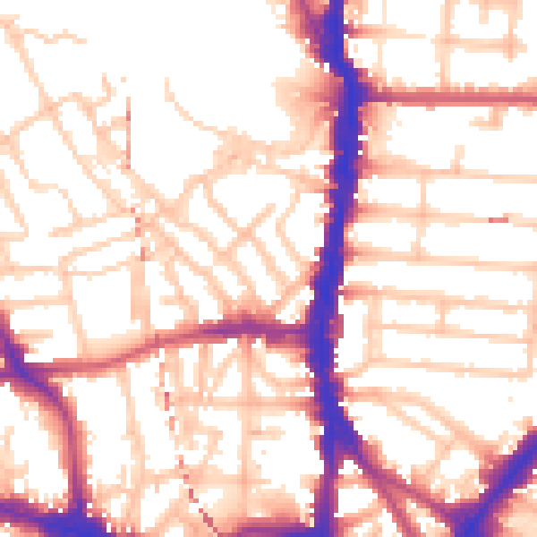
Daytime· 07:00 – 23:00
55.0dB

Everything within walking distance
Schools, transport stops and scenic spots near this property — 104 points of interest in total.
Common questions
The questions buyers, sellers and homeowners most often ask about 7 Alma Street, Camden, London, NW5 3DJ. Each answer is also embedded as structured data for search engines.