Are you a property professional?Get qualified leads from motivated homeowners.
Get started21 Marquis Road, Camden, London, NW1 9UD
3 sales on record
About 21 Marquis Road
A plain-English summary derived from public records, EPC certificates, sold prices and local data.
21 Marquis Road is a four-bedroom end-of-terrace house in Camden, London, London (NW1 9UD). It has a recorded floor area of 147 m² (around 1582 sq ft), construction records dating it to 1900-1929 and council tax band G. The latest certificate (October 2021) shows an E (score 54), well below the UK norm with real room to improve. The rating has held steady at E across 2 certificates since December 2008. Between certificates, wall efficiency went from Very Poor to Poor and window efficiency went from Very Poor to Poor; while roof efficiency dropped from Good to Very Poor and lighting dropped from Very Good to Average. The recommended improvements would lift it to C (score 72), a 2-band jump. Period features are noted in the property record.
Sale prices here have outpaced London HPI: 7.4% per year against 0% for the wider region. Today's modelled estimate of £1,883,000 is 10.7% above the 2022 sale price. On a £-per-square-foot basis, the last sale (£1,075/sq ft) was about 108.3% above the typical sold price in the postcode. At 147 m² the property is well over the postcode median (49 m² across 22 EPCs), placing it in the larger end of the local stock. It lags the bulk of the postcode on energy efficiency (less efficient than 73% of similar EPCs). 4 bedrooms is on the larger side for this postcode, where 2 is the typical count. Most recent transfer: February 2022 at £1,701,000. That sale was during the post-pandemic price surge, when transactions cleared materially above pre-2020 trend.
What this property has
Pulled from EPC certificates, claim submissions and our property model. Empty categories are hidden — we only show what's known.
Inside
- Bedrooms4
- Bathrooms3
- EnsuiteYes
- StudyYes
Energy performance
Every EPC certificate filed against this property — current rating, recorded improvements, and where there's headroom to reach a higher band.
21 Marquis Road's carbon output runs well above what efficient homes in the postcode produce.
Current Certificate(1 of 2)
Oct 2021
EPC Rating
A
B
C
D
E
E54
F
G
Main Heating
Gas
Main Fuel
Gas
Hot Water
Good
Windows
Poor
CO2 Emissions
7.0 t/year
Occupancy
Owner Occupied
Sales history & valuation
Recorded transactions, our model's current estimate, and a quick read on what neighbouring properties have sold for.
Latest sale on 21 Marquis Road was the highest on Land Registry record across the postcode.
Current estimate
See how we calculated this£1,883,000
Modelled from EPC, postcode comparables and a sale-price growth of 7.4% per year over 19 years.
Last sold (2022)
£1,701,000
Growth on file: 7.4% per year over 19 years.
Sales timeline
Versus other Marquis Road homes
Four headline reads against 8 similar houses on this street, drawn from the latest EPC and Land Registry data.
21 Marquis Road outperforms the street on floor area by a wide margin.
Price per m²
£11,571
Street avg £8,990
Floor Area
147 m²
Street avg 122 m²
Habitable Rooms
5 rooms
Similar properties nearby
A handful of close matches in the same postcode area, ranked by likeness on bedrooms, type and floor area.
The neighbourhood at a glance
A condensed read of the local area. Each tile links through to the full breakdown on the London district page.
Reported crime in the wider district is trending notably upward year-on-year.
Crime
18/mo
Rising year-on-year across the wider district.
Nearest stop
0.1 km
Brewery Road (N7) — bus stop.
Road noise across the postcode
Modelled day and night-time noise levels around NW1 9UD from Defra's strategic mapping. The pin marks this postcode's centroid.
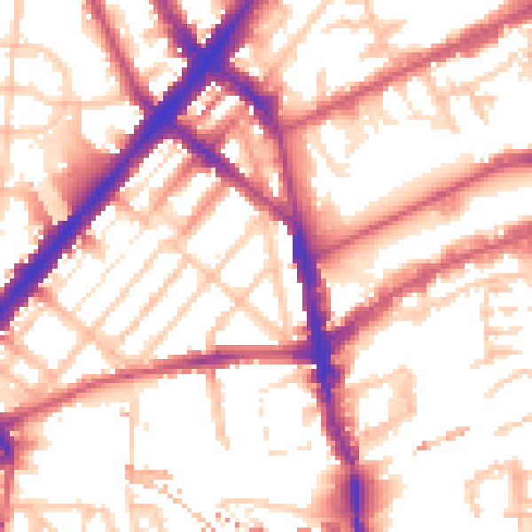
Daytime· 07:00 – 23:00
55.9dB

Everything within walking distance
Schools, transport stops and scenic spots near this property — 114 points of interest in total.
Beautiful places to visit nearby
Curated scenic spots within reach of this postcode, served by Beautifulplaces.ai. Photography and tagging come from their open dataset.
Common questions
The questions buyers, sellers and homeowners most often ask about 21 Marquis Road, Camden, London, NW1 9UD. Each answer is also embedded as structured data for search engines.