Are you a property professional?Get qualified leads from motivated homeowners.
Get started26 Carlcroft Place, Cramlington, NE23 6ET
3 sales on record
About 26 Carlcroft Place
A plain-English summary derived from public records, EPC certificates, sold prices and local data.
26 Carlcroft Place is a four-bedroom detached house in Cramlington (NE23 6ET). It has a recorded floor area of 80 m² (around 861 sq ft), construction records dating it to 1967-1975 and council tax band C. The latest certificate (September 2014) shows a D (score 63), on the cusp of jumping into the C band. The rating has held steady at D across 2 certificates since August 2010. Between certificates, roof efficiency dropped from Average to Very Poor and lighting dropped from Average to Very Poor. The recommended improvements would lift it to B (score 83), a 2-band jump. The latest certificate is from September 2014, so improvements made since then won't be reflected. Other recorded features include a conservatory.
Sale prices here have outpaced England HPI: 6% per year against 0% for the wider region. On a £-per-square-foot basis, the last sale (£395/sq ft) was about 90.1% above the typical sold price in the postcode. At 80 m² the property is well over the postcode median (60 m² across 23 EPCs), placing it in the larger end of the local stock. One planning record on file: an extension approved in 2014. Past consents include an extension, meaningful when judging how the property has evolved. Most recent transfer: March 2024 at £340,000.
What this property has
Pulled from EPC certificates, claim submissions and our property model. Empty categories are hidden — we only show what's known.
Inside
- Bedrooms4
- Bathrooms2
- Dining roomYes
- ConservatoryYes
Energy performance
Every EPC certificate filed against this property — current rating, recorded improvements, and where there's headroom to reach a higher band.
Recommended upgrades on file would lift this property by multiple EPC bands.
EPC Expired
This certificate is over 10 years old and is no longer valid.Expired 02 Sept 2024
Planning history
Applications and permits filed against 26 Carlcroft Place, Cramlington, NE23 6ET, sourced from the PlanIt planning register.
26 Carlcroft Place has an approved extension on the planning record.
- Oct 2014ExtensionFullGranted
Proposed bedroom, dining and kitchen extension.
Sales history & valuation
Recorded transactions, our model's current estimate, and a quick read on what neighbouring properties have sold for.
Latest sale on 26 Carlcroft Place was the highest on Land Registry record across the postcode.
Current estimate
See how we calculated this£341,000
Modelled from EPC, postcode comparables and a sale-price growth of 6.0% per year over 28 years.
Last sold (2024)
£340,000
Growth on file: 6.0% per year over 28 years.
Sales timeline
Versus other Carlcroft Place homes
Four headline reads against 23 similar houses on this street, drawn from the latest EPC and Land Registry data.
Price per m² for 26 Carlcroft Place runs comfortably ahead of the street norm.
Price per m²
£4,250
Street avg £2,394
Floor Area
80 m²
Street avg 61 m²
Habitable Rooms
5 rooms
Similar properties nearby
A handful of close matches in the same postcode area, ranked by likeness on bedrooms, type and floor area.
The neighbourhood at a glance
A condensed read of the local area. Each tile links through to the full breakdown on the Cramlington district page.
Reported crime in the wider district is trending notably upward year-on-year.
Crime
7/mo
Rising year-on-year across the wider district.
Nearest stop
0.3 km
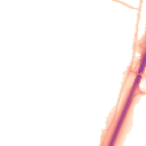
Road noise across the postcode
Modelled day and night-time noise levels around NE23 6ET from Defra's strategic mapping. The pin marks this postcode's centroid.
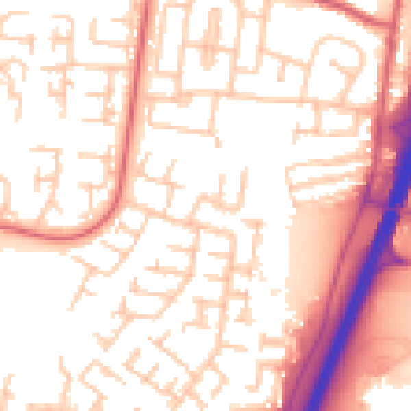
Daytime· 07:00 – 23:00
55.0dB
Everything within walking distance
Schools, transport stops and scenic spots near this property — 43 points of interest in total.
Beautiful places to visit nearby
Curated scenic spots within reach of this postcode, served by Beautifulplaces.ai. Photography and tagging come from their open dataset.
Common questions
The questions buyers, sellers and homeowners most often ask about 26 Carlcroft Place, Cramlington, NE23 6ET. Each answer is also embedded as structured data for search engines.