Are you a property professional?Get qualified leads from motivated homeowners.
Get started8 Saffron Garth, Patrington, Hull, HU12 0RF
This property in Patrington, Hull, Hull. Explore detailed information about this Patrington, Hull property including energy performance, price history, local schools, transport links and crime statistics.
Property Type
Property
Bedrooms
—
Floor Area
— m²
Council Tax
Band B
Get started
Ready to take the next step? Find the right professionals for your property journey.
Energy Performance
EPC rating and efficiency details
A
B
C
D
E
F
G
No EPC on record
This property doesn't have an Energy Performance Certificate yet. An EPC helps us give a more accurate valuation and is required to sell or let.
Price & History
Transactions and market trends
Transaction history
No sales history found
Nearby in HU12 0RF
18 Saffron Garth Patrington Hull HU12 0RF
Dec 2023
£180,000
12 Saffron Garth Patrington Hull HU12 0RF
Dec 2022
£152,000
10 Saffron Garth Patrington Hull HU12 0RF
Sept 2021
£137,000
7 Saffron Garth Patrington Hull HU12 0RF
Nov 2020
£157,000
15 Saffron Garth Patrington Hull HU12 0RF
Mar 2020
£155,000
11 Saffron Garth Patrington Hull HU12 0RF
Oct 2019
£110,000
1 / 4
House Price Index
England+1.5%
101.6
Jan 26
UK HPI from HM Land Registry. Baseline: Jan 2015 = 100.
How This Property Compares on Saffron Garth
See how this property stacks up against others nearby
Not enough similar properties in this postcode to make meaningful comparisons.
Get alerts for HU12 0RF
New sales, price changes, and market updates in this area
About Patrington, Hull
This property is located in Patrington, a village and civil parish in the East Riding of Yorkshire, within postal district HU 12.
Patrington is a large village and civil parish in the East Riding of Yorkshire, England, in an area known as Holderness. It is 9 mi (14 km) south‑east of Hedon, 16 mi (26 km) south‑east of Kingston upon Hull and 4 mi (6.4 km) south‑west of Withernsea on the A1033. Along with Winestead, it was a seat of the ancient Hildyard/Hilliard/Hildegardis family. The village’s setting on the Holderness plain gives it a rural character, while proximity to the coast town of Withernsea and the city of Kingston upon Hull provides access to larger amenities and services. Patrington’s designation as a civil parish indicates a local community structure, and its position on a main road suggests convenient transport links to surrounding areas.
Places to visit
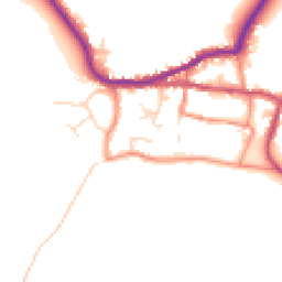
Road Noise
Average road noise levels for this postcode
Daytime
07:00 – 23:00
47.9dB
Low
Night-time
23:00 – 07:00
39.9dB
Low55 dB
60 dB
65 dB
70 dB
75 dB
80 dB
Defra Road Noise Strategic Mapping, Round 4Crime Analysis
5 months of data for Hull
Total Crimes
13
Monthly Avg
3
Recent Trend
Stable
Most Common
Violence & Sexual
Crime by Category
Violence & Sexual9(69%)
Burglary2(15%)
Other Crime1(8%)
Criminal Damage & Arson1(8%)
Recent Incidents
Violence & Sexual
Nov 2025On or near East Carr Road
Other Crime
Nov 2025On or near East Carr Road
Violence & Sexual
Nov 2025On or near Cooks Gardens
Violence & Sexual
Nov 2025On or near Church Lane
Violence & Sexual
Nov 2025On or near Albert Terrace
Burglary
Oct 2025On or near Albert Terrace
Data from Police UK • Updated monthly
Local Amenities
Schools and transport links nearby
Nearby Schools
1 within 3kmP
Patrington CofE Primary Academy
290m
3 mins
Transport Links
16 within 3kmPatrington Westgate
Bus Stop234m
3 mins
Patrington School
Bus Stop280m
3 mins
Patrington Northside
Bus Stop506m
6 mins
Patrington Station Road
Bus Stop834m
10 mins
Patrington Haven
Bus Stop1.4km
17 mins
Patrington Winestead Lane
Bus Stop1.5km
18 mins
School data from Dept. for Education • Transport data from NaPTAN
Nearby Property Businesses
Local professionals serving this area
Surveyor
Frank Hill & Son (Auctioneers and Valuers) Ltd
Hull
RICS
Surveyor
Scotts Property LLP
Hull
RICSResidentialFree Advice
Surveyor
Leonards
Hull
RICSResidential
Surveyor
Garness Jones (Commercial) Limited
Hull
RICS

Home Inspector Services
Hull
RICSResidential
Surveyor
Compass Building Consultancy Limited
Hull
RICSResidential
Surveyor
Doric Surveyors
Hull
RICSResidential

GGA Chartered Building Surveyors
Hull
RICSResidential
Map
17 points of interest nearby
Map data from OpenStreetMap • Transport data from NaPTAN • School data from Dept. for Education • Scenic data from Beautifulplaces.ai
Frequently Asked Questions
Common questions about this property