Are you a property professional?Get qualified leads from motivated homeowners.
Get started1 Bluebell Grove, Up Hatherley, Cheltenham, GL51 3BJ
This property in Up Hatherley, Cheltenham, Cheltenham. Explore detailed information about this Up Hatherley, Cheltenham property including energy performance, price history, local schools, transport links and crime statistics.
Property Type
Property
Bedrooms
—
Floor Area
— m²
Council Tax
Band D
Get started
Ready to take the next step? Find the right professionals for your property journey.
Energy Performance
EPC rating and efficiency details
A
B
C
D
E
F
G
No EPC on record
This property doesn't have an Energy Performance Certificate yet. An EPC helps us give a more accurate valuation and is required to sell or let.
Price & History
Transactions and market trends
Transaction history
No sales history found
Nearby in GL51 3BJ
7 Bluebell Grove Up Hatherley Cheltenham GL51 3BJ
Nov 2024
£250,000
17 Bluebell Grove Up Hatherley Cheltenham GL51 3BJ
Apr 2024
£255,250
21 Bluebell Grove Up Hatherley Cheltenham GL51 3BJ
Oct 2022
£189,000
23 Bluebell Grove Up Hatherley Cheltenham GL51 3BJ
Mar 2019
£180,000
3 Bluebell Grove Up Hatherley Cheltenham GL51 3BJ
May 2017
£277,500
8 Bluebell Grove Up Hatherley Cheltenham GL51 3BJ
Jul 2012
£325,000
1 / 2
House Price Index
Cheltenham+3.9%
101.8
Jan 26
UK HPI from HM Land Registry. Baseline: Jan 2015 = 100.
How This Property Compares on Bluebell Grove
See how this property stacks up against others nearby
Not enough similar properties in this postcode to make meaningful comparisons.
Get alerts for GL51 3BJ
New sales, price changes, and market updates in this area
About Up Hatherley, Cheltenham
This property is located in Up Hatherley, a suburb of Cheltenham within the GL 51 postal district, where the local landscape is shaped by the nearby Hatherley Brook.
Up Hatherley is a civil parish and a suburb of the spa town of Cheltenham, Gloucestershire, England. Formerly a hamlet in the parish of Shurdington, it now forms part of the wider Cheltenham area. Hatherley Brook is a tributary of the River Severn; it begins at Up Hatherley and flows in a westernly direction towards Longford, where it meets the Severn. The locality falls within the GL 51 postal district. The setting is rural with a brook running through it, linking the community to the wider river system of the Severn. The description highlights its status as a civil parish and its historical connection to the nearby spa town of Cheltenham, suggesting a blend of village character and proximity to a larger urban centre.
Places to visit
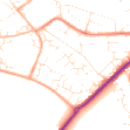
Road Noise
Average road noise levels for this postcode
Daytime
07:00 – 23:00
49.4dB
Low
Night-time
23:00 – 07:00
40.2dB
Low55 dB
60 dB
65 dB
70 dB
75 dB
80 dB
Defra Road Noise Strategic Mapping, Round 4Crime Analysis
12 months of data for Cheltenham
Total Crimes
52
Monthly Avg
4
Recent Trend
Rising
Most Common
Violence & Sexual
Crime by Category
Violence & Sexual17(33%)
Other Theft13(25%)
Shoplifting7(13%)
Vehicle Crime4(8%)
Criminal Damage & Arson3(6%)
Public Order3(6%)
Burglary2(4%)
Weapons1(2%)
Bicycle Theft1(2%)
Drugs1(2%)
Recent Incidents
Vehicle Crime
Nov 2025On or near Bournside Road
Burglary
Nov 2025On or near Monks Croft
Other Theft
Nov 2025On or near Monks Croft
Violence & Sexual
Nov 2025On or near Monks Croft
Violence & Sexual
Nov 2025On or near Monks Croft
Violence & Sexual
Nov 2025On or near Monks Croft
Data from Police UK • Updated monthly
Local Amenities
Schools and transport links nearby
Nearby Schools
16 within 3kmP
Warden Hill Primary School
251m
3 mins
P
Greatfield Park Primary School
410m
5 mins
P
St James' Church of England Primary School
911m
11 mins
S
Cheltenham Bournside School and Sixth Form Centre
762m
9 mins
Transport Links
30 within 3kmAzalea Drive
Bus Stop165m
2 mins
Lincoln Avenue
Bus Stop197m
2 mins
Jasmin Way
Bus Stop246m
3 mins
Morrisons Superstore
Bus Stop256m
3 mins
Chelmsford Avenue
Bus Stop272m
3 mins
St Christophers Church
Bus Stop285m
3 mins
School data from Dept. for Education • Transport data from NaPTAN
Nearby Property Businesses
Local professionals serving this area
Surveyor
Maple Leaf Property Consultants Ltd
Cheltenham
RICS
Surveyor
Dadson & Butler Ltd
Northleach
RICS

Barrett Corp and Harrington Limited
RICSResidential
Surveyor
The Surveying Practice
Cheltenham
RICS
Surveyor
Sheldon Bosley Knight Ltd
Winchcombe
RICSResidential
Surveyor
Jeremy Moore Associates Limited
Cheltenham
RICSResidential

Cotswold Surveyors
Cheltenham
RICSResidential
Surveyor
Nuven Surveyors Ltd
Cheltenham
RICSResidential
Map
46 points of interest nearby
Map data from OpenStreetMap • Transport data from NaPTAN • School data from Dept. for Education • Scenic data from Beautifulplaces.ai
Frequently Asked Questions
Common questions about this property