Are you a property professional?Get qualified leads from motivated homeowners.
Get started43 Chestnut Drive, Hagley, Stourbridge, DY9 0GH
About 43 Chestnut Drive
A plain-English summary derived from public records, EPC certificates, sold prices and local data.
43 Chestnut Drive is a three-bedroom mid-terrace house in Hagley, Stourbridge, Stourbridge (DY9 0GH). It has a recorded floor area of 66 m² (around 710 sq ft), construction records dating it to 2003-2006 and council tax band C. The latest certificate (January 2019) shows a C (score 74). Earlier certificates rated it B (December 2008); the latest reading is one band lower. Between certificates, hot-water efficiency dropped from Very Good to Good and main heating dropped from Very Good to Good. The recommended improvements would push it to B (score 88). The home occupies a cul-de-sac position.
Sale prices here have outpaced England HPI: 3.5% per year against 0% for the wider region. On a £-per-square-foot basis, the last sale (£408/sq ft) was about 61.1% above the typical sold price in the postcode. At 66 m² it's 27.5% smaller than the typical home in the postcode (91 m² median across 43 EPCs). Most recent transfer: January 2023 at £290,000.
What this property has
Pulled from EPC certificates, claim submissions and our property model. Empty categories are hidden — we only show what's known.
Inside
- Bedrooms3
- Bathrooms2
- EnsuiteYes
Outside
- Private garden
Energy performance
Every EPC certificate filed against this property — current rating, recorded improvements, and where there's headroom to reach a higher band.
Current Certificate(1 of 2)
Jan 2019
EPC Rating
A
B
C
C74
D
E
F
G
Main Heating
Gas
Main Fuel
Gas
Hot Water
Good
Windows
Good
CO2 Emissions
2.0 t/year
Occupancy
Owner Occupied
Sales history & valuation
Recorded transactions, our model's current estimate, and a quick read on what neighbouring properties have sold for.
43 Chestnut Drive valuation sits well clear of the typical sold price in this postcode.
Current estimate
See how we calculated this£307,000
Modelled from EPC, postcode comparables and a sale-price growth of 3.5% per year over 18 years.
Last sold (2023)
£290,000
Growth on file: 3.5% per year over 18 years.
Sales timeline
Full property reportLaunch offer · 33% off
The complete analysis of 43 Chestnut Drive, Hagley, Stourbridge, DY9 0GH
Everything we know about this property, compiled into one in-depth, downloadable report.
Detailed AI analysis
Versus other Chestnut Drive homes
Four headline reads against 39 similar houses on this street, drawn from the latest EPC and Land Registry data.
Price per m² for 43 Chestnut Drive runs comfortably ahead of the street norm.
Price per m²
£4,394
Street avg £3,168
Floor Area
66 m²
Street avg 97 m²
Habitable Rooms
4 rooms
Similar properties nearby
A handful of close matches in the same postcode area, ranked by likeness on bedrooms, type and floor area.
The neighbourhood at a glance
A condensed read of the local area. Each tile links through to the full breakdown on the Stourbridge district page.
Rail-style transport is unusually close for this postcode.
Crime
6/mo
Steady year-on-year across the wider district.
Nearest stop
0.3 km
Newfield Road — bus stop.
Road noise across the postcode
Modelled day and night-time noise levels around DY9 0GH from Defra's strategic mapping. The pin marks this postcode's centroid.
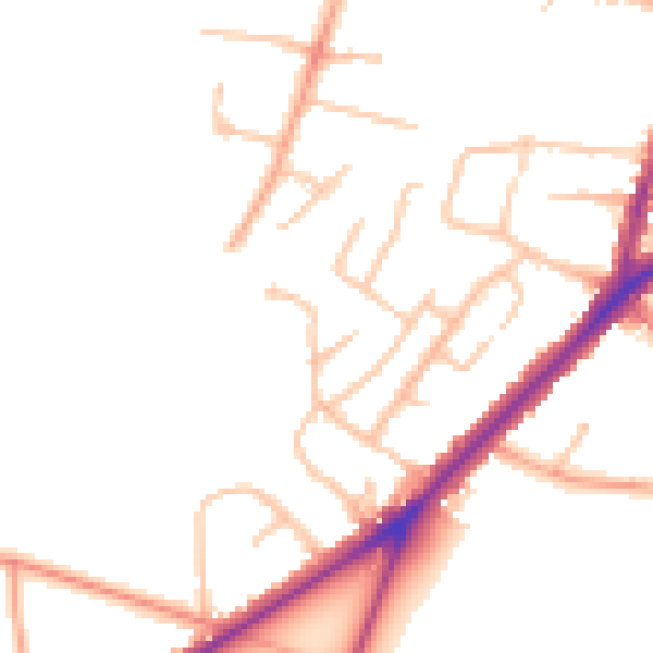
Daytime· 07:00 – 23:00
48.0dB

Everything within walking distance
Schools, transport stops and scenic spots near this property — 37 points of interest in total.
Common questions
The questions buyers, sellers and homeowners most often ask about 43 Chestnut Drive, Hagley, Stourbridge, DY9 0GH. Each answer is also embedded as structured data for search engines.