Are you a property professional?Get qualified leads from motivated homeowners.
Get startedSold in 2016DetachedCharacter Fireplace
10 Anderton Close, Bury, BL8 2HQ
This 87 square metre property in Bury carries an energy performance rating of D, in line with typical UK homes. It is heated by a gas central heating system and is currently listed as owner-occupied. The property last sold for £227,000 in March 2016.
Property Type
Detached House
Bedrooms
3
Bathrooms
1
Floor Area
87 m²
Council Tax
Band D
Property Features
Built 1967–1975
Double Garage
Off-street covered parking
Dining Room
Separate dining space
Recently Refurbished
Renovated and updated
Cul-de-sac
Quiet, low-traffic location
Extension Potential
Scope to extend (subject to planning)
Get started
Ready to take the next step? Find the right professionals for your property journey.
Energy Performance
EPC rating and efficiency details
EPC Expired
This certificate is over 10 years old and is no longer valid.Expired 03 Apr 2023
EPC Rating
A
B
C
D
D63
E
F
G
Main Heating
Gas
Main Fuel
Gas
Hot Water
Good
Windows
Good
CO2 Emissions
4.0 t/year
Tenure
Owner Occupied
Price & History
Transactions and market trends
Estimated value
£352,000
How our AI predicts property prices · Accurate to within 10%
Automated estimate only. For an accurate valuation, consult a surveyor or estate agent.
Transaction history
+19.5%(1y)
£227,000Latest
Mar 2016£190,000
Sept 2014£165,000
Aug 2013Source: HM Land Registry
House Price Index
Bury+3.6%
107.6
Jan 26
UK HPI from HM Land Registry. Baseline: Jan 2015 = 100.
How This Property Compares on Anderton Close
See how this property stacks up against others nearby
Comparing to 8 other houses on this street
Price per m²
Property value per square metre of floor space
£2,609/£2,797 avg
LowerHigher
Higher than only 29% of similar properties
Years Held
Time since last sale — indicates ownership stability
10 years/7 years avg
ShorterLonger
Held longer than 71% of similar properties
EPC Rating
Government energy efficiency score (1–100)
63 (D)/62 (D) avg
Less efficientMore efficient
Around average
Floor Area
Total internal floor space
87 m²/117 m² avg
SmallerLarger
Larger than only 25% of similar properties
CO₂ Emissions
Annual carbon output from heating, hot water & lighting
4.0 t/year/5.5 t/year avg
Higher emissionsLower emissions
Lower emissions than 69% of similar properties
Habitable Rooms
Living spaces like bedrooms & living rooms
5 rooms/6 rooms avg
FewerMore
More rooms than only 31% of similar properties
Comparisons are based on the most recent EPC data for each property in this postcode. Only similar property types (houses) are compared.
Get alerts for BL8 2HQ
New sales, price changes, and market updates in this area
Places to visit
Road Noise
Average road noise levels for this postcode
Daytime
07:00 – 23:00
51.3dB
Low
Night-time
23:00 – 07:00
41.0dB
Low55 dB
60 dB
65 dB
70 dB
75 dB
80 dB
Defra Road Noise Strategic Mapping, Round 4Crime Analysis
1 months of data for Bury
Total Crimes
1
Monthly Avg
1
Recent Trend
Stable
Most Common
Violence & Sexual
Crime by Category
Violence & Sexual1(100%)
Recent Incidents
Violence & Sexual
Aug 2025On or near Nithe Walk
Data from Police UK • Updated monthly
Local Amenities
Schools and transport links nearby
Nearby Schools
29 within 3kmP
Greenhill Primary School
138m
2 mins
P
Lowercroft Primary School
467m
6 mins
P
Chantlers Primary School
607m
7 mins
S
The Elton High School
1.3km
15 mins
S
St Gabriel's RC High School, a Voluntary Academy
1.8km
22 mins
S
The Derby High School
1.9km
23 mins
Transport Links
30 within 3kmWadebridge Drive
Bus Stop171m
2 mins
Mile Lane
Bus Stop226m
3 mins
Watling Street
Bus Stop262m
3 mins
Garstang Drive
Bus Stop277m
3 mins
Preesall Close
Bus Stop350m
4 mins
Chantlers Avenue
Bus Stop352m
4 mins
School data from Dept. for Education • Transport data from NaPTAN
Nearby Property Businesses
Local professionals serving this area
Surveyor
Robin Gascoigne - Chartered Surveyor MRICS
Bury
RICS
Surveyor
Youngs Home Surveys
Bury
RICSResidential
Surveyor
Behr & Co
Bury
RICS
Surveyor
Houzecheck Surveying Ltd
Whitefield Burry
RICSResidential
Surveyor
SPM Surveyors Limited
Bury
RICS
Surveyor
Ian S Parr - Chartered Surveyors
Bury
RICSResidential
Surveyor
CDT Consulting Limited
Bury
RICS
Surveyor
Wildbrook Real Estate Limited
Bury
RICS
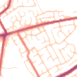
Map
59 points of interest nearby
Map data from OpenStreetMap • Transport data from NaPTAN • School data from Dept. for Education • Scenic data from Beautifulplaces.ai
Frequently Asked Questions
Common questions about this property