Are you a property professional?Get qualified leads from motivated homeowners.
Get startedLowest CarbonSold in 2021
32 Hawthorn Avenue, Bury, BL8 1DU
This 82 square metre property in Bury carries an energy performance rating of D, in line with typical UK homes. It is heated by a gas central heating system and is currently listed as owner-occupied. The property last sold for £215,000 in August 2021, up from £160,000 previously.
Property Type
Semi-Detached House
Bedrooms
4
Floor Area
82 m²
Council Tax
Band C
Property Features
Built 1930–1949
Get started
Ready to take the next step? Find the right professionals for your property journey.
Energy Performance
EPC rating and efficiency details
EPC Expired
This certificate is over 10 years old and is no longer valid.Expired 07 Sept 2023
EPC Rating
A
B
C
D
D64
E
F
G
Main Heating
Gas
Main Fuel
Gas
Hot Water
Good
Windows
Average
CO2 Emissions
3.5 t/year
Tenure
Owner Occupied
Price & History
Transactions and market trends
Estimated value
£265,000
How our AI predicts property prices · Accurate to within 10%
Automated estimate only. For an accurate valuation, consult a surveyor or estate agent.
Transaction history
+34.4%(7y)
£215,000Latest
Aug 2021£160,000
Nov 2014£117,000
Mar 2014Source: HM Land Registry
House Price Index
Bury+3.6%
107.6
Jan 26
UK HPI from HM Land Registry. Baseline: Jan 2015 = 100.
How This Property Compares on Hawthorn Avenue
See how this property stacks up against others nearby
Comparing to 10 other houses on this street
Price per m²
Property value per square metre of floor space
£2,622/£846 avg
LowerHigher
Higher than all similar properties
Years Held
Time since last sale — indicates ownership stability
5 years/12 years avg
ShorterLonger
Lowest among similar properties
EPC Rating
Government energy efficiency score (1–100)
64 (D)/59 (D) avg
Less efficientMore efficient
Around average
Floor Area
Total internal floor space
82 m²/101 m² avg
SmallerLarger
Lowest among similar properties
CO₂ Emissions
Annual carbon output from heating, hot water & lighting
3.5 t/year/5.4 t/year avg
Higher emissionsLower emissions
Lower emissions than 90% of similar properties
Habitable Rooms
Living spaces like bedrooms & living rooms
5 rooms/5 rooms avg
FewerMore
Around average
Comparisons are based on the most recent EPC data for each property in this postcode. Only similar property types (houses) are compared.
Get alerts for BL8 1DU
New sales, price changes, and market updates in this area
Places to visit
Road Noise
Average road noise levels for this postcode
Daytime
07:00 – 23:00
51.1dB
Low
Night-time
23:00 – 07:00
41.1dB
Low55 dB
60 dB
65 dB
70 dB
75 dB
80 dB
Defra Road Noise Strategic Mapping, Round 4Crime Analysis
1 months of data for Bury
Total Crimes
1
Monthly Avg
1
Recent Trend
Stable
Most Common
Violence & Sexual
Crime by Category
Violence & Sexual1(100%)
Recent Incidents
Violence & Sexual
Aug 2025On or near Nithe Walk
Data from Police UK • Updated monthly
Local Amenities
Schools and transport links nearby
Nearby Schools
32 within 3kmP
Woodbank Primary School
127m
2 mins
P
Elton Community Primary School
447m
5 mins
P
Guardian Angels Roman Catholic Primary School, Bury
808m
10 mins
S
The Elton High School
1.1km
13 mins
S
St Gabriel's RC High School, a Voluntary Academy
1.6km
19 mins
S
Bury College
1.8km
21 mins
Transport Links
30 within 3kmBrandle Avenue
Bus Stop100m
1 min
Grantham Drive
Bus Stop253m
3 mins
Hunstanton Drive
Bus Stop343m
4 mins
Skegness Close
Bus Stop364m
4 mins
Woodhill Street
Bus Stop375m
5 mins
Fenton Street
Bus Stop382m
5 mins
School data from Dept. for Education • Transport data from NaPTAN
Nearby Property Businesses
Local professionals serving this area
Surveyor
Youngs Home Surveys
Bury
RICSResidential
Surveyor
Behr & Co
Bury
RICS
Surveyor
Houzecheck Surveying Ltd
Whitefield Burry
RICSResidential
Surveyor
SPM Surveyors Limited
Bury
RICS
Surveyor
Ian S Parr - Chartered Surveyors
Bury
RICSResidential
Surveyor
Robin Gascoigne - Chartered Surveyor MRICS
Bury
RICS
Surveyor
CDT Consulting Limited
Bury
RICS
Surveyor
Wildbrook Real Estate Limited
Bury
RICS
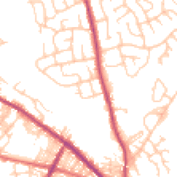
Map
62 points of interest nearby
Map data from OpenStreetMap • Transport data from NaPTAN • School data from Dept. for Education • Scenic data from Beautifulplaces.ai
Frequently Asked Questions
Common questions about this property