Are you a property professional?Get qualified leads from motivated homeowners.
Get started1 Carn Brea Avenue, Pool, Redruth, TR15 3TH
This property in Pool, Redruth, Redruth. Explore detailed information about this Pool, Redruth property including energy performance, price history, local schools, transport links and crime statistics.
Property Type
Property
Bedrooms
—
Floor Area
— m²
Council Tax
Band B
Get started
Ready to take the next step? Find the right professionals for your property journey.
Energy Performance
EPC rating and efficiency details
A
B
C
D
E
F
G
No EPC on record
This property doesn't have an Energy Performance Certificate yet. An EPC helps us give a more accurate valuation and is required to sell or let.
Price & History
Transactions and market trends
Transaction history
No sales history found
Nearby in TR15 3TH
No nearby sales found
House Price Index
England+1.5%
101.6
Jan 26
UK HPI from HM Land Registry. Baseline: Jan 2015 = 100.
How This Property Compares on Carn Brea Avenue
See how this property stacks up against others nearby
Not enough similar properties in this postcode to make meaningful comparisons.
Get alerts for TR15 3TH
New sales, price changes, and market updates in this area
About Pool, Redruth
This property is located in Pool, a neighbourhood of Redruth in the TR15 district, surrounded by the town’s historic streets and close to the A393 and A3047 roads that link it to the wider Cornwall region.
Pool is a small area within the town and civil parish of Redruth, situated in Cornwall, England. Redruth lies approximately at the junction of the A393 and A3047 roads, on the route of the old London to Land's End trunk road, and is about 9 miles (14 km) west of Truro, 12 miles (19 km) east of St Ives, 18 miles (29 km) north east of Penzance and 11 miles (18 km) north west of Falmouth. At the 2021 census the population of the parish was 15,626 and the population of the built up area was 15,455. The locality falls within the TR15 postcode district and is part of the broader Redruth community, which offers a mix of historic character and modern amenities within a compact town setting.
Places to visit
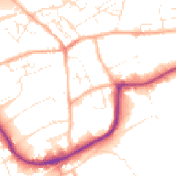
Road Noise
Average road noise levels for this postcode
Daytime
07:00 – 23:00
52.4dB
Low
Night-time
23:00 – 07:00
41.5dB
Low55 dB
60 dB
65 dB
70 dB
75 dB
80 dB
Defra Road Noise Strategic Mapping, Round 4Crime Analysis
8 months of data for Redruth
Total Crimes
41
Monthly Avg
5
Recent Trend
Stable
Most Common
Violence & Sexual
Crime by Category
Violence & Sexual24(59%)
Criminal Damage & Arson8(20%)
Public Order4(10%)
Other Theft3(7%)
Vehicle Crime1(2%)
Weapons1(2%)
Recent Incidents
Criminal Damage & Arson
Nov 2025On or near Manor Gardens
Violence & Sexual
Nov 2025On or near Fore Street
Violence & Sexual
Nov 2025On or near Fore Street
Violence & Sexual
Nov 2025On or near Fore Street
Violence & Sexual
Nov 2025On or near Fore Street
Violence & Sexual
Nov 2025On or near Manor Gardens
Data from Police UK • Updated monthly
Local Amenities
Schools and transport links nearby
Nearby Schools
11 within 3kmP
Treloweth Community Primary School
996m
12 mins
P
Roskear Primary & Nursery School
1.8km
22 mins
P
Rosemellin Community Primary School
1.9km
22 mins
S
Pool Academy
500m
6 mins
S
Redruth School
2.2km
27 mins
Transport Links
30 within 3kmCarn Brea Leisure Centre
Bus Stop160m
2 mins
Carn Brea Leisure Centre
Bus Stop185m
2 mins
Health Centre
Bus Stop197m
2 mins
Health Centre
Bus Stop201m
2 mins
Fore Street
Bus Stop314m
4 mins
Morrisons
Bus Stop412m
5 mins
School data from Dept. for Education • Transport data from NaPTAN
Nearby Property Businesses
Local professionals serving this area

Bradleys Surveyors
Redruth
RICSResidential
Surveyor
Owen + Co
Redruth
RICSResidential
Surveyor
W M G Weller & Son Ltd
Redruth
RICSResidential
Surveyor
Pink Pebble
Redruth
RICSResidential
Surveyor
Kemp Engineering & Surveying
Redruth
RICS
Surveyor
C M Gunn
Redruth
RICSResidential
Surveyor
Lay's Auctioneers Limited
Redruth
RICS
Surveyor
ALS Surveyors Ltd
Redruth
RICSResidential
Map
41 points of interest nearby
Map data from OpenStreetMap • Transport data from NaPTAN • School data from Dept. for Education • Scenic data from Beautifulplaces.ai
Frequently Asked Questions
Common questions about this property