Are you a property professional?Get qualified leads from motivated homeowners.
Get startedExtendedLong-term Owner
1 Polgarth, Pool, Redruth, TR15 3NL
This 56 square metre property in Pool, Redruth, Redruth carries an energy performance rating of D, in line with typical UK homes. It is heated by electric heating and is currently listed as owner-occupied. Records show the property last changed hands for £144,000 back in 2007.
Property Type
End-Terrace House
Bedrooms
2
Floor Area
56 m²
Council Tax
Band A
Property Features
Built 1983–1990
Private Garden
Enclosed private garden
Allocated Parking
Recently Refurbished
Renovated and updated
Get started
Ready to take the next step? Find the right professionals for your property journey.
Energy Performance
EPC rating and efficiency details
EPC Expired
This certificate is over 10 years old and is no longer valid.Expired 15 May 2024
EPC Rating
A
B
C
D
D66
E
F
G
Main Heating
Electric
Main Fuel
Electric
Hot Water
Average
Windows
Good
CO2 Emissions
3.7 t/year
Tenure
Owner Occupied
Price & History
Transactions and market trends
Estimated value
£185,000
How our AI predicts property prices · Accurate to within 10%
Automated estimate only. For an accurate valuation, consult a surveyor or estate agent.
Transaction history
+74.5%(5y)
£144,000Latest
Jul 2007£82,500
Oct 2002£39,000
Apr 1999Source: HM Land Registry
House Price Index
England+1.5%
101.6
Jan 26
UK HPI from HM Land Registry. Baseline: Jan 2015 = 100.
How This Property Compares on Polgarth
See how this property stacks up against others nearby
Comparing to 5 other houses on this street
Price per m²
Property value per square metre of floor space
£2,571/£1,434 avg
LowerHigher
Higher than all similar properties
Years Held
Time since last sale — indicates ownership stability
19 years/23 years avg
ShorterLonger
Lowest among similar properties
EPC Rating
Government energy efficiency score (1–100)
66 (D)/64 (D) avg
Less efficientMore efficient
More efficient than only 20% of similar properties
Floor Area
Total internal floor space
56 m²/67 m² avg
SmallerLarger
Larger than 60% of similar properties
CO₂ Emissions
Annual carbon output from heating, hot water & lighting
3.7 t/year/3.3 t/year avg
Higher emissionsLower emissions
Lower emissions than only 20% of similar properties
Habitable Rooms
Living spaces like bedrooms & living rooms
3 rooms/4 rooms avg
FewerMore
More rooms than only 10% of similar properties
Comparisons are based on the most recent EPC data for each property in this postcode. Only similar property types (houses) are compared.
Get alerts for TR15 3NL
New sales, price changes, and market updates in this area
About Pool, Redruth
This property is located in Pool, a neighbourhood of Redruth in the TR15 district, surrounded by the town’s historic streets and close to the A393 and A3047 roads that link it to the wider Cornwall region.
Pool is a small area within the town and civil parish of Redruth, situated in Cornwall, England. Redruth lies approximately at the junction of the A393 and A3047 roads, on the route of the old London to Land's End trunk road, and is about 9 miles (14 km) west of Truro, 12 miles (19 km) east of St Ives, 18 miles (29 km) north east of Penzance and 11 miles (18 km) north west of Falmouth. At the 2021 census the population of the parish was 15,626 and the population of the built up area was 15,455. The locality falls within the TR15 postcode district and is part of the broader Redruth community, which offers a mix of historic character and modern amenities within a compact town setting.
Places to visit
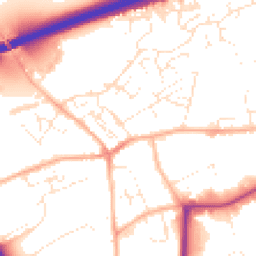
Road Noise
Average road noise levels for this postcode
Daytime
07:00 – 23:00
52.7dB
Low
Night-time
23:00 – 07:00
41.1dB
Low55 dB
60 dB
65 dB
70 dB
75 dB
80 dB
Defra Road Noise Strategic Mapping, Round 4Crime Analysis
8 months of data for Redruth
Total Crimes
41
Monthly Avg
5
Recent Trend
Stable
Most Common
Violence & Sexual
Crime by Category
Violence & Sexual24(59%)
Criminal Damage & Arson8(20%)
Public Order4(10%)
Other Theft3(7%)
Vehicle Crime1(2%)
Weapons1(2%)
Recent Incidents
Criminal Damage & Arson
Nov 2025On or near Manor Gardens
Violence & Sexual
Nov 2025On or near Fore Street
Violence & Sexual
Nov 2025On or near Fore Street
Violence & Sexual
Nov 2025On or near Fore Street
Violence & Sexual
Nov 2025On or near Fore Street
Violence & Sexual
Nov 2025On or near Manor Gardens
Data from Police UK • Updated monthly
Local Amenities
Schools and transport links nearby
Nearby Schools
10 within 3kmP
Treloweth Community Primary School
804m
10 mins
P
Rosemellin Community Primary School
1.9km
23 mins
P
Roskear Primary & Nursery School
1.9km
23 mins
S
Pool Academy
243m
3 mins
S
Redruth School
2.2km
26 mins
Transport Links
30 within 3kmFore Street
Bus Stop55m
1 min
Cort Treloweth
Bus Stop201m
2 mins
Health Centre
Bus Stop228m
3 mins
Health Centre
Bus Stop234m
3 mins
Townfield
Bus Stop258m
3 mins
Townfield
Bus Stop258m
3 mins
School data from Dept. for Education • Transport data from NaPTAN
Nearby Property Businesses
Local professionals serving this area

Bradleys Surveyors
Redruth
RICSResidential
Surveyor
Owen + Co
Redruth
RICSResidential
Surveyor
W M G Weller & Son Ltd
Redruth
RICSResidential
Surveyor
Pink Pebble
Redruth
RICSResidential
Surveyor
Kemp Engineering & Surveying
Redruth
RICS
Surveyor
C M Gunn
Redruth
RICSResidential
Surveyor
Lay's Auctioneers Limited
Redruth
RICS
Surveyor
ALS Surveyors Ltd
Redruth
RICSResidential
Map
40 points of interest nearby
Map data from OpenStreetMap • Transport data from NaPTAN • School data from Dept. for Education • Scenic data from Beautifulplaces.ai
Frequently Asked Questions
Common questions about this property