Are you a property professional?Get qualified leads from motivated homeowners.
Get startedEPC B Rated
1 Meadow View, Trevithick Lane, Pool, Redruth, TR15 3DP
This 116 square metre property in Pool, Redruth, Redruth carries an energy performance rating of B, indicating very good energy efficiency standards. The property is heated by a gas central heating system. It was sold for £320,000 in March 2023, representing a significant increase from its previous sale.
Property Type
Semi-Detached House
Bedrooms
4
Bathrooms
2
Floor Area
116 m²
Council Tax
Band N/A
Property Features
Private Garden
Enclosed private garden
Off Road Parking
En-suite Bathroom
Private bathroom attached to bedroom
Dining Room
Separate dining space
Utility Room
Separate laundry and storage
Open-plan Living
Combined kitchen and living area
Recently Refurbished
Renovated and updated
Get started
Ready to take the next step? Find the right professionals for your property journey.
Energy Performance
EPC rating and efficiency details
EPC Rating
A
B
B84
C
D
E
F
G
Main Heating
Gas
Main Fuel
Gas
Hot Water
Good
Windows
Very Good
CO2 Emissions
1.6 t/year
Tenure
—
Price & History
Transactions and market trends
Estimated value
£337,000
How our AI predicts property prices · Accurate to within 10%
Automated estimate only. For an accurate valuation, consult a surveyor or estate agent.
Transaction history
+59.6%(4y)
£320,000Latest
Mar 2023£200,495
Sept 2019£99,000
Jan 2009£67,700
Oct 2002Source: HM Land Registry
House Price Index
England+1.5%
101.6
Jan 26
UK HPI from HM Land Registry. Baseline: Jan 2015 = 100.
How This Property Compares on Trevithick Lane
See how this property stacks up against others nearby
Not enough similar properties in this postcode to make meaningful comparisons.
Get alerts for TR15 3DP
New sales, price changes, and market updates in this area
About Pool, Redruth
This property is located in Pool, a neighbourhood of Redruth in the TR15 district, surrounded by the town’s historic streets and close to the A393 and A3047 roads that link it to the wider Cornwall region.
Pool is a small area within the town and civil parish of Redruth, situated in Cornwall, England. Redruth lies approximately at the junction of the A393 and A3047 roads, on the route of the old London to Land's End trunk road, and is about 9 miles (14 km) west of Truro, 12 miles (19 km) east of St Ives, 18 miles (29 km) north east of Penzance and 11 miles (18 km) north west of Falmouth. At the 2021 census the population of the parish was 15,626 and the population of the built up area was 15,455. The locality falls within the TR15 postcode district and is part of the broader Redruth community, which offers a mix of historic character and modern amenities within a compact town setting.
Places to visit
Road Noise
Average road noise levels for this postcode
Daytime
07:00 – 23:00
52.3dB
Low
Night-time
23:00 – 07:00
40.8dB
Low55 dB
60 dB
65 dB
70 dB
75 dB
80 dB
Defra Road Noise Strategic Mapping, Round 4Crime Analysis
8 months of data for Redruth
Total Crimes
41
Monthly Avg
5
Recent Trend
Stable
Most Common
Violence & Sexual
Crime by Category
Violence & Sexual24(59%)
Criminal Damage & Arson8(20%)
Public Order4(10%)
Other Theft3(7%)
Vehicle Crime1(2%)
Weapons1(2%)
Recent Incidents
Criminal Damage & Arson
Nov 2025On or near Manor Gardens
Violence & Sexual
Nov 2025On or near Fore Street
Violence & Sexual
Nov 2025On or near Fore Street
Violence & Sexual
Nov 2025On or near Fore Street
Violence & Sexual
Nov 2025On or near Fore Street
Violence & Sexual
Nov 2025On or near Manor Gardens
Data from Police UK • Updated monthly
Local Amenities
Schools and transport links nearby
Nearby Schools
10 within 3kmP
Treloweth Community Primary School
598m
7 mins
P
Rosemellin Community Primary School
2.1km
25 mins
P
Roskear Primary & Nursery School
2.1km
26 mins
S
Pool Academy
444m
5 mins
S
Redruth School
2.0km
24 mins
Transport Links
30 within 3kmMorrisons
Bus Stop116m
1 min
Morrisons
Bus Stop149m
2 mins
Fore Street
Bus Stop242m
3 mins
Townfield
Bus Stop280m
3 mins
Townfield
Bus Stop287m
3 mins
Treloweth Community Centre
Bus Stop297m
4 mins
School data from Dept. for Education • Transport data from NaPTAN
Nearby Property Businesses
Local professionals serving this area

Bradleys Surveyors
Redruth
RICSResidential
Surveyor
Owen + Co
Redruth
RICSResidential
Surveyor
W M G Weller & Son Ltd
Redruth
RICSResidential
Surveyor
Pink Pebble
Redruth
RICSResidential
Surveyor
Kemp Engineering & Surveying
Redruth
RICS
Surveyor
C M Gunn
Redruth
RICSResidential
Surveyor
Lay's Auctioneers Limited
Redruth
RICS
Surveyor
ALS Surveyors Ltd
Redruth
RICSResidential
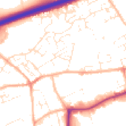
Map
40 points of interest nearby
Map data from OpenStreetMap • Transport data from NaPTAN • School data from Dept. for Education • Scenic data from Beautifulplaces.ai
Frequently Asked Questions
Common questions about this property