Are you a property professional?Get qualified leads from motivated homeowners.
Get startedSold in 2000
9 Carnforth Road, Cheadle Hulme, Cheadle, SK8 5QD
This property in Cheadle Hulme, Cheadle, Cheadle. The property last sold for £54,950 in June 2000.
Property Type
Property
Bedrooms
—
Floor Area
— m²
Council Tax
Band B
Get started
Ready to take the next step? Find the right professionals for your property journey.
Energy Performance
EPC rating and efficiency details
A
B
C
D
E
F
G
No EPC on record
This property doesn't have an Energy Performance Certificate yet. An EPC helps us give a more accurate valuation and is required to sell or let.
Price & History
Transactions and market trends
Transaction history
£54,950Latest
Jun 2000Source: HM Land Registry
Nearby in SK8 5QD
5 Carnforth Road Cheadle Hulme Cheadle SK8 5QD
Oct 2024
£215,000
8 Carnforth Road Cheadle Hulme Cheadle SK8 5QD
Jan 2023
£235,000
17 Carnforth Road Cheadle Hulme Cheadle SK8 5QD
Dec 2022
£310,000
15 Carnforth Road Cheadle Hulme Cheadle SK8 5QD
Jul 2017
£159,000
1 Carnforth Road Cheadle Hulme Cheadle SK8 5QD
Sept 2016
£132,000
11 Carnforth Road Cheadle Hulme Cheadle SK8 5QD
May 2016
£149,500
1 / 2
House Price Index
England+1.5%
101.6
Jan 26
UK HPI from HM Land Registry. Baseline: Jan 2015 = 100.
How This Property Compares on Carnforth Road
See how this property stacks up against others nearby
Not enough similar properties in this postcode to make meaningful comparisons.
Get alerts for SK8 5QD
New sales, price changes, and market updates in this area
About Cheadle Hulme, Cheadle
This property is located in Cheadle, a village in the Metropolitan Borough of Stockport, Greater Manchester, within the historic county of Cheshire.
Cheadle is a village in the Metropolitan Borough of Stockport, in the county of Greater Manchester, England. Within the boundaries of the historic county of Cheshire, it borders Cheadle Hulme, Gatley, Heald Green and Cheadle Heath in Stockport, and East Didsbury in Manchester. In 2011, it had a population of 14,698.
Places to visit
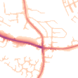
Road Noise
Average road noise levels for this postcode
Daytime
07:00 – 23:00
49.4dB
Low
Night-time
23:00 – 07:00
39.3dB
Low55 dB
60 dB
65 dB
70 dB
75 dB
80 dB
Defra Road Noise Strategic Mapping, Round 4Crime Analysis
1 months of data for Cheadle
Total Crimes
1
Monthly Avg
1
Recent Trend
Stable
Most Common
Public Order
Crime by Category
Public Order1(100%)
Recent Incidents
Public Order
Aug 2025On or near Eton Drive
Data from Police UK • Updated monthly
Local Amenities
Schools and transport links nearby
Nearby Schools
37 within 3kmP
Ladybridge Primary School
459m
6 mins
P
Bridge Hall Primary School
983m
12 mins
P
Adswood Primary School
1.1km
13 mins
S
Stockport Academy
1.3km
16 mins
S
Laurus Cheadle Hulme
1.7km
20 mins
S
Aquinas College
2.5km
31 mins
Transport Links
30 within 3kmCarnforth Road
Bus Stop47m
1 min
Adswood Turning Circle
Bus Stop82m
1 min
Ladybridge Road
Bus Stop103m
1 min
Adswood Park
Bus Stop137m
2 mins
Councillor Lane
Bus Stop199m
2 mins
Micker Brook
Bus Stop224m
3 mins
School data from Dept. for Education • Transport data from NaPTAN
Nearby Property Businesses
Local professionals serving this area
Map
67 points of interest nearby
Map data from OpenStreetMap • Transport data from NaPTAN • School data from Dept. for Education • Scenic data from Beautifulplaces.ai
Frequently Asked Questions
Common questions about this property